Start your project with reliable, scan-accurate documentation you can trust.
STATS
Years in As-Built Documentation
U.S. Markets Served
±2mm
Verified Dimensional Accuracy
Buildings Documented
3D Laser Scanning Across Denver: Submarkets & Commercial Sectors
Denver’s project landscape varies significantly by neighborhood and asset type. From office tenant improvements and retail build-outs to industrial retrofits, healthcare upgrades, and hotel renovations, each project requires accurate existing-conditions documentation tailored to real-world site constraints.
LiDAR Precise Plans delivers consistent, field-verified 3D laser scanning, as-built drawings, and MEP documentation across every Denver submarket ensuring reliable data capture regardless of building type, age, or complexity.
Downtown & LoDo Office, Adaptive Reuse & Historic Conversions
Downtown Denver is experiencing a surge in office repositioning, adaptive reuse, and mixed-use redevelopment alongside ongoing hospitality upgrades. Projects range from office-to-residential conversions to tenant improvements in aging commercial buildings where original documentation is incomplete or outdated.
We deliver precise as-built drawings and MEP coordination data for these high-stakes projects, capturing column grids, floor-to-floor dimensions, ceiling plenums, and mechanical systems in environments where accuracy is critical for design feasibility and permitting.
RiNo & Five Points Mixed-Use, Retail & Warehouse Conversions
River North continues to see rapid growth in mixed-use development, retail build-outs, and warehouse conversions. These projects often involve irregular floor plates, exposed structural systems, and legacy utility routing that traditional measurement methods fail to capture accurately.
Our high-density 3D laser scanning documents open spans, roof structures, and existing MEP systems, enabling design teams to coordinate new layouts and infrastructure with confidence.
Denver Tech Center & Cherry Creek Corporate TIs, Hospitality Upgrades & Class A Repositioning
Cherry Creek and the Denver Tech Center are seeing sustained investment in Class A office repositioning and multi-floor tenant improvements. These projects require highly accurate floor plans, reflected ceiling plans, and MEP documentation to support phased construction and leasing strategies.
Our scanning workflows capture each level with dimensional accuracy within ±2mm, enabling design teams to plan layouts and coordinate above-ceiling systems without field conflicts.
Aurora, DIA Corridor & Front Range Industrial, Healthcare & Institutional Projects
The DIA corridor and surrounding Front Range areas support a wide range of industrial, healthcare, and institutional projects, including logistics facilities, medical expansions, and educational buildings requiring modernization.
Our regional scanning capabilities ensure consistent documentation standards across all project types (from industrial facilities and hospitals to large-scale commercial properties) without additional mobilization costs.
Need Accurate Building Documentation?
Our expert team provides precise Denver as-built services using cutting-edge LiDAR technology.
LiDAR Scanning for Hotel Renovation Projects in Denver
Hotel renovation is one of the most documentation-intensive project types within commercial construction. While LiDAR Precise Plans supports a full range of commercial asset classes, including office, retail, industrial, and healthcare, hospitality projects require a uniquely controlled and low-disruption scanning approach.
Properties must remain partially operational during renovations, guest experience standards constrain scheduling, and decades of incremental modifications mean the building’s actual conditions rarely match existing drawing sets.
Denver’s hospitality market amplifies these challenges. With more than 58,000 hotel rooms in the metro area and ongoing renovation and brand-conversion activity, owners and operators require accurate, field-verified documentation that can be captured without interrupting operations.
Our 3D laser scanning services for hotel renovation projects include:
- Guest room and corridor documentation for PIP-driven and brand-standard renovations
- Lobby, ballroom, and meeting space capture for repositioning and expansion programs
- Back-of-house and kitchen scanning for equipment upgrades and code compliance
- MEP system mapping across multiple guest floors to support phased mechanical upgrades
- Exterior façade and roof scanning for envelope restoration and waterproofing
- Full-property baseline documentation for pre-acquisition due diligence
All data is captured with dimensional accuracy within ±2mm, ensuring reliable coordination across architectural, structural, and MEP disciplines.
Our low-disruption scanning protocols are specifically designed for occupied hospitality environments. We coordinate schedules around guest occupancy, operate efficiently in active spaces, and complete data capture with minimal impact to daily operations.
Office Buildings
Our LiDAR scanning Denver services capture precise floor plans, ceiling details, and MEP systems for office renovations and tenant improvements. We document everything from historic downtown buildings to modern office complexes with millimeter accuracy.
Hotels & Hospitality
For hotel renovations and expansions, our accurate as-built documentation provides the foundation for successful design. We capture detailed floor plans, elevations, and site conditions to support your project from concept to completion. we also offer Matterport 3D Virtual Tours providing immersive property.
Mixed-Use Developments
Complex mixed-use projects require comprehensive documentation. Our Denver as-built services deliver detailed BIM models that integrate architectural, structural, and MEP elements for seamless coordination across all disciplines.
MEP Coordination for Denver Commercial &Hospitality Projects
Mechanical, electrical, and plumbing conflicts are the leading source of field rework on renovation projects. When above-ceiling conditions are undocumented or inaccurately drawn, trades clash during installation, schedules slip, and costs often escalate by six figures on a mid-size commercial or hospitality job.
Our MEP coordination process uses LiDAR-captured data to produce accurate documentation of existing mechanical, electrical, and plumbing systems. This is especially critical in Denver’s older commercial stock and mid-rise hotel properties, where decades of tenant modifications and system patches have created conditions above the ceiling that bear no resemblance to any drawing on file.
Our MEP scanning captures:
- Ductwork routing, sizing, and clearance dimensions through ceiling plenums
- Piping systems, including domestic water, waste, and HVAC distribution
- Electrical conduit, cable tray, and panel locations
- Equipment positions, access clearances, and service connections
- Fire protection systems, including sprinkler mains, branch lines, and heads
By delivering verified MEP data before design begins, we enable engineers and contractors to run clash detection, plan system upgrades, and coordinate trade sequencing with confidence, eliminating the expensive field surprises that plague renovation projects operating from outdated or incomplete documentation.
Single-Family Homes
Our residential as-built services Denver provide homeowners and architects with precise floor plans, elevations, and site documentation. Whether you’re planning a kitchen remodel or a full-home renovation, our accurate as-built drawings provide the foundation for successful design.
Luxury Mountain Properties
Denver’s unique mountain architecture presents special documentation challenges. Our LiDAR scanning services capture complex geometries, elevation changes, and site conditions with precision, supporting both interior and exterior renovations.
Multi-Family Developments
For apartment renovations and condominium updates, our comprehensive as-built documentation includes detailed unit layouts, common areas, and building systems. Our BIM models support efficient space planning and coordination across multiple units.
Ready to Start Your Residential Project?
Get accurate as-built documentation for your Denver residential property.
3D Laser Scanning in Denver with for Commercial & Hospitality Projects
All scan data is delivered as registered point clouds in E57 and LAZ formats—supporting seamless integration with all major AEC platforms.
For raw data deliverables, explore our dedicated point cloud services page to understand formats, accuracy, and integration options.
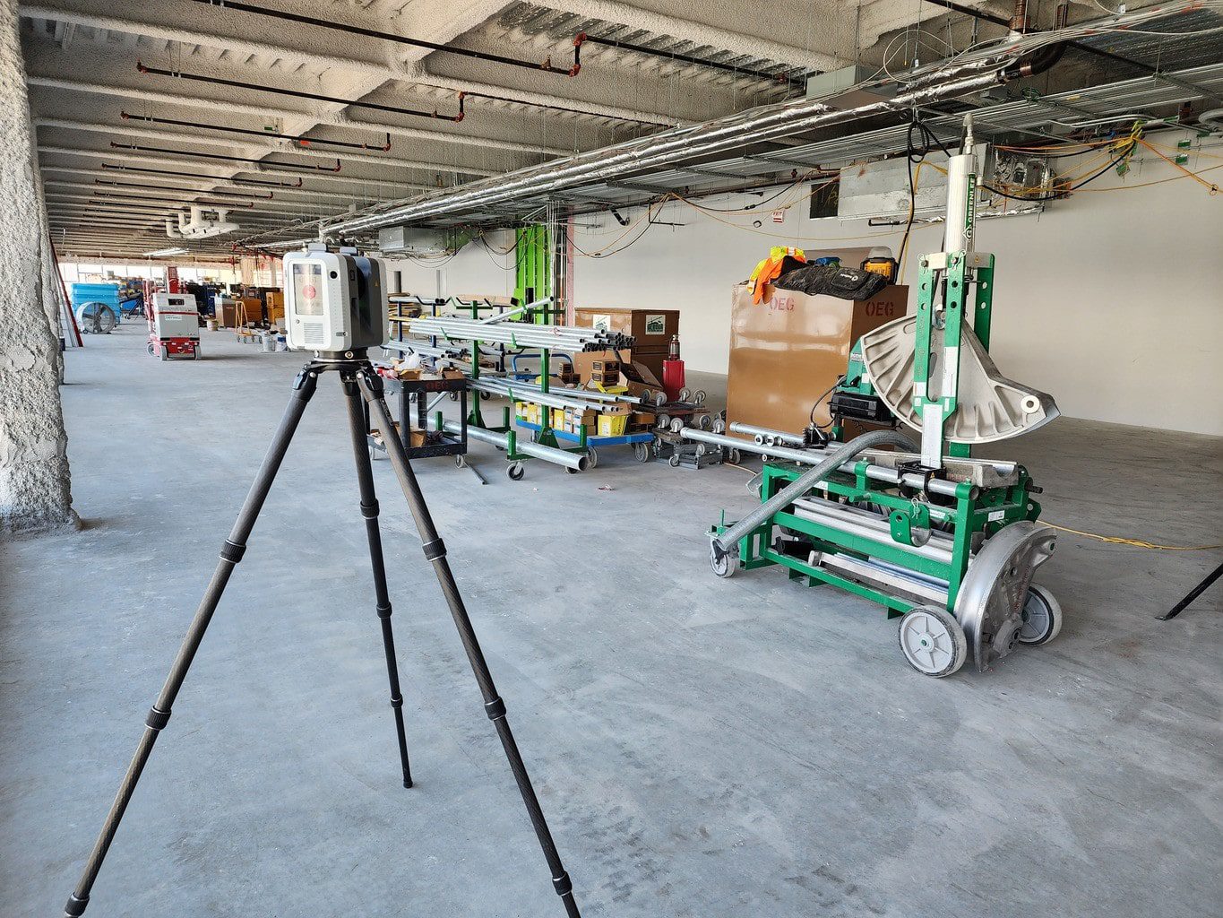
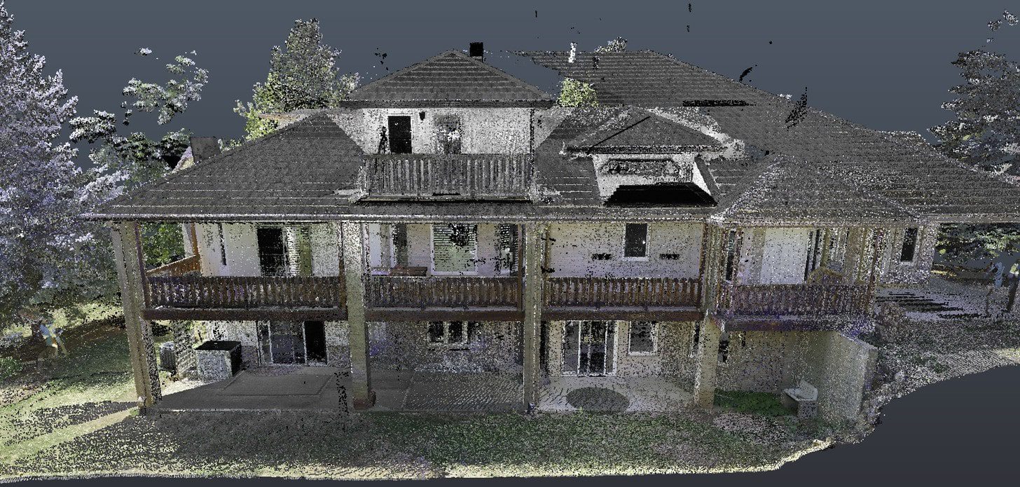
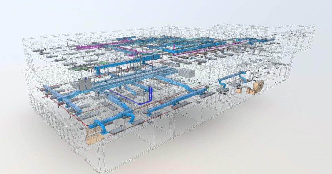
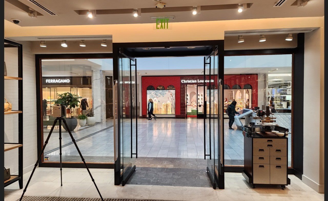
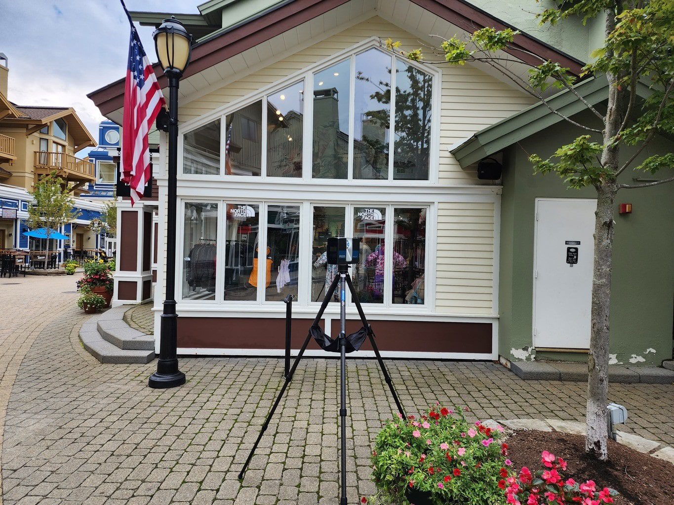
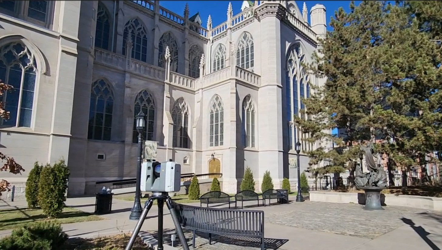
3D laser scanning is the foundation of every documentation engagement we perform in Denver. Using advanced LiDAR technology, our scanners capture millions of spatial data points per position, producing dense, navigable point clouds that represent the building’s true geometry—not outdated or assumed conditions from legacy drawings.
This is especially critical in Denver, where much of the commercial building stock was constructed between the 1960s and 1990s. In many cases, original plans no longer reflect decades of renovations, system upgrades, and tenant modifications. A point cloud captures what actually exists today, enabling accurate design, coordination, and planning.
Core Capabilities of Our Denver 3D Laser Scanning Services:
- Point cloud delivery in E57 and LAZ formats, compatible with all major AEC platforms
- Dimensional accuracy within ±2mm across all scan positions
- Complete spatial capture of architectural, structural, and MEP systems in a single visit
- Efficient documentation of large-footprint environments, including offices, retail spaces, warehouses, and industrial facilities
- Low-disruption scanning protocols for occupied commercial environments, including healthcare, retail, and hospitality
- Calibrated workflows for reliable data capture in Colorado’s high-altitude conditions
Point cloud data significantly reduces the need for repeated site visits during design development. Architects, engineers, and contractors can remotely access the dataset to extract measurements, verify clearances, and identify constraints, improving coordination while saving time and cost across the project lifecycle.
Benefits of LiDAR for MEP Documentation
- Precise location of existing pipes, ducts, and conduits
- Accurate ceiling plenum space documentation
- Early clash detection before construction begins
- Reduced field modifications during installation
- Comprehensive MEP coordination drawings
- Integration with BIM models for holistic building understanding
Our MEP coordination drawings help engineers and contractors understand existing conditions before design begins. By capturing the precise location of pipes, ducts, conduits, and equipment, we provide the data needed to plan efficient system upgrades with minimal disruption.
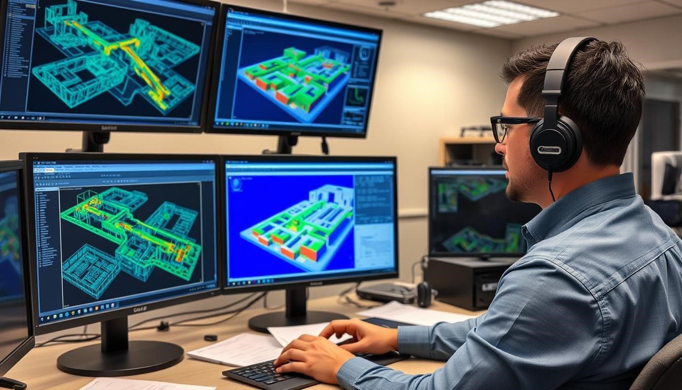
The BIM models we create from LiDAR scan data allow for virtual coordination meetings where all stakeholders can visualize and resolve potential conflicts before construction begins, saving time and reducing costly field modifications.
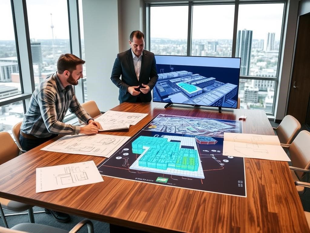
Scan to BIM for Denver Commercial Renovation & Construction Projects
Denver’s construction pipeline has shifted heavily toward renovation, repositioning, and adaptive reuse across commercial sectors. With new office development slowing and demand increasing for tenant improvements, industrial upgrades, and selective hotel conversions, the need for scan-to-BIM services that convert field-captured conditions into coordinated Revit models continues to grow.
Our scan-to-BIM workflows support the full range of project types shaping Denver’s built environment:
- Office tenant improvements and Class A repositioning projects
- Office-to-residential and mixed-use adaptive reuse developments
- Retail and commercial build-outs requiring coordinated existing conditions
- Industrial facility upgrades and warehouse repurposing along major corridors
- Healthcare, institutional, and civic renovation projects
- Hotel renovations requiring phased modeling and MEP coordination
We produce Revit models at LOD 200 and LOD 300, scaled to each project’s coordination and planning requirements. All models are derived from 3D laser scanning data with dimensional accuracy within ±2mm, ensuring reliable alignment between existing conditions and design intent.
These models enable clash detection across architectural, structural, and MEP systems before construction begins—reducing RFIs, minimizing change orders, and eliminating the multi-trade conflicts that impact budgets and schedules.
Retail Chains
For multi-location retailers, our standardized as-built documentation process ensures consistent quality across all sites. We provide detailed floor plans, reflected ceiling plans, and storefront elevations to support your brand implementation.
Shopping Centers
Our comprehensive scanning services document entire shopping centers, from individual tenant spaces to common areas. These retail as-built drawings support leasing activities, tenant improvements, and overall property management.
Restaurants
Restaurant renovations require precise documentation of kitchen layouts, dining areas, and building systems. Our LiDAR scanning Denver services capture these complex spaces with accuracy, supporting efficient design and permitting processes.
Ski Resort & Mountain Project Documentation
Colorado’s unique mountain terrain and ski resorts present special documentation challenges. Our Denver LiDAR as-built drawing services are ideally suited for capturing complex mountain structures, ski lodges, and resort facilities with precision.
“The accuracy of the LiDAR scans provided for our mountain lodge renovation was exceptional. The ability to capture our complex timber frame structure and stone elements with such precision made our design process significantly more efficient.“
— James Wilson, Mountain Resort Development Director
Our ski resort as-built scanning services document lodge facilities, lift stations, and mountain structures with millimeter precision. We understand the unique challenges of working in mountain environments and provide comprehensive documentation that supports renovations, expansions, and facility upgrades.
Planning a Mountain Project?
Get precise as-built documentation for your Colorado mountain facility.
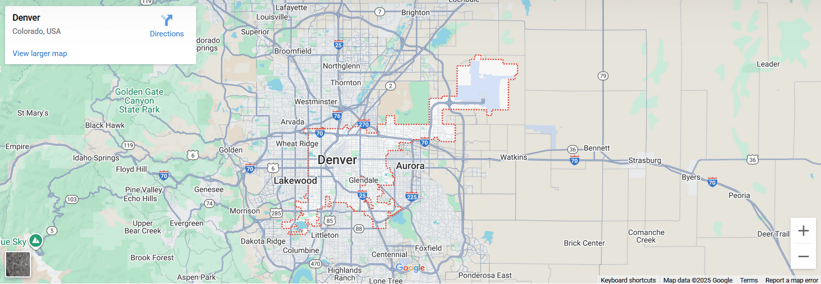
Regional Coverage: 3D Laser Scanning Across the Denver Metro & Front Range
LiDAR Precise Plans provides 3D laser scanning services across the entire Denver metro and Front Range corridor—from Boulder and Broomfield in the north, to Lakewood and Golden in the west, Aurora and the DIA corridor in the east, and extending south to Castle Rock and Colorado Springs.
This regional coverage allows commercial clients to standardize documentation workflows across multiple properties, project types, and locations—working with a single, reliable scanning partner for consistent results.
Advantages of a Single Regional Scanning Partner:
- Uniform deliverable standards across every property in a portfolio
- One vendor relationship for all Front Range scanning and documentation needs
- Coordinated scheduling for multi-site commercial projects and phased programs
- No mobilization surcharges between Denver metro locations
- Centralized data management for large-scale documentation and asset portfolios
Whether the scope includes pre-acquisition due diligence, tenant improvements, renovation planning, or ongoing facility documentation, our regional presence ensures consistent execution, reliable data capture, and streamlined project coordination across every engagement.
1. Site Scanning
- Initial site assessment
- Strategic scanner placement
- High-resolution LiDAR capture
- Comprehensive photo documentation
- Quality verification in the field
- Noise filtering and cleanup
- Accuracy verification
- Color mapping from photos
- Cloud optimization
- 3D BIM model development
- MEP system documentation
- Quality control review
- Final delivery and support
Scan to BIM vs Scan to CAD:Which Does Your Denver Project Need?
One of the most common questions we receive from Denver architects and contractors is whether they need a full BIM model or CAD drawings. The answer depends on your project type, your coordination requirements, and how many disciplines are working from the documentation.
✅ Scan to BIM — Choose When:
- Required for Revit-based design workflows
- Supports multi-discipline clash detection (arch, structural, MEP)
- Best for hotel renovations, large commercial TIs, office-to-residential conversions
- Delivered as LOD 200 or LOD 300 Revit models
- Higher upfront cost — saves significantly on RFIs and change orders
- Required for BIM-mandated projects and most institutional work
✅ Scan to CAD — Choose When:
- Best for permit submissions, leasing, and space planning
- Works for projects using AutoCAD or traditional 2D design workflows
- Ideal for retail rollouts, residential, and single-discipline scopes
- Faster turnaround and lower cost than full BIM
- Can be upgraded to BIM if project scope expands
Not sure which is right for your project? We scope most Denver engagements with both options in the proposal so you can make an informed decision based on actual project requirements and budget.
Learn more about our Scan to BIM services or Scan to CAD services to see deliverables, use cases, and turnaround times for each workflow.
Residential As-Built Documentation in Denver
Denver’s residential market presents unique documentation challenges that LiDAR handles better than any traditional method. From Wash Park and Highland Victorians to Park Hill bungalows and Washington Park Tudors, Denver’s older residential stock was built before CAD existed — which means renovation architects are routinely working from zero documentation or hand-sketched floor plans that don’t reflect actual field conditions.
Adding to this complexity, Denver’s accessory dwelling unit (ADU) boom has created strong demand for as-built documentation to support permit submissions to Denver Community Planning and Development, where verified existing conditions are required before ADU additions can be approved. Our residential scanning services cover:
Single-Family Homes & Historic Properties
Whether you’re planning a full renovation of a 1920s bungalow in the Highlands or a kitchen expansion in a Wash Park Colonial, our LiDAR scanning delivers precise floor plans, ceiling heights, structural element locations, and exterior dimensions all from a single site visit. Typical residential scanning is completed in 2-4 hours with drawings delivered in 5-7 business days.
Multi-Family & ADU Projects
For apartment renovations, condo updates, and ADU additions, our as-built documentation includes detailed unit layouts, common area plans, and building sections. We work with Denver’s permitting requirements and provide the verified existing-conditions drawings that CPD reviewers expect for ADU applications.
Luxury Mountain & Foothills Properties
Colorado’s mountain architecture presents documentation challenges that standard measurement methods can’t handle complex rooflines, irregular topography, log and timber framing, and site conditions that change with the season. Our Leica RTC360 captures these environments with the dimensional accuracy within ±2mm, regardless of elevation or site complexity.
Why Denver Teams Choose LiDAR Precise Plans
Selecting the wrong scanning partner on a commercial project introduces risk that compounds throughout every phase of design and construction. Inaccurate as-built documentation leads to design errors, which generate change orders, delay schedules, and increase project costs. LiDAR Precise Plans is built to eliminate that risk from the start.
What Sets Our Denver Operation Apart:
- Full-service coverage across the Denver metro and Front Range, with no travel fees
- Extensive experience across commercial sectors, including office, retail, industrial, healthcare, and hospitality environments
- Proven MEP coordination workflows that reduce field conflicts before construction begins
- Consistent QA standards and deliverable formatting across every project
- Dimensional accuracy within ±2mm across all scan positions
- Revit models at LOD 200 and LOD 300, plus point cloud exports in E57 and LAZ formats
- Fast turnaround for commercial documentation and scan-to-BIM deliverables
- Same-week scanning availability for time-sensitive project schedules
- Strong working knowledge of Denver’s permitting requirements, building stock, and construction environment
On commercial projects, the cost of unreliable documentation is often measured in significant rework, delays, and coordination issues. Our process is designed to provide accurate, field-verified data from day one—supporting better decisions, smoother coordination, and more predictable project outcomes.
FAQs About As-Built Drawings in Denver
Get answers to common questions about our Denver LiDAR as-built drawing services.
3D laser scanning in Denver accurately captures existing conditions for commercial buildings. This includes offices, retail spaces, hotels, and industrial facilities. This technology provides precise spatial data that drives successful renovations, tenant improvements, and adaptive reuse projects. Architects and contractors use 3D laser scanning. This helps them cut errors, avoid rework, and improve project planning from the start.
LiDAR scanning services in Denver offer millimeter-level accuracy. They consistently achieve this within ±2–3mm, no matter the site conditions or equipment used. This precision ensures reliable measurements for architectural design, MEP coordination, and construction planning. It's crucial for complex or renovation-focused commercial settings.
As-built drawings in Denver show the real dimensions and layout of a building. They are checked in the field, so they are more accurate than old or original plans. They are key for renovation and tenant improvement projects. They help teams avoid design conflicts, meet permitting needs, and ensure smooth coordination between architecture and engineering.
The cost of 3D laser scanning in Denver depends on factors such as building size, complexity, accessibility, and required deliverables like point clouds, CAD drawings, or BIM models. Smaller projects can cost a few thousand dollars. In contrast, large commercial properties or multi-site portfolios need custom proposals. These proposals depend on the project's scope and timeline.
Scan to BIM converts laser scan data into intelligent 3D Revit models used for coordination and clash detection across multiple disciplines. Scan to CAD produces 2D drawings such as floor plans and reflected ceiling plans, ideal for permitting and space planning. The right choice depends on project complexity and workflow requirements.
Yes, LiDAR scanning is widely used for hotel renovation projects in Denver. It enables accurate documentation of guest rooms, corridors, lobbies, and back-of-house areas while minimizing disruption to operations. This is very useful for renovations and upgrades in busy hospitality settings.
3D laser scanning significantly improves MEP coordination by capturing the exact locations of ductwork, piping, conduit, and equipment. In Denver’s older commercial buildings, this helps engineers spot clashes early. They can plan system upgrades accurately and reduce costly conflicts during construction.
Most 3D laser scanning projects in Denver can be completed within a few hours to a few days for fieldwork, depending on site size and complexity. Deliverables such as as-built drawings or BIM models are typically provided within 1–2 weeks, with faster turnaround available for time-sensitive commercial projects.
Request a Quote for Denver & Front Range Projects
Planning a commercial renovation, tenant improvement, facility upgrade, or new documentation project in Denver? LiDAR Precise Plans delivers fast, detailed proposals for 3D laser scanning, as-built drawings, and scan-to-BIM engagements of any scale.
To Streamline Your Quote, Please Provide:
- Project address(es) and number of buildings or floors
- Estimated total square footage
- Required deliverables: point cloud, BIM model, as-built drawings, or a combination
- Target project timeline and scheduling constraints
- Site access details or occupied-space considerations
We return most proposals within 24 hours and can typically schedule field scanning within the same week, depending on project scope and access requirements. For multi-site commercial portfolios or phased projects, we develop tailored engagement plans aligned with your design and construction schedule.
Request a Free Consultation
Preserving History with Precision Plans
Our Denver-based team provides historic building as-built services↗ for restoration and tax credit applications on heritage structures throughout Colorado.