Professional LiDAR Scanning Across Los Angeles County - Serving Entertainment Studios, Commercial Buildings & Residential Properties
Get precise LiDAR as-built drawings in Los Angeles for construction, renovation, and preservation. Our 3D laser scanning services capture millimeter‑level spatial data to produce comprehensive CAD plans, BIM models, and digital twins—deliverables prepared to support LADBS permit submissions and design coordination.
As builts are detailed records of the final constructed conditions, essential for remodeling, permitting, and future modifications.
Start Your Project Today
Request a free consultation or call for same‑week site visits
Why Los Angeles Projects Need As-Built Drawings
As-built drawings (existing conditions surveys) record how a building was actually constructed—exact dimensions, structural elements, and systems—so designers and contractors can plan with confidence. In Los Angeles’ complex permitting and construction environment, accurate surveys reduce risk and keep projects on schedule and budget. Engineering plays a critical role in ensuring the accuracy and quality of as-built drawings, supporting successful project outcomes.
- LADBS permit resubmission nightmares
- Seismic retrofit documentation requirements
- Historic-Cultural Monument compliance
- Soft-story ordinance measurements
- CASp inspection documentation
Professional As-Built Drawing Services in Los Angeles
Our as-built services specialize in creating accurate and detailed as-built drawings for residential, commercial, and industrial properties throughout Los Angeles and surrounding areas. Our team leverages advanced LiDAR scanning technology to deliver high-quality as-built plans tailored to your exact needs. Whether you’re a building owner, architect, engineer, or contractor, we provide precise, reliable construction documentation with quick turnaround times. From scan-to-BIM workflows to record drawings, our as-built services ensure you have accurate project information for informed construction decisions, regardless of property size or complexity.

Permit Compliance
For LADBS submissions and local permit reviews, clear records of existing conditions are essential. Our LiDAR surveys produce CAD-ready plans and spatial data that streamline approvals and minimize costly resubmissions or inspection delays.

Design Accuracy
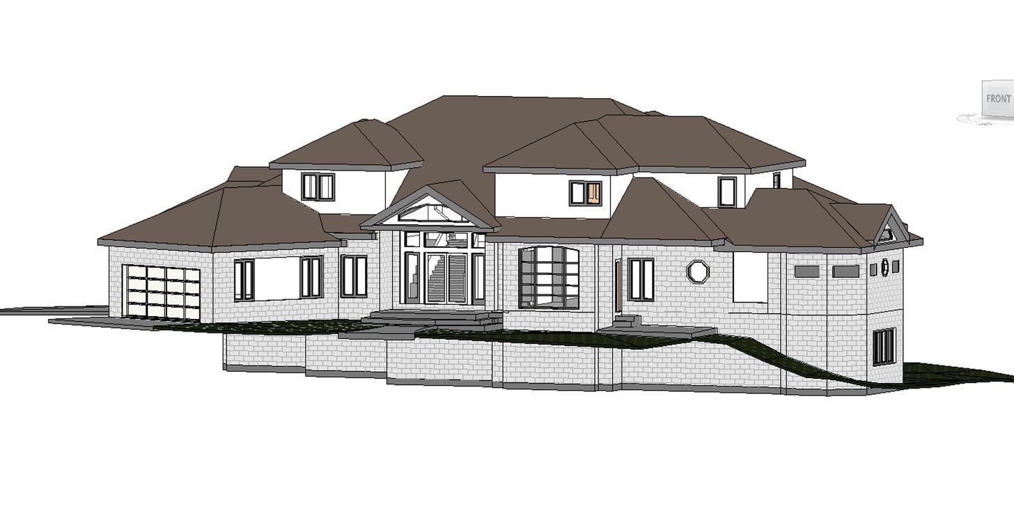
Architects and engineers rely on precise spatial data to avoid redesigns and change orders. Our as-built services convert point clouds into accurate plans and models so your design team can move straight into detailing and coordination with confidence.
Documentation That Supports LADBS Submissions
Our as-built drawings are formatted to support LADBS plan check submissions.
We understand what documentation reviewers expect—dimensioned floor plans, reflected ceiling plans, exterior elevations with accurate heights and setbacks, and site plans with proper survey references.
For projects involving:
- Seismic retrofits and soft-story compliance
- Historic-Cultural Monument properties
- Mills Act buildings
- Adaptive reuse conversions
- Tenant improvements in existing buildings
…your architect or engineer needs accurate existing conditions data. Our LiDAR scans and CAD deliverables provide the foundation for their design work and permit packages.
We’ve supported LA projects across Downtown, West LA, Santa Monica, Pasadena, and the San Fernando Valley, delivering documentation that helps design teams avoid costly resubmissions due to field dimension discrepancies.
The Role of LiDAR Scanning in Modern Los Angeles Construction
LiDAR laser scanning has transformed how Los Angeles teams capture existing conditions—delivering rapid, millimeter‑accurate spatial data that replaces slow, error‑prone manual measures. The resulting point clouds form the foundation for CAD plans, BIM models, and digital twins used across design, real estate, and construction workflows. Drafting precise technical drawings using CAD software and laser measurement tools is essential for reliable documentation.
How LiDAR Scanning Works
State‑of‑the‑art scanners emit millions of laser pulses per second to measure distance to surfaces, creating dense point clouds (.e57, .rcs) that capture every architectural and MEP element. Our capture services ensure accurate registration and georeferencing so modelers can produce reliable Revit files and 2D CAD deliverables for immediate use. Site plan drawings are a key deliverable provided to illustrate the current layout and conditions of a property.
Superior to Traditional Methods
Compared with tape measures and handheld tools, LiDAR scanning reduces on‑site time dramatically—typical single‑family home scans take under two hours and many commercial scans finish in a day. Faster scans and precise data lower construction risk, shorten bid cycles, and help project managers avoid costly change orders.
LiDAR Scanning Advantages
- Captures millions of measurement points with industry‑grade accuracy (confirm specific scanner spec for ±2mm)
- Creates point clouds and spatial data compatible with AutoCAD, Revit and common BIM workflows (scan‑to‑BIM)
- Delivers models and data (.e57, .rcs/.rcp, .dwg, .rvt) for analysis and design coordination
- Reduces site visits and disruption while documenting hard‑to‑reach areas
- Provides a precise record of existing conditions for construction and real estate decisions
Historic Building Documentation in Los Angeles
Los Angeles’ historic architecture—from Spanish Colonial Revival landmarks to Art Deco towers and Mid-Century Modern residences—requires precise existing-conditions documentation before any restoration or adaptive reuse begins. For Historic-Cultural Monument (HCM) properties and Mills Act buildings, inaccurate measurements can delay LADBS approvals and jeopardize preservation efforts.
Our LiDAR-based as-built documentation captures:
- Detailed façade geometry and ornamental profiles (terracotta, cast stone, decorative metalwork)
- Structural systems for seismic retrofit planning
- Interior layouts and original built-ins (millwork, cabinetry, fixtures)
- MEP systems for adaptive reuse coordination
The resulting point clouds and CAD/BIM deliverables provide the accuracy preservation architects need for LADBS Historic Resource review, Mills Act compliance, seismic upgrades, and restoration detailing.
Example: We documented a 1920s Art Deco building in Downtown LA, capturing cornice profiles and ornamental façade details for restoration review. The high-resolution scans allowed craftspeople to reproduce period-accurate elements while meeting current seismic and accessibility codes.
Preservation Compliance
For Historic‑Cultural Monument and Mills Act projects, clear records of existing conditions are essential. Our LiDAR surveys create CAD‑ready plans and 3D models that help professionals prepare permit packages and meet local preservation requirements. We offer different package options tailored to project complexity and client needs.
Restoration Accuracy
High‑resolution point clouds document ornate moldings, cornices, and unique structural details so craftspeople can reproduce elements precisely. For example, we documented an Art Deco façade to recreate cornice profiles used in a recent restoration project. Materials and finishes are also recorded for permitting, maintenance, and future renovations.
“The detailed scans allowed our team to match original moulding profiles exactly—critical for authentic restoration and for preservation review.”
— Michael Mueller, Downtown LA
Preserve Los Angeles' architectural heritage with precise surveys and models
Preservation professionals and project managers: request a sample deliverable set to review point clouds and CAD exports.
Commercial LiDAR Services for Los Angeles Developers
Serving Los Angeles developers, our commercial LiDAR services deliver precise as-built surveys and models that accelerate design, permitting, and construction. Los Angeles commercial projects—from Grand Avenue office towers to Abbot Kinney retail conversions to Arts District adaptive reuse—demand accurate existing conditions documentation. We provide data and deliverables that help real estate teams and project managers make confident decisions. Clarifying the scope of work allows us to tailor our services and deliverables to each commercial project.
Office Buildings
We capture floor plans, ceiling plans, and MEP systems for tenant improvements, space planning, and facility management. Typical engagement: 1‑day on site, point cloud deliverable plus a Revit model within 7 days—supporting faster construction bidding and reduced change orders.
Retail & Mixed-Use
Accurate as‑built floor plans and CAD exports help retail developers maximize leasable space and speed tenant fit‑outs. Our site scans minimize downtime for existing tenants and provide models for leasing and design coordination. Doors and their specifications are captured for both interior and exterior plans.
Industrial & Warehouses
Document clearances, structural systems, and MEP infrastructure with precise scanning to support layout optimization, code‑compliant modifications, and efficient construction sequencing. Understanding the existing structure is crucial for compliance and accurate planning.
Optimize your Los Angeles commercial project with accurate as-built surveys—lower risk, faster schedules, and clearer scopes for contractors.
Residential As-Built Services in Los Angeles
From luxury estates in Bel Air and Beverly Hills to historic homes in Pasadena and South Pasadena, multi-family buildings across Silver Lake and Echo Park, beach properties in Santa Monica and Venice, and developments throughout Downtown LA, Koreatown, West Hollywood, Culver City, and the San Fernando Valley, our residential LiDAR services deliver accurate as-built surveys that make design and construction decisions straightforward. Using precise point clouds and scan-to-BIM workflows, we provide floor plans, elevations, and BIM models that architects, contractors, and project managers across Greater Los Angeles rely on for remodeling, additions, and historic preservation projects. We handle complete projects or specific deliverables based on your requirements.
Single-Family Homes
We produce accurate floor plans and elevations for renovations and additions. Typical deliverables include 2D CAD plans and a Revit model, enabling architects and contractors to move directly into detailed design and construction documentation. Files and models can be shared via a secure link for digital collaboration.
Multi-Family Housing
Our comprehensive scans capture unit layouts, common areas, and building systems for code compliance, conversions, and large remodels—helping property owners and project managers plan scopes and budgets with confidence. Defining the project scope sets expectations and ensures efficient completion.
ADUs & Additions
Navigate LADBS requirements with accurate as‑built data. We provide the spatial data and CAD deliverables needed for ADU permit submissions and ensure your addition aligns with local code and site constraints. Even when limited access to as-built drawings is available, we provide solutions to document existing conditions.
| Residential Service | Typical Timeframe | Deliverables | Best For |
|---|---|---|---|
| Basic Floor Plans | 2–3 Days | 2D CAD Plans, PDF | Simple Renovations, Space Planning |
| Comprehensive As-Built | 5–7 Days | Floor Plans, Elevations, Sections, CAD/PDF | Major Renovations, Additions |
| 3D BIM Model | 7–10 Days | Revit Model, 2D Drawings, 3D Visualization | Complex Remodels, Historic Homes |
Transform your Los Angeles home with accurate as‑built surveys and BIM models—provide site address and approximate square footage for a faster quote.
Benefits of LiDAR As-Built Documentation in Los Angeles
Accurate LiDAR scans give Los Angeles teams a single source of truth—fast capture, reliable data, and deliverables that support design, permitting, and construction.
Our built service offerings are comprehensive, covering a range of remodeling and new construction projects.
Our service is known for its speed, accuracy, and technological advancements in providing detailed as-built drawings and project support.
Schedule a free site assessment and receive a sample point cloud or BIM preview to evaluate our models and data for your project. Our team’s expertise in creating as-built drawings for various project sizes ensures quality results. We also provide as-built drafting services specifically for real estate brokers to support property transactions.
The course of each project follows a structured sequence of steps, from initial assessment to final documentation, ensuring a smooth and efficient workflow.
Below are the practical benefits our clients see on every project.
Save Time and Money
- Reduce on-site measuring time by up to 80% with efficient capture services
- Limit costly design errors and change orders through accurate spatial data
- Streamline permit approvals using CAD and BIM deliverables that meet local requirements
- Prevent construction delays by identifying unexpected conditions early
- Support clearer contractor bids with detailed scopes based on precise models
Eliminate Guesswork
- Capture exact dimensions of complex spaces and architectural details
- Document hard‑to‑access areas (ceiling plenums, mechanical rooms) with point clouds
- Record precise locations of structural elements and MEP systems for coordination
- Identify building irregularities and out‑of‑plumb conditions before construction
- Create a reliable existing conditions record for all stakeholders
Comprehensive Deliverables
- Accurate floor plans, elevations, and sections ready for CAD and construction
- Detailed site plans and exterior documentation for real estate and design
- 3D BIM models and Revit exports for coordination and analysis
- Point clouds for further analysis and digital preservation
- Digital twins and virtual walkthroughs for facility management and remote review
Want to see sample deliverables? Request a sample point cloud or BIM package to review how our models and data can provide detailed analysis for your project.
Why Choose Our Los Angeles LiDAR Services

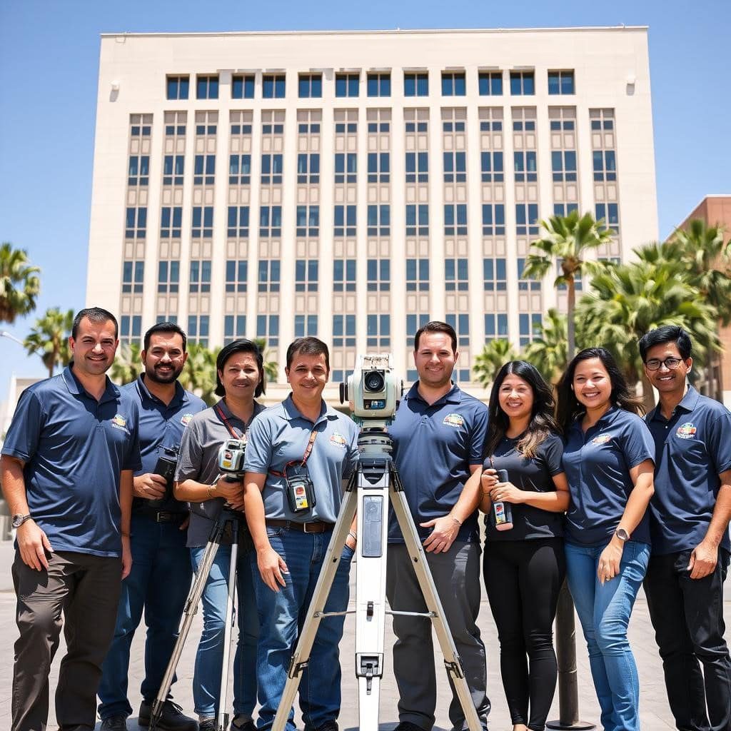
Local LiDAR Teams Serving Los Angeles
Our Los Angeles teams know local codes, permit workflows, and neighborhood building types—so professionals get deliverables formatted for LADBS and local reviewers. We work closely with architects, project managers, and contractors to ensure site constraints and existing conditions are clear from day one.

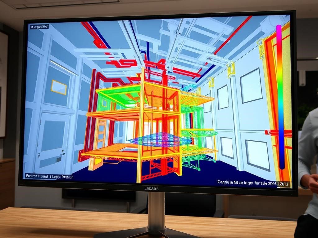
Technology & Workflow: From Scan to CAD/BIM
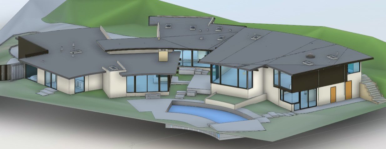
We use industry‑grade laser scanners and proven workflows to capture millions of data points, producing accurate point clouds and models. Our scan‑to‑BIM process converts spatial data into Revit and CAD deliverables so design teams receive usable models for coordination and analysis.

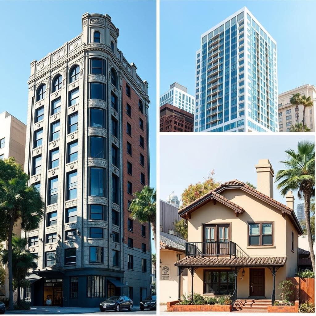
Diverse Experience Across LA Projects
We support a wide range of projects—historic restorations, office renovations, retail build‑outs, and industrial conversions—delivering reliable models and data that reduce risk during construction and aid real estate decisions.
“Their team delivered clean point clouds and a Revit model that our architects used immediately—saving weeks in coordination time.”
— Commercial Developer, Los Angeles
Serving All LA Neighborhoods
We’ve documented properties across Greater Los Angeles—from Downtown LA and Hollywood to Santa Monica, Pasadena, and the San Fernando Valley. Whether your project involves soft-story retrofits in West LA, historic preservation in Highland Park, or commercial tenant improvements in Culver City, our teams deliver consistent accuracy and quick turnaround across all LA neighborhoods.
Our Process – From Scan to Deliverables

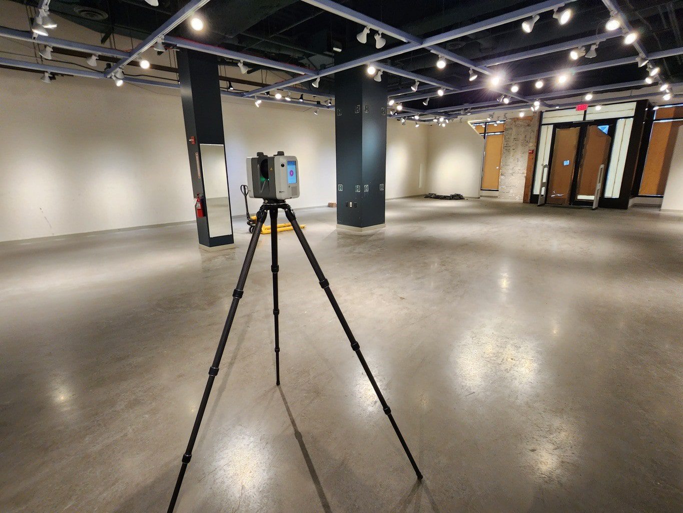
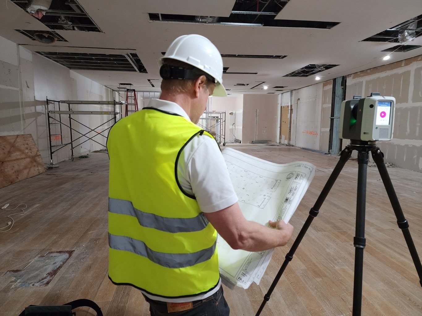
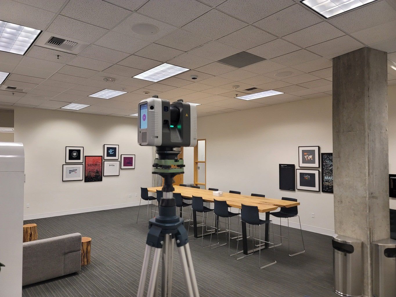
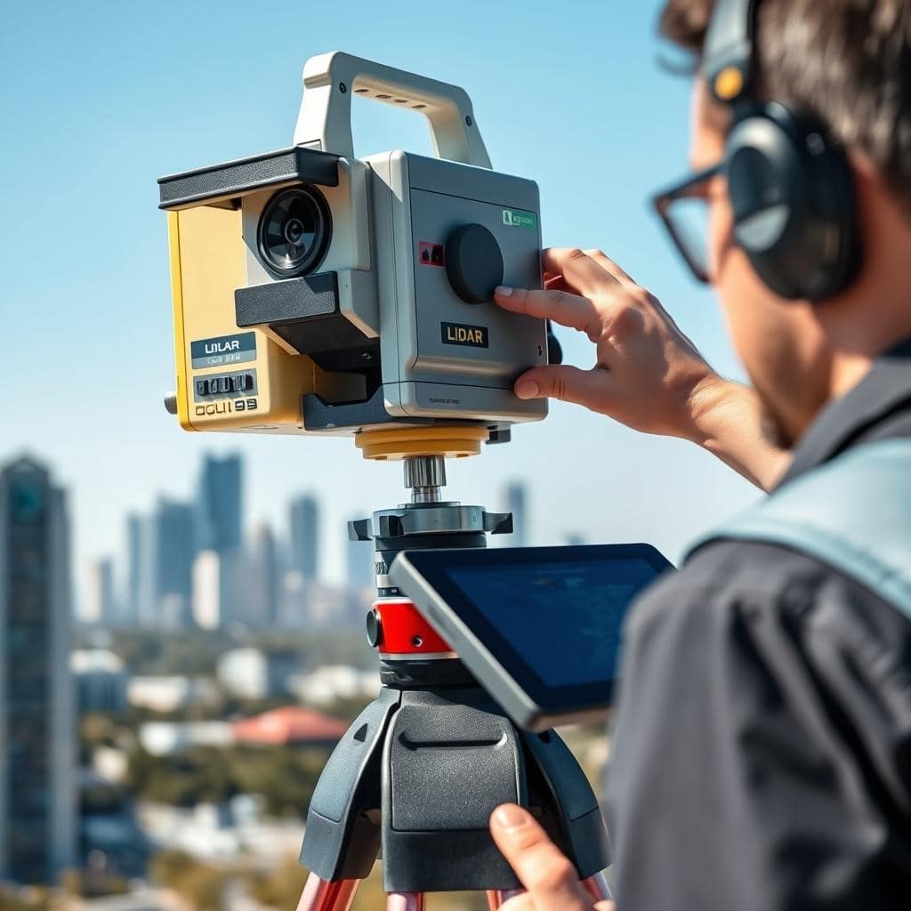
Step 1: On-site Capture Services & Safety
Our technicians perform efficient on‑site scanning across Los Angeles, using industry‑grade laser scanners to collect comprehensive point clouds of interiors and exteriors. Typical single‑family scans take hours, while larger commercial sites are scheduled for one or more days depending on scope—always with site safety and occupant coordination in mind.

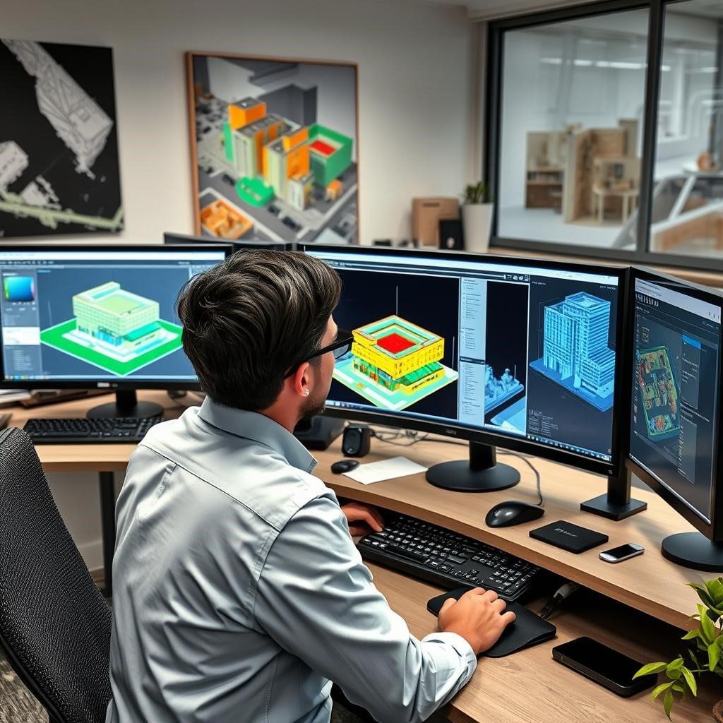
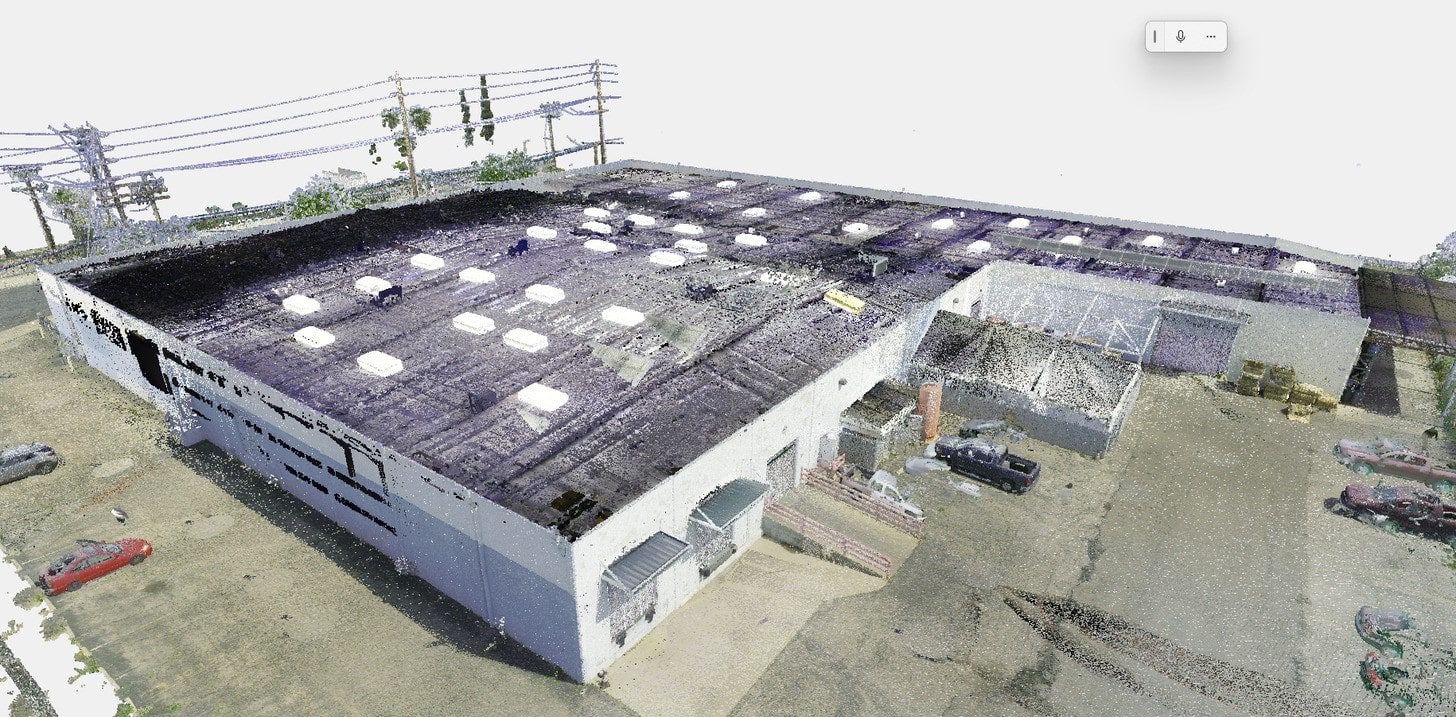
Step 2: Processing Point Clouds & Data Analysis
Back in the office, we register and clean scans, align multiple stations, and run quality checks so the point cloud is ready for modeling and analysis. Processed data (.e57, .rcs/.rcp) enables precise measurements and feeds scan‑to‑BIM workflows for accurate modeling.

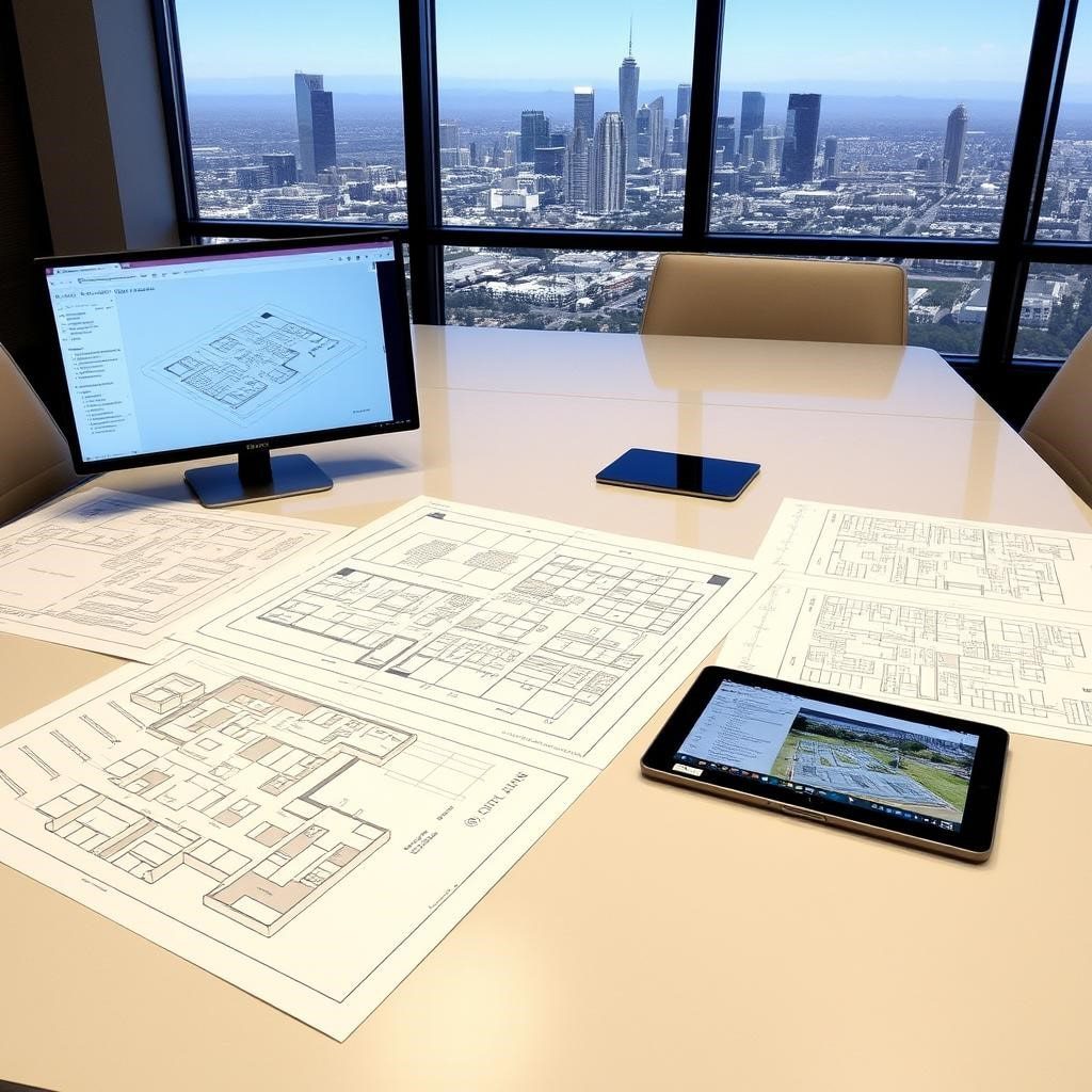
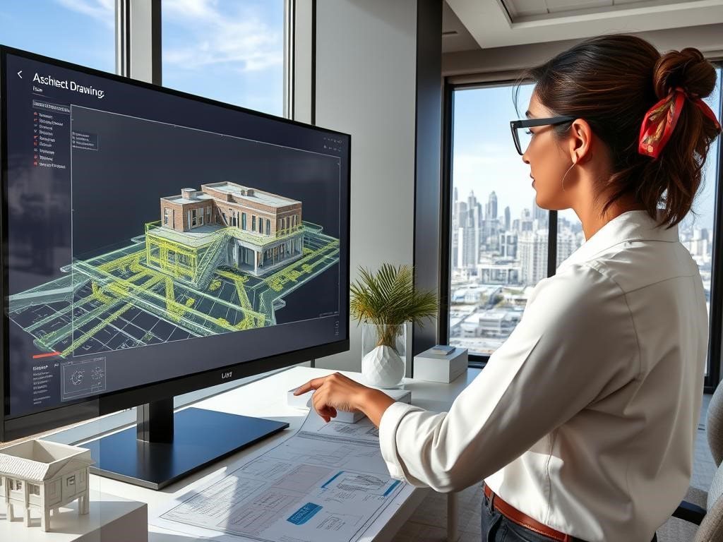
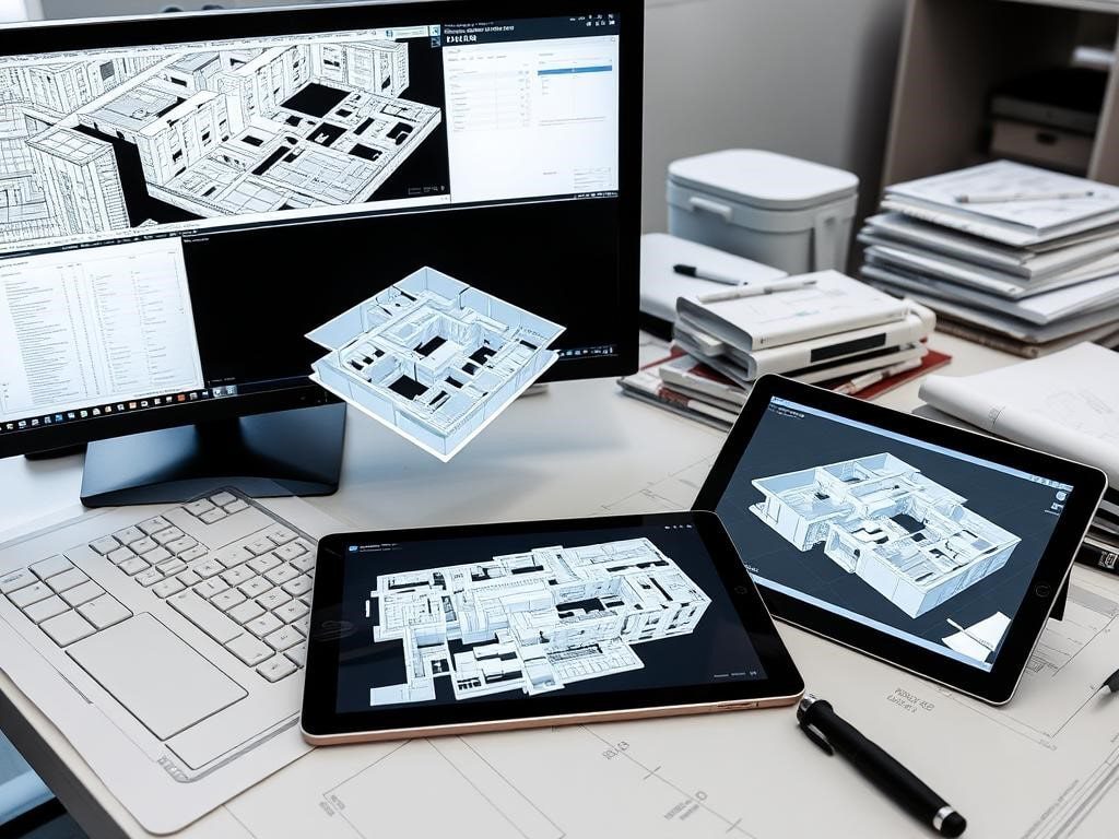
Step 3: Deliverables — CAD, BIM Models & Digital Twins
We convert point clouds into usable deliverables to match your needs: 2D CAD drawings (.dwg), Revit BIM models (.rvt), point cloud packages for analysis, and digital twins or virtual walkthroughs for facility teams. Typical turnaround varies by scope; ask for a free sample deliverable with your quote.
Ready to Start Your Los Angeles Project?
Schedule a free site assessment and receive a sample point cloud or BIM preview to evaluate our models and data for your project.
Frequently Asked Questions About As-Built Drawings in Los Angeles
How accurate are your LiDAR scans?
Our scanners produce industry‑grade spatial data; typical delivered accuracy is stated per project (many scanners achieve ±2mm under controlled conditions). We verify accuracy during processing and include quality reports with each deliverable so project managers can rely on the data for design and construction.
Do I need as-built drawings for LADBS permit applications?
Yes, for most Los Angeles renovation, addition, and tenant improvement projects, LADBS requires accurate existing conditions documentation. As-built drawings show the current state of your building—dimensions, structural elements, MEP systems—so plan checkers can review proposed changes against actual conditions.
Projects that typically require as-built documentation include:
– Additions and major renovations
– Seismic retrofits and soft-story compliance
– Historic-Cultural Monument alterations
– Change of occupancy or use
– Tenant improvements requiring permits
Our LiDAR-based as-built drawings are formatted for LADBS submissions with dimensioned floor plans, reflected ceiling plans, and site plans that meet plan check requirements. We deliver CAD files that architects and engineers can incorporate directly into their permit packages, helping avoid resubmissions due to inaccurate fiel
What's the difference between LiDAR scanning and traditional as-built measurement?
Traditional as-built measurement uses tape measures and laser distance tools to manually record dimensions—a process that’s time-consuming, prone to human error, and difficult for complex spaces or high ceilings. A typical 3,000 sq ft building might take 2-3 days to measure manually.
LiDAR scanning captures millions of measurement points in hours, creating a precise 3D point cloud of the entire space. This means:
– Accuracy: ±1/8″ precision vs. ±1/2″ or more with manual methods
– Speed: 2-4 hours on-site vs. multiple days
– Completeness: Captures hard-to-reach areas (ceiling heights, mechanical systems)
– Verification: Point cloud serves as permanent record if dimensions are questioned
– Reduced site visits: One scan captures everything vs. multiple return trips
For Los Angeles projects with tight schedules and LADBS permit requirements, LiDAR scanning reduces project risk and accelerates timelines compared to traditional measurement methods.
How long does a typical LiDAR as-built project take in Los Angeles?
Timelines depend on size and scope. A typical single‑family home scan is done in 1–2 hours with deliverables in 3–5 business days; medium commercial scans often finish on site in 1 day with BIM models ready in 7–10 business days. We provide firm schedules on request.
How much does LiDAR scanning cost for a residential property in Los Angeles?
What deliverables do you provide for Los Angeles projects?
We offer flexible deliverables to meet project needs, including:
- 2D CAD drawings (floor plans, elevations, sections)
- 3D BIM models (Revit) and scan‑to‑BIM exports
- Raw and processed point clouds (.e57, .rcs/.rcp)
- Digital twins and virtual walkthroughs for facility teams
- PDF documentation and QA reports
Files are delivered in formats compatible with common design and construction workflows and can be prepared for LADBS submissions when required.
Do you work with Los Angeles historic buildings?
Yes. We document historic structures with high‑resolution scans and deliver detailed as‑built drawings and models to support preservation, restoration, and adaptive reuse. We are experienced preparing data and drawings to assist with Historic‑Cultural Monument and Mills Act processes.
Can LiDAR scanning help with seismic retrofit documentation in LA?
Can we receive point cloud data only?
Absolutely. Many clients request processed point clouds (.e57 or .rcs) for in‑house modeling or analysis. We can also supply measured extracts, CAD overlays, or a BIM model if you prefer a turnkey deliverable.
How much does LiDAR scanning cost in Los Angeles?
Pricing varies with building size, complexity, and deliverables. Typical residential ranges are $0.60–$1.50 per sq ft and commercial ranges $0.45–$1.50 per sq ft. These are approximate—contact us with project details for a customized quote and volume discounts.
Have a specific project? Project managers and real estate professionals can request a free sample point cloud or BIM preview to evaluate our data and models for your needs.
Get Started with Los Angeles As-Built Drawings
We convert point clouds into usable deliverables to match your needs: 2D CAD drawings (.dwg), Revit BIM models (.rvt), point cloud packages for analysis, and digital twins or virtual walkthroughs for facility teams. Typical turnaround varies by scope; ask for a free sample deliverable with your quote.
Ready to move your Los Angeles project forward with precise as‑built surveys and BIM models? Contact our local teams today to discuss scope and schedule a free site assessment. We serve the greater Los Angeles area, including:
- Downtown Los Angeles
- Hollywood and West Hollywood
- Beverly Hills and Bel Air
- Santa Monica and Venice
- Pasadena and San Gabriel Valley
- Long Beach and South Bay
- San Fernando Valley
Call (310) 425-3448
For project managers and real estate professionals: request a sample deliverable (point cloud, CAD, or BIM) to review before you commit—our capture services can provide detailed floor plans and models to support your next project today.
Preserving History with Precision Plans
In Los Angeles, we deliver historic preservation as-built drawings↗ for theaters, hotels, and landmark properties across the city’s rich architectural landscape.


