Start your project with reliable, scan-accurate documentation you can trust.

STATS
Years in Commercial Architecture
U.S. Markets Served
±1/2"
Verified Dimensional Accuracy
Buildings Documented
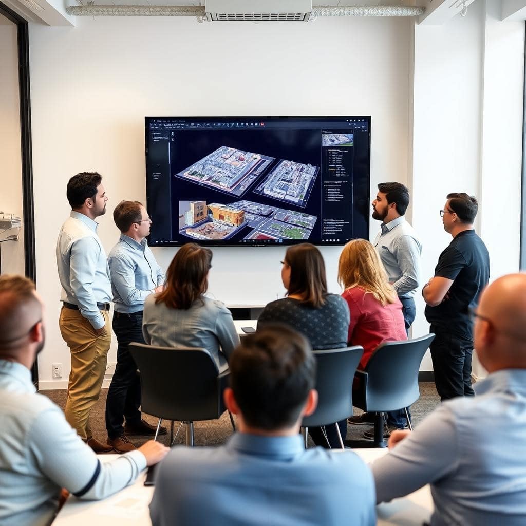
Professional LiDAR Scanning Across Phoenix Metro - Serving Residential, Commercial & Industrial Projects
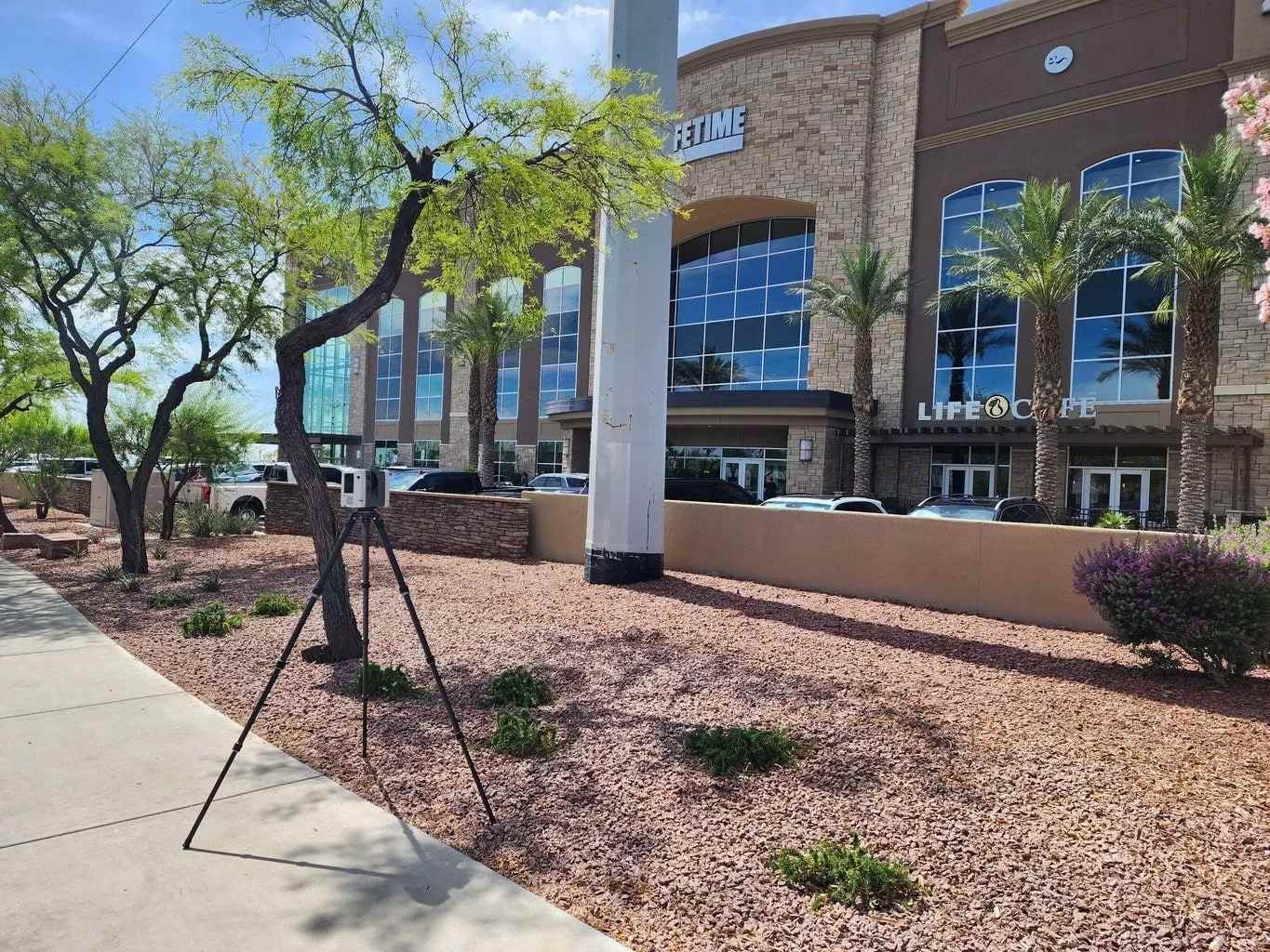
Our 3D laser scanning services in Phoenix, AZ deliver ±1/8″ accuracy with as-built drawings and LiDAR deliverables returned in 48–72 hours. We provide reality capture, scan-to-BIM, scan-to-CAD, and point cloud solutions for architects, engineers, and contractors across Phoenix, Scottsdale, Tempe, and Mesa. Whether you need existing conditions documentation for a renovation, as-built plans for a commercial facility, or precise site data for a new development our Leica RTC360-equipped team captures it all without disruption to your operations. Serving Phoenix Metro Neighborhoods & Zip Codes We provide 3D laser scanning and as-built drawings across the entire Phoenix metro, including Downtown Phoenix (85004), Midtown (85012–85014), Arcadia (85018), Camelback Corridor (85016), North Phoenix (85027–85054), Ahwatukee (85044–85048), Scottsdale (85250–85260), Tempe (85281–85284), Mesa (85201–85213), Chandler (85224–85249), and Paradise Valley. Same-week mobilization available across all areas.
What is 3D Laser Scanning? LiDAR Technology Explained
LiDAR (Light Detection and Ranging) technology uses laser pulses to measure distances with exceptional precision. These systems emit laser beams that bounce off surfaces and return to the sensor, with the time difference between emission and reception precisely calculated to determine distance. The process involves capturing detailed spatial data from each scan and converting it into digital formats for further analysis and modeling. The result is a highly accurate “point cloud” – a three-dimensional representation of the scanned environment.
Modern LiDAR systems can collect millions of data points per second. This technology has revolutionized industries ranging from architecture and construction to urban planning and environmental management by providing unprecedented spatial accuracy and detail.
Get a free estimate, most Phoenix projects quoted within 4 business hours
Our expert team provides comprehensive LiDAR solutions tailored to your specific requirements.
3D Laser Scanning & As-Built Drawing Services in Phoenix
LiDAR Precise Plans delivers the full spectrum of 3D laser scanning services and as-built drawing services in Phoenix from reality capture and point cloud processing to scan-to-CAD drawings and scan-to-BIM Revit models. Our Phoenix team serves architects, engineers, general contractors, and facility managers across every project type: commercial as-built documentation, residential as-built drawings, retail buildouts, hospitality renovations, industrial facilities, and historic preservation.
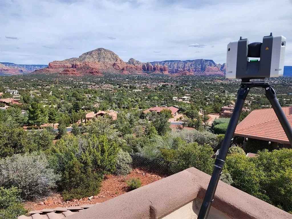
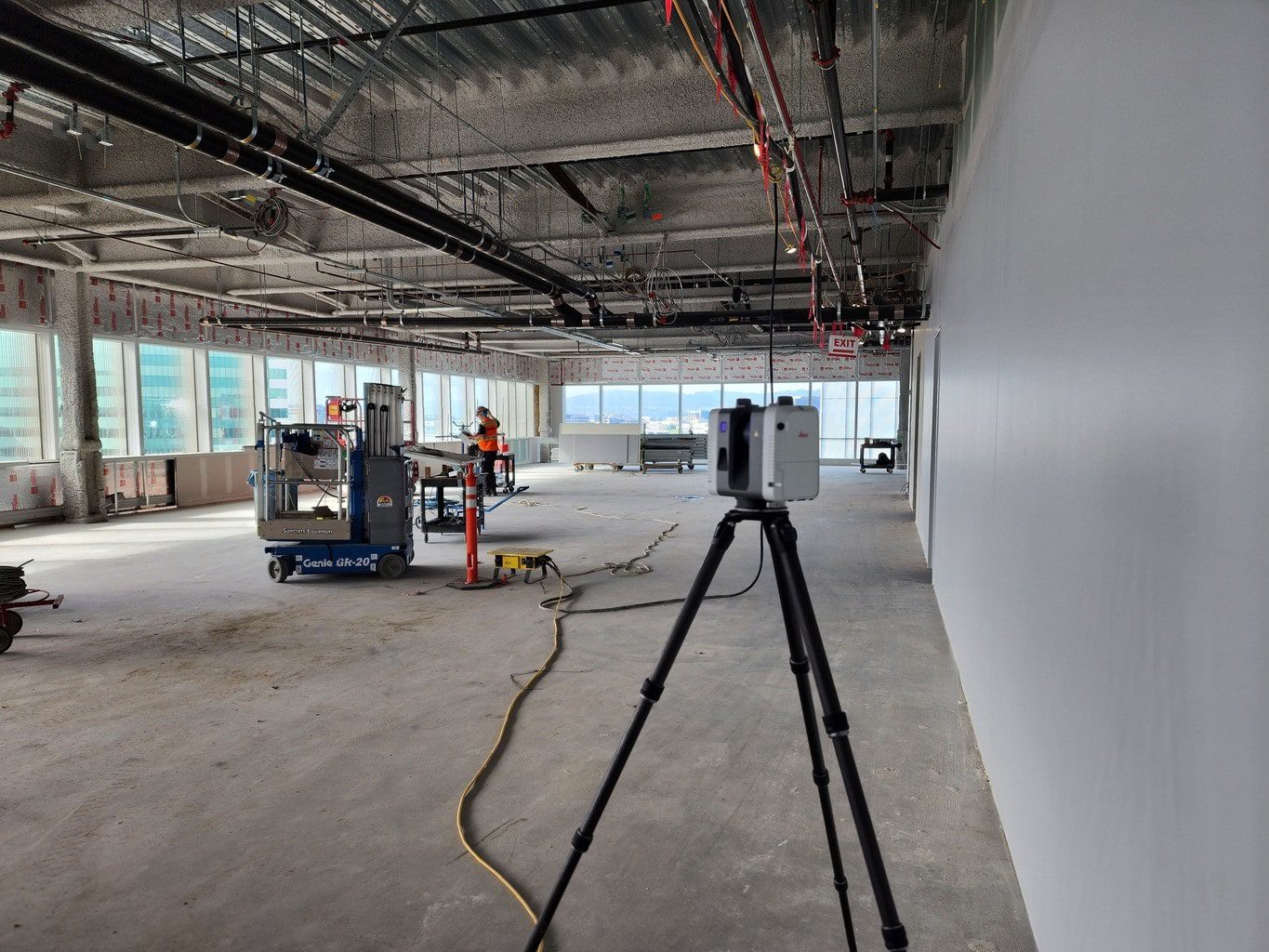
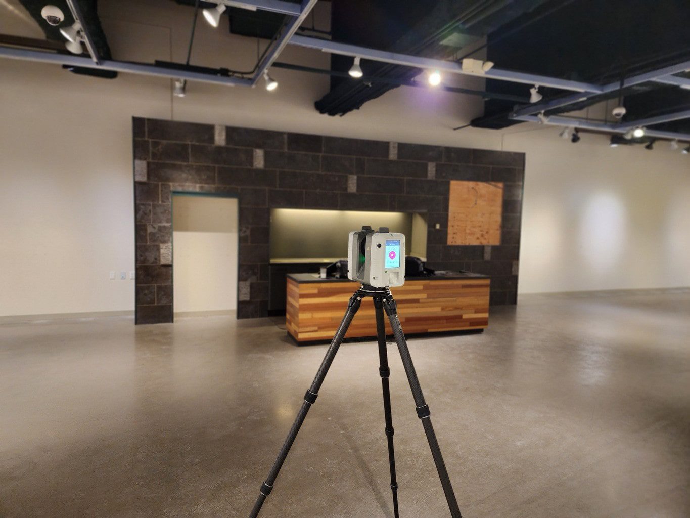
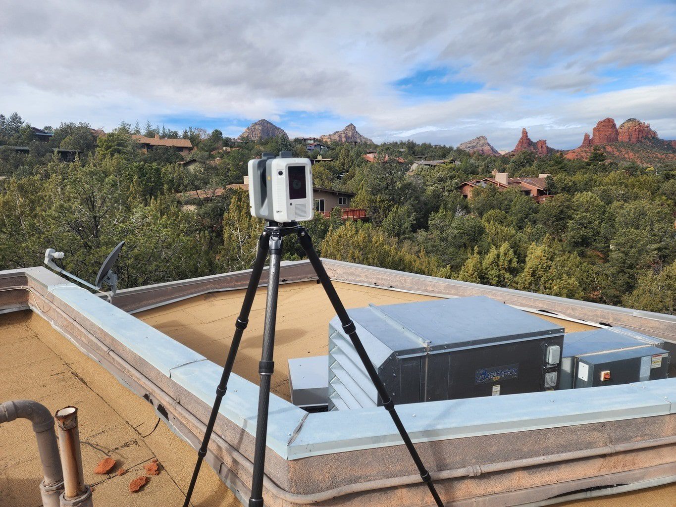
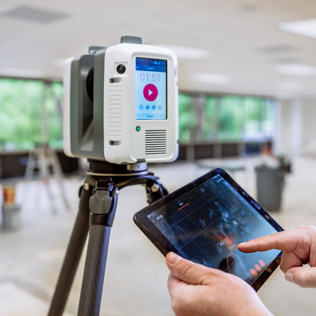
Every project starts with our Leica RTC360 scanner capturing existing conditions with ±1/8″ accuracy. We convert that raw point cloud data into permit-ready deliverables layered DWG files, intelligent Revit models, or registered point cloud exports in E57/LAZ format — and deliver within 48–72 hours. Whether you need existing conditions documentation for a single-suite tenant improvement or a full scan-to-BIM model for a multi-story commercial renovation, our Phoenix team has the equipment, workflow, and local experience to deliver.
3D Laser Scanning & Point Cloud Capture — Phoenix AZ

Our 3D laser scanning services provide highly accurate documentation of existing conditions with exceptional efficiency. Using advanced terrestrial LiDAR scanners and specialized methods, we capture millions of measurement points to generate precise point clouds that reveal detailed architectural, structural, and MEP elements across your project site. The data we provide ensures the exact dimensions needed for reliable digital models, supporting the successful completion of each job by delivering the accuracy and detail required for construction, engineering, or design tasks.
- Comprehensive site capture without disruptive manual measurements
- Rapid data collection for time-sensitive projects
- High-accuracy point clouds to support 2D drawings and 3D models
- Clear visualization of complex spaces including MEP and fire protection systems
- Capture of exact dimensions for reliable project outcomes
Topographic Surveys - Phoenix Construction and Site Planning
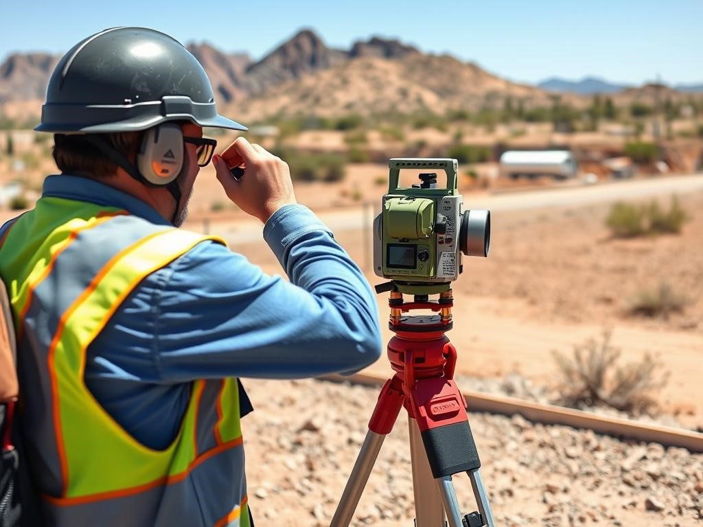
Our LiDAR-based topographic surveys provide exceptionally detailed terrain analysis for construction and development projects throughout Phoenix. Using state-of-the-art terrestrial laser scanning equipment, we capture precise ground elevations, slopes, and features with millimeter-level accuracy. Our technology also enables accurate surveying of infrastructure such as roads and bridges, supporting inspection, maintenance, and redesign needs.
These surveys form the foundation for site planning, civil engineering, and landscape design, delivering:
- Highly accurate terrain models with dense point spacing
- Comprehensive feature identification and classification
- Site Plan creation for any type of terrian.
- Detailed contour mapping at customizable intervals
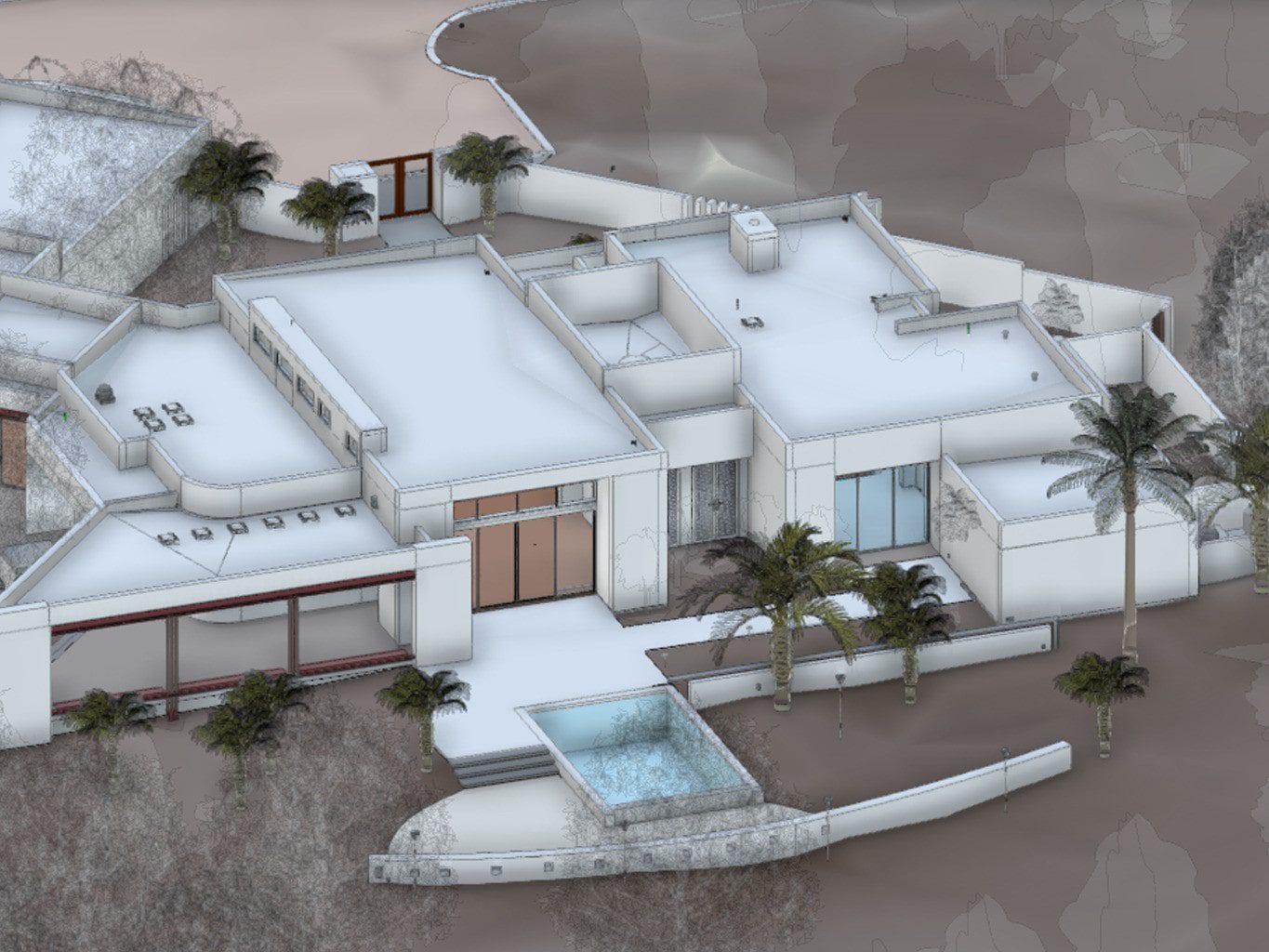
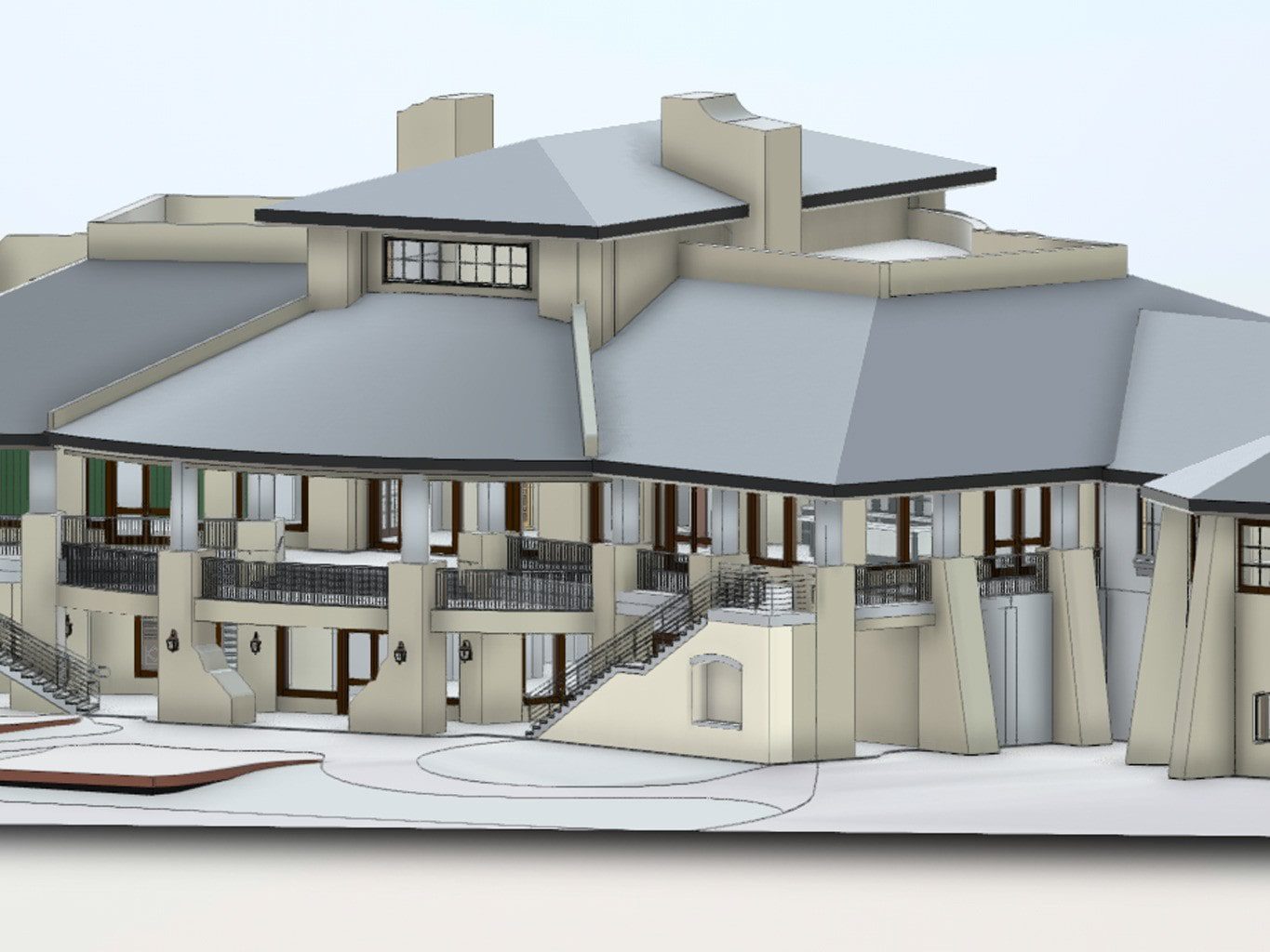
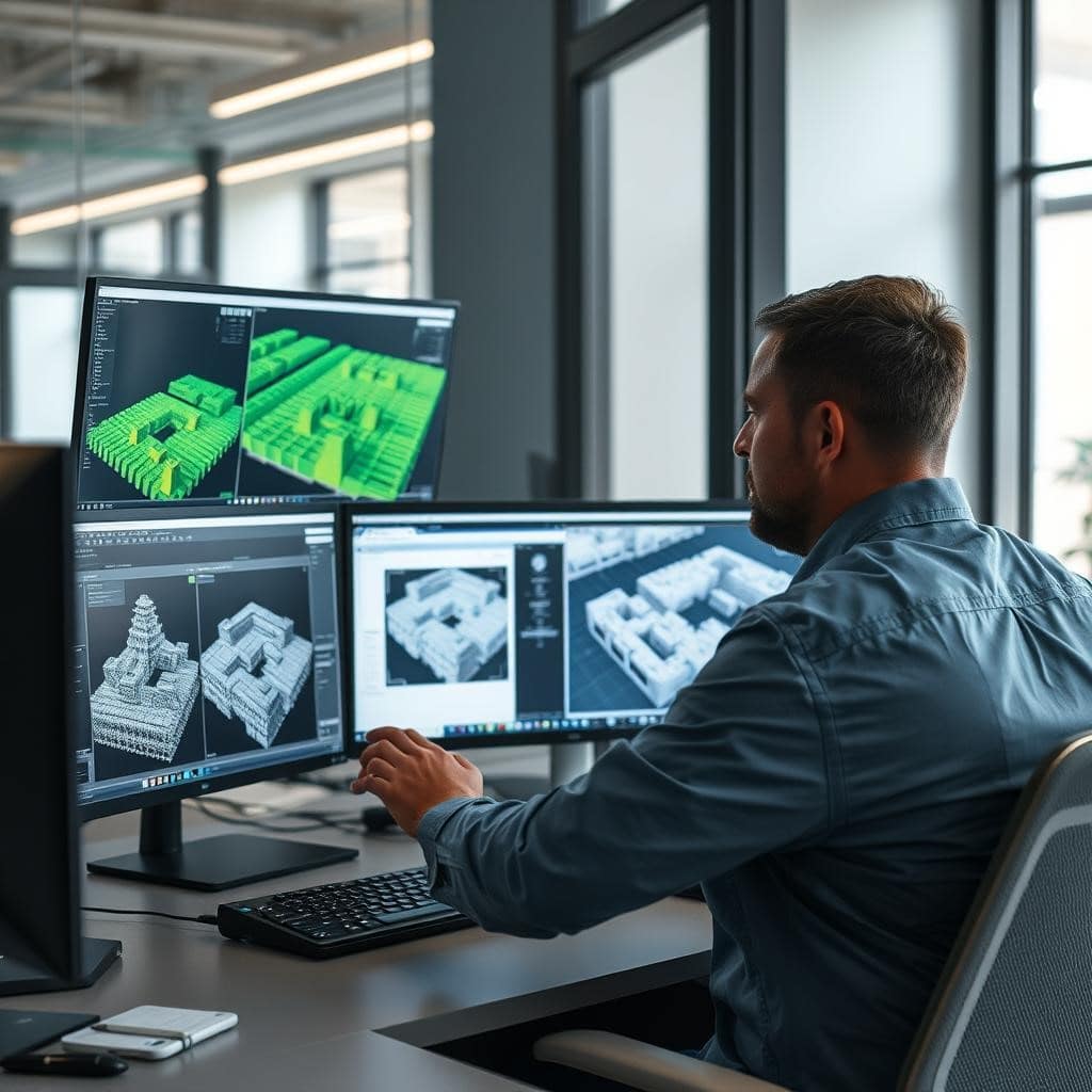
Scan to BIM & 3D Modeling Services — Phoenix AZ
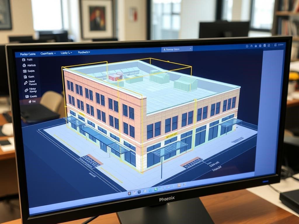
Our 3D modeling services transform raw LiDAR point cloud data into detailed, actionable digital models of your Phoenix property or project site. These models provide comprehensive spatial understanding and serve as the foundation for design, analysis, visualization, and reverse engineering of physical assets.
From building information modeling (BIM) to digital twins of existing structures, our 3D modeling capabilities include:
- Detailed BIM models for architecture and engineering
- Clash detection and spatial coordination
- Realistic visualizations for presentations and planning
- Delivery of CAD models for design and engineering workflows
We ensure quality and accuracy in the final delivery of digital models, providing project-ready outputs that meet your requirements.
Existing Conditions Documentation By Industry , Phoenix, Scottsdale, Tempe & Mesa
Phoenix’s construction and development market spans diverse building types from Scottsdale mixed-use and medical office to Downtown Phoenix adaptive reuse and Mesa industrial facilities. Our existing conditions documentation and 3D laser scanning services are tailored to the specific requirements of each sector. Below you’ll find how we serve residential homeowners, commercial property owners, retail operators, hospitality brands, historic preservation teams, and industrial facilities across the Phoenix metro.
Residential As-Built Drawings & LiDAR, Phoenix Homeowners
For Phoenix homeowners and residential developers, our LiDAR services provide crucial data for informed decision-making and precise planning.
- Accurate boundary and property line verification
- Detailed site planning for new home construction
- Precise pool and landscape design planning
- Flood risk assessment and drainage planning
- Solar panel placement optimization
- As-built documentation for any type of house, supporting renovations and maintenance
Our residential LiDAR services help Phoenix homeowners maximize their property potential while avoiding costly planning errors. From custom home builds to property improvements, accurate spatial data ensures optimal results and helps reduce change orders during residential construction or renovation.
Commercial As-Built Documentation — Phoenix Buildings & Facilities
Phoenix’s commercial sector benefits from our comprehensive LiDAR solutions that streamline development, renovation, and facility management processes, providing facility managers with the accurate data they need for effective building operation and planning.
- Detailed as-built documentation for existing structures
- BIM integration for renovation and expansion projects
- Space optimization and utilization analysis
- MEP system documentation and coordination
- ADA compliance verification and planning
Our team is ready to assist commercial clients and facility managers with their documentation and modeling needs, helping Phoenix businesses reduce construction costs, minimize disruptions, and optimize their physical assets through accurate spatial data and modeling.
Looking for industry-specific LiDAR solutions in Phoenix?
Our team specializes in tailored LiDAR services for your specific industry requirements.
Retail As-Built Drawings & LiDAR Scanning, Phoenix Stores & Shopping Centers
Phoenix retailers benefit from our LiDAR services that optimize space utilization and enhance customer experience.
- Comprehensive site selection analysis
- Detailed floor plan and fixture layout optimization
- Customer flow analysis and improvement planning
- Precise as-built documentation for renovations
Our retail-focused LiDAR services help Phoenix businesses maximize their space efficiency, improve customer experience, and streamline renovation projects through accurate spatial data.
Hospitality As-Built Documentation, Phoenix & Scottsdale Hotels, Resorts & Venues
Phoenix’s thriving hospitality sector leverages our LiDAR services for property development, management, and guest experience enhancement.
- Comprehensive property documentation and digital twins
- Expansion planning and visualization
- Amenity placement optimization
- Accessibility compliance verification
Our hospitality-focused LiDAR services help Phoenix hotels and resorts enhance their properties, plan improvements, and maintain accurate facility documentation for efficient operations.
Ready to achieve similar results for your Phoenix project?
Our team has the expertise and technology to deliver exceptional LiDAR solutions for your specific needs.
Why Phoenix Architects & Contractors Choose LiDAR Precise Plans
Our Phoenix LiDAR services utilize the most advanced technology available, combined with state-of-the-art methods for data collection and processing, ensuring exceptional data quality and project outcomes. Our equipment and software advantages include:
Higher data accuracy, and more valuable deliverables for our Phoenix clients across all industries.
Hardware Excellence
- Multi-platform LiDAR systems for aerial, mobile, and terrestrial applications
- High-density scanners capturing up to 2 million points per second
- Integrated high-resolution imaging for colorized point clouds
- Survey-grade GPS integration for precise georeferencing
Software Capabilities
- Advanced point cloud processing for optimal data quality
- Specialized modeling software for diverse deliverables
- BIM integration for architecture and engineering workflows
- Custom visualization tools for client communication
Accuracy, Tolerances & QA/QC Process
Our Phoenix 3D laser scanning services achieve ±1/8″ (3mm) positional accuracy — meeting AIA, NIBS, and LOD 300 BIM standards required for commercial renovation, tenant improvement, and permit submissions across Phoenix and Scottsdale.
Every project follows our 4-step QA/QC process:
1. Pre-scan calibration: Leica RTC360 scanner is field-calibrated before every scan session to verify measurement integrity under Phoenix’s high-temperature conditions.
2. Minimum 30% scan overlap: All scan stations maintain at least 30% overlap coverage to eliminate blind spots and ensure complete existing conditions documentation across every floor and elevation.
3. Registration verification: All projects are delivered with RMS registration error under 3mm. Every dataset is reviewed for alignment accuracy before production begins.
4. Client deliverable review: Final CAD drawings, Revit models, or point cloud exports are reviewed against scope requirements before handoff. Every project report includes accuracy documentation so your team has full traceability.
Our Phoenix as-built drawings are trusted by architects, engineers, and general contractors who need verified data they can build from — not estimates.
As-Built Drawings Delivered in 48–72 Hours
Speed matters on Phoenix construction projects. Our standard turnaround for as-built drawings and scan-to-CAD deliverables is 48–72 hours from completed scan to final file delivery — with same-week scheduling available across Phoenix, Scottsdale, Tempe, Mesa, Chandler, and the broader metro.
Here’s how we hit that timeline consistently:
Same-day scan completion: Most residential and small commercial properties are fully scanned in 3–6 hours using the Leica RTC360. Larger commercial as-built projects requiring full MEP documentation are typically completed in one full day on-site.
Parallel processing: Point cloud registration and cleanup begins while scanning is still in progress, compressing the total project timeline without compromising accuracy.
Dedicated Phoenix production team: CAD drafters and BIM modelers work from verified point cloud data to produce layered DWG files and LOD 300 Revit models on a defined delivery schedule.
Rush delivery available: For time-sensitive Phoenix projects, 24-hour turnaround on as-built drawings is available. Contact us with your address and square footage for availability.
Need scan-to-BIM instead of CAD? Revit model delivery typically runs 3–5 business days depending on building complexity and MEP scope. Request sample files from a comparable Phoenix commercial project before committing.
Recent Phoenix Project: Scottsdale Mixed-Use Renovation
Our team scanned a 4-story, 26,000 sqft mixed-use building in Scottsdale in a single day using the Leica RTC360. Working around active ground-floor retail, we completed all scan positions with zero operational disruption. Deliverables included fully registered point clouds, 38 CAD sheets, and a LOD 300 Revit model all delivered within 5 business days.
The general contractor used our MEP documentation to identify and resolve 3 coordination conflicts before rough-in, avoiding an estimated $35,000–$50,000 in change orders. The architect confirmed dimensions matched field conditions to within 2mm across all floors.
This technological advantage translates to faster project completion, higher data accuracy, and more valuable deliverables for our Phoenix clients across all industries.
Request a LiDAR Services Consultation
Ready to leverage the power of LiDAR technology for your Phoenix project? Contact us today for a free estimate on our LiDAR services. Request sample DWG or Revit files from a similar Phoenix project before committing
Prefer to speak with a LiDAR specialist directly?
Trusted Phoenix LiDAR Company 48-Hr Turnaround, ±1/8" Accuracy
When selecting a LiDAR service provider in Phoenix, expertise, technology, and local knowledge make all the difference. We support contractors with reliable data that streamlines construction workflows and helps minimize project delays. Our team combines industry-leading capabilities with deep understanding of Phoenix’s unique environment and development landscape.
Local Expertise
Our team has extensive experience throughout the Phoenix metropolitan area, serving clients in Downtown Phoenix and other key neighborhoods, with deep understanding of local terrain, building practices, and regulatory requirements.
Technical Excellence
We invest in the most advanced LiDAR technology and continuous staff training to deliver exceptional data quality and innovative solutions for every project.
Client-Focused Approach
We prioritize understanding your specific project requirements and delivering customized solutions that address your unique challenges and objectives.
Ready to experience the difference of professional LiDAR services in Phoenix?
Contact our team today to discuss your project requirements and discover how our LiDAR solutions can deliver exceptional results.
Frequently Asked Questions About 3D Laser Scanning Phoenix
Phoenix's construction market from Scottsdale mixed-use to Mesa medical campuses to downtown Phoenix adaptive reuse moves fast, and teams can't afford to design off outdated or nonexistent drawings. LiDAR scanning gives Phoenix project teams verified existing conditions before design begins, eliminating the field conflicts and change orders that derail schedules. It's also the only practical method for documenting occupied commercial buildings without shutting down operations — a key consideration in the Valley's active retail and hospitality market.
Phoenix commercial projects typically range from $2,950–$6,500 for a single-tenant suite scan-to-CAD set, up to $9,000–$15,000+ for a multi-story building with full Scan-to-BIM and MEP documentation. Scottsdale hospitality and medical office projects often fall in the mid-range due to ceiling complexity. We provide fixed-fee proposals — no hourly billing, no surprises — usually within 24 hours of a site description.
It depends on what your team does downstream. Phoenix architects and interior designers typically request AutoCAD floor plans, reflected ceiling plans, and elevations (DWG/PDF) as their working base. General contractors and MEP engineers on larger Valley projects often need a Revit BIM model (RVT) for coordination. Developers and facility managers sometimes want the registered point cloud itself for ongoing use. We scope every Phoenix project to match your actual workflow — not a default package.
The Leica RTC360 we use is rated for operation above 120°F — the Phoenix summer heat doesn't affect scanner performance. What does matter is thermal expansion in steel-framed commercial buildings: we schedule sensitive scans for early morning or climate-controlled interiors when tight tolerances are specified. Deliverables are typically produced to approximately ±1/8" accuracy depending on project scope and deliverables.If your project requires tighter tolerances (structural or MEP-critical work), we confirm that during scoping.
Yes, and this comes up often on Phoenix tenant improvement and medical office projects. We can produce both deliverables from the same scan dataset — a 2D AutoCAD set for permit submission and a Revit BIM model for design coordination. For a full breakdown of each workflow, see our Scan-to-CAD and Scan-to-BIM service pages. For Phoenix projects, just tell us what your downstream team uses and we'll match the scope accordingly.
We're based in the Southwest and cover the entire Phoenix metro — Scottsdale, Tempe, Mesa, Chandler, Glendale — with no travel surcharge and typical field scheduling within 3–5 business days of contract execution. Rush mobilization (24–48 hours) is available for time-sensitive projects. Drawing delivery follows field work by 5–10 business days for CAD and 7–14 for BIM, depending on scope.
The majority of our Phoenix work falls into four categories: tenant improvements and retail rollouts, shopping center renovations, medical office and healthcare facilities (where MEP accuracy is non-negotiable), hospitality and restaurant renovations, and multi-family/mixed-use documentation for developers working in the urban core.
Many national retail brands rely on LiDAR scanning when expanding into Phoenix shopping centers and mixed-use developments, where accurate existing conditions documentation is critical before design and construction begin.
If you have an existing conditions or as-built documentation need anywhere in the Phoenix metro — Scottsdale, Tempe, Mesa, Chandler, or Glendale we can quickly review the scope and recommend the right deliverables.
Preserving History with Precision Plans
Our Phoenix team specializes in historic building documentation and preservation as-builts↗, helping property owners protect the city’s unique architectural heritage.