Start your project with reliable, scan-accurate documentation you can trust.

STATS
Years in Commercial Architecture
U.S. Markets Served
±1/2"
Verified Dimensional Accuracy
Buildings Documented
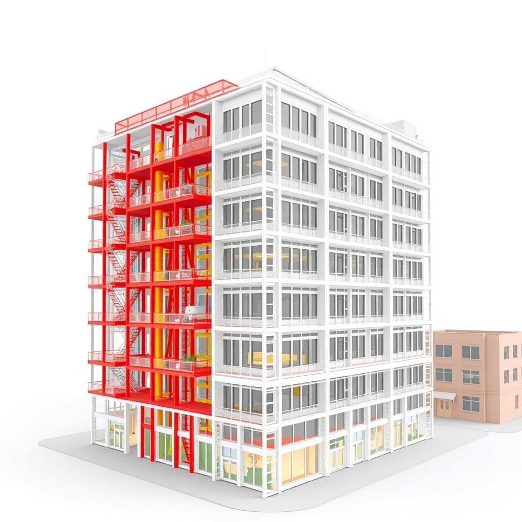
San Francisco as-built drawings produced from advanced LiDAR scans with typical accuracy of ±2–3 mm. We convert detailed point clouds into permit-ready measured drawings, floor plans, and CAD/Revit files that help architects, contractors, and property owners save time, reduce costly rework, and keep projects on schedule.
Need Precise Measured Drawings?
Request a tailored quote — our team responds quickly and provides sample files so clients can review formats and scope before committing.
Professional As-Built Drawings & Measured Floor Plans in San Francisco
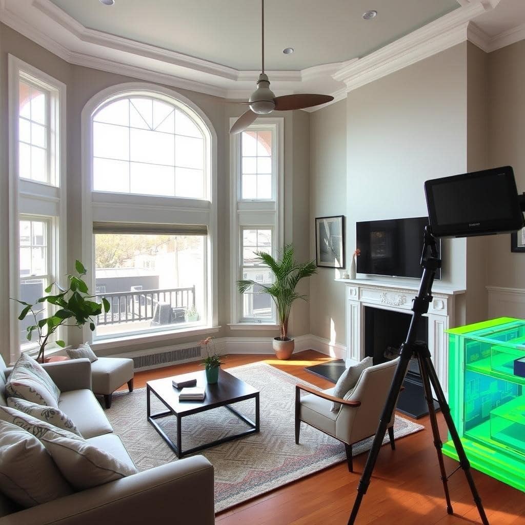
Our San Francisco as-built drawings team uses LiDAR scanning to produce measured floor plans, elevations, sections, and 3D models delivered in CAD (DWG) and Revit (RVT) formats. Whether you need a scan-to-CAD for a straightforward renovation or a full scan-to-BIM model for complex commercial projects, we deliver permit-ready documentation.
Our point cloud services capture every detail from structural elements to MEP systems, giving architects, contractors, engineers, and developers the reliable existing-conditions data they need to reduce rework and keep San Francisco projects on schedule.
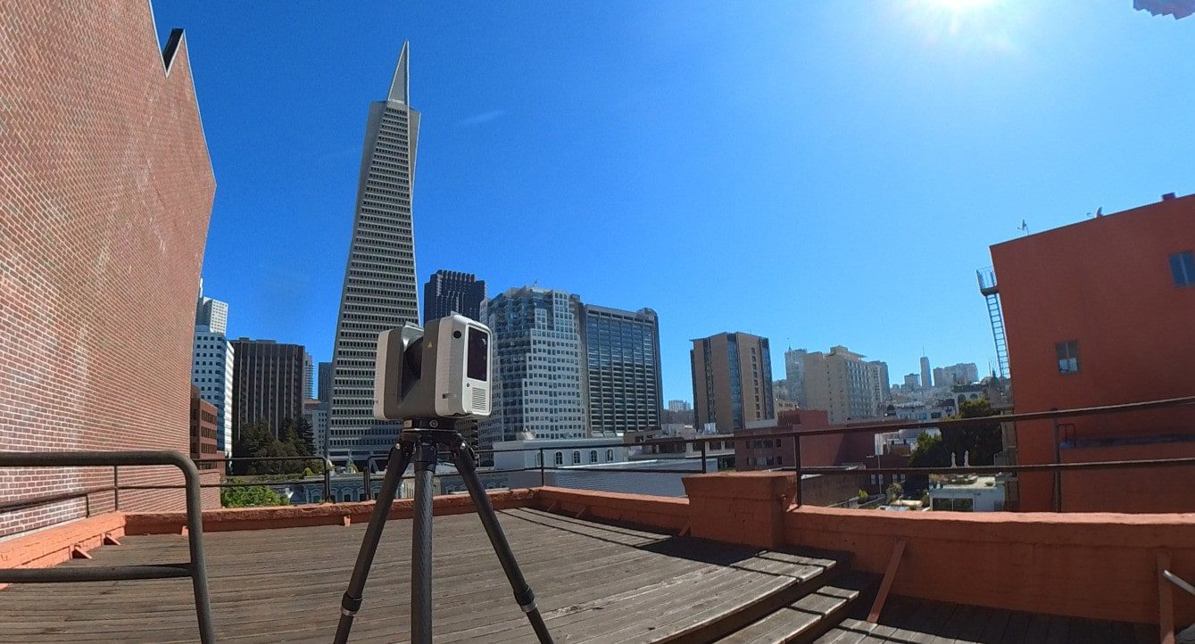
3D Laser Scanning & LiDAR Scanning for Seismic Retrofits in San Francisco
San Francisco’s seismic retrofit requirements demand accurate existing-conditions data. Our 3D laser scanning and LiDAR services are used to document buildings for soft-story retrofits, structural upgrades, and code compliance.
We are familiar with local Department of Building Inspection (DBI) requirements, including documentation needed for seismic upgrades, ADUs, and historic properties. Our as-built drawings and MEP documentation are structured to support permit submissions and engineering analysis.
Whether you’re working on a retrofit, tenant improvement, or preservation project, we deliver accurate, field-verified data that reduces design risk and supports faster approvals.
Have a project in mind? We’d love to hear about it.
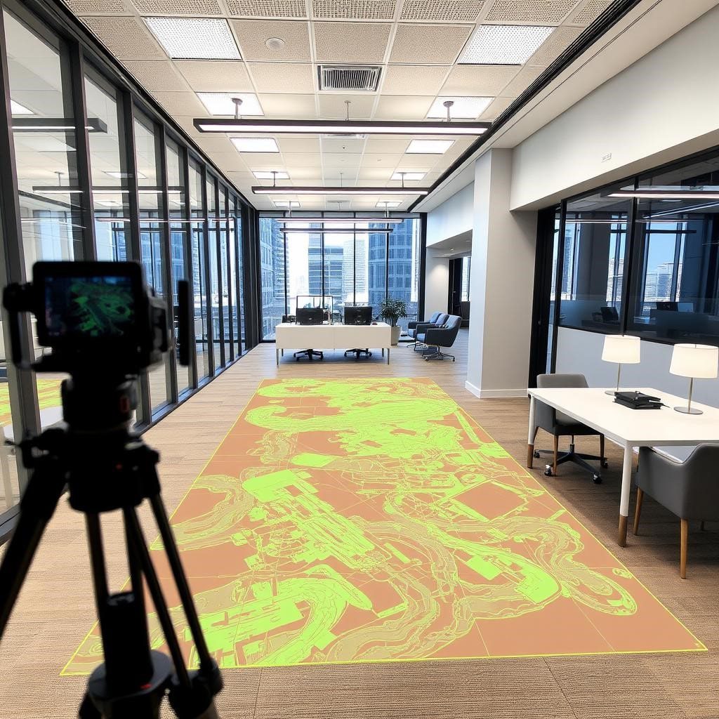
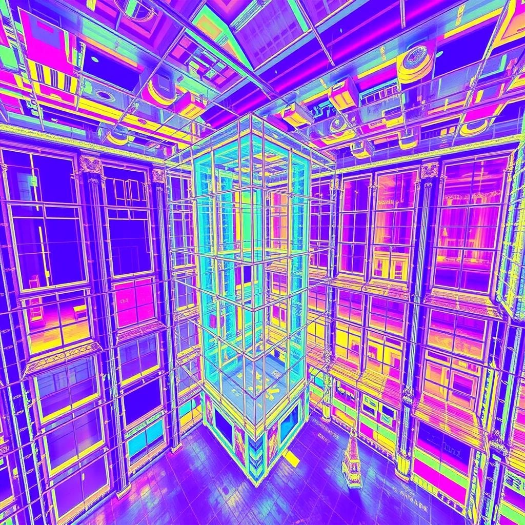
Point Cloud Services with Scan to CAD & Scan to BIM in San Francisco
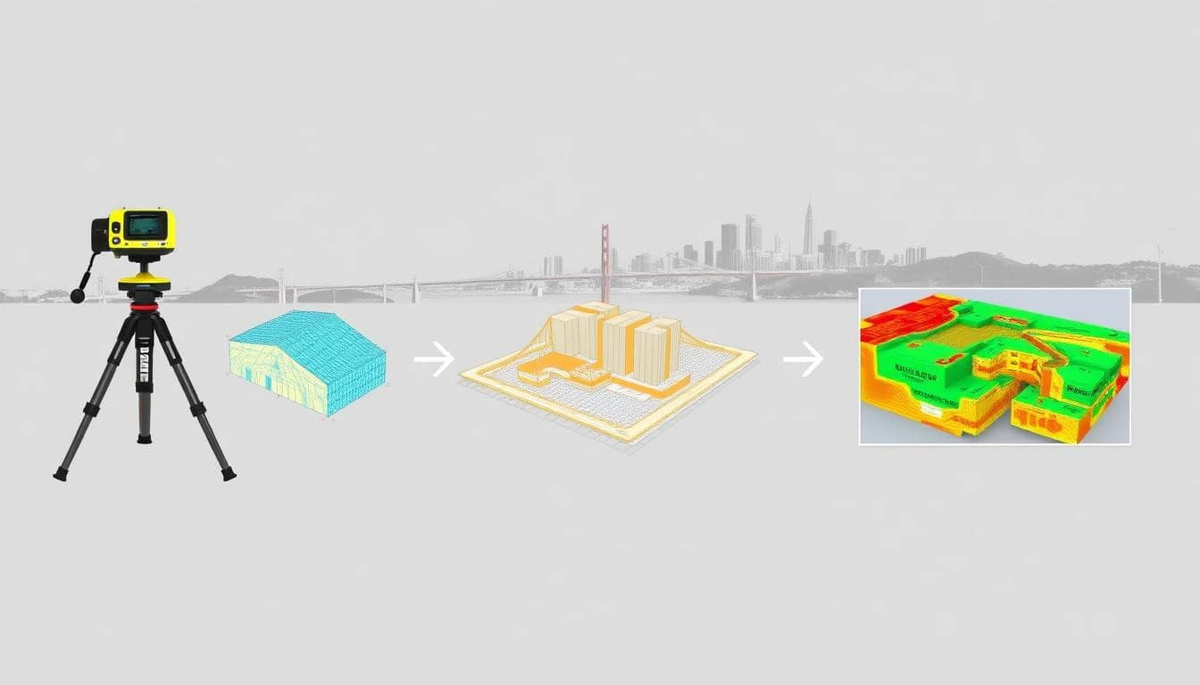
San Francisco architects, engineers, and contractors rely on our point cloud services to convert raw laser-scanned data into production-ready scan-to-CAD drawings (DWG) and scan-to-BIM models (Revit). Our 3D laser scanning captures millions of data points in minutes, documenting existing conditions with a typical accuracy of ±2–3 mm.
We deliver layered CAD files, intelligent Revit models with architectural and MEP components, and exportable point clouds (E57/LAZ), giving your team everything needed for renovation design, clash detection, and construction coordination on San Francisco projects.
Not sure which deliverable you need? We’ll help you figure it out.
Why San Francisco Architects & Contractors Choose Our LiDAR Scanning Services
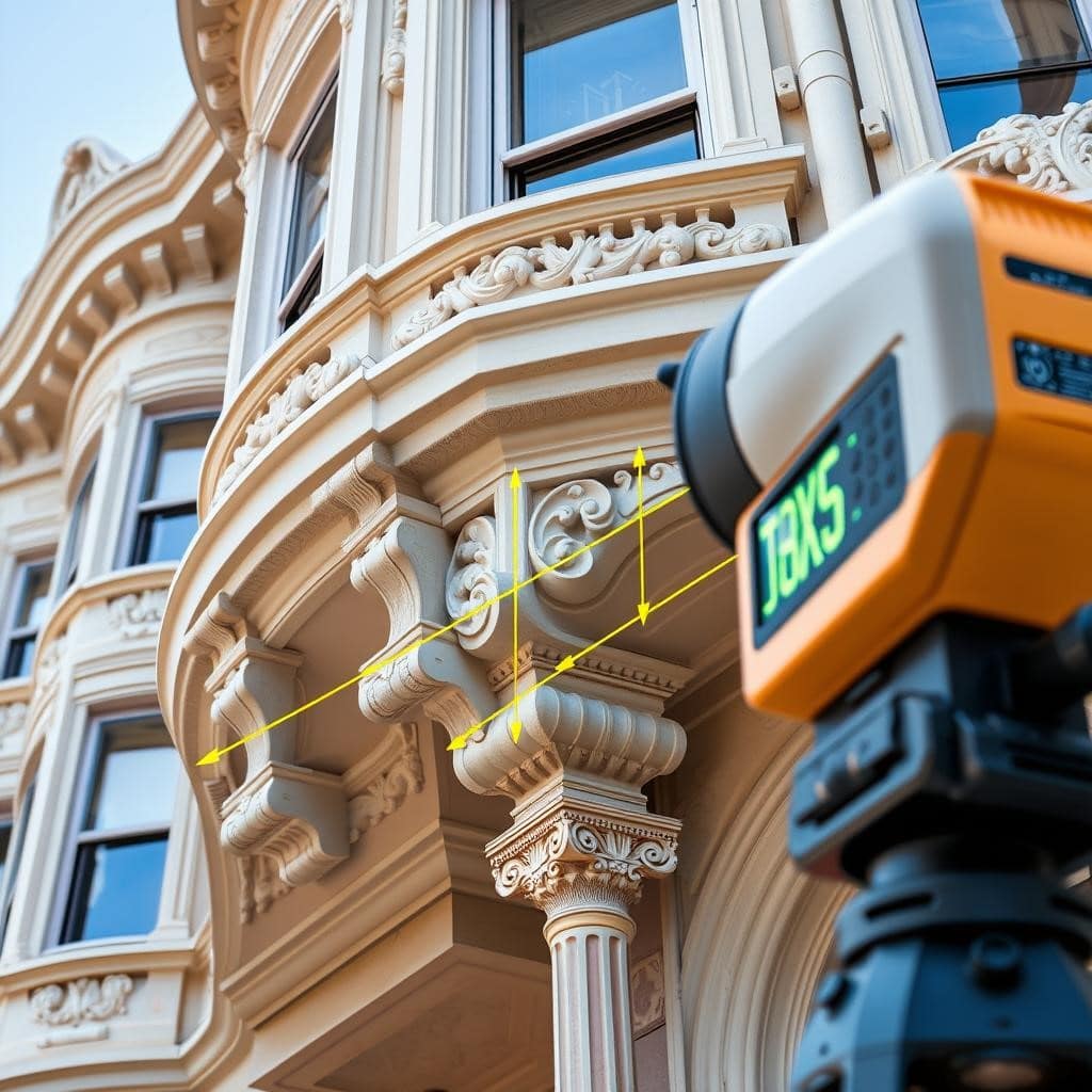
San Francisco professionals proudly choose LiDAR Precise Plans because we’re dedicated to combining cutting-edge LiDAR scanning technology with thorough field verification to ensure you receive reliable as-built drawings. For historic preservation projects, our detailed measured drawings beautifully capture intricate facades and unique geometries, making HPC reviews seamless.
For commercial as-built projects, we provide everything from floor plans and MEP documentation to reflected ceiling plans and BOMA area calculations. Our innovative scan-to-BIM and scan-to-CAD workflows generate permit-ready files for seismic retrofits, tenant improvements, and ADU additions. Plus, our point cloud services equip engineers and contractors with an invaluable digital record of every building, paving the way for successful projects.
Have a project in mind? We’d love to hear about it.
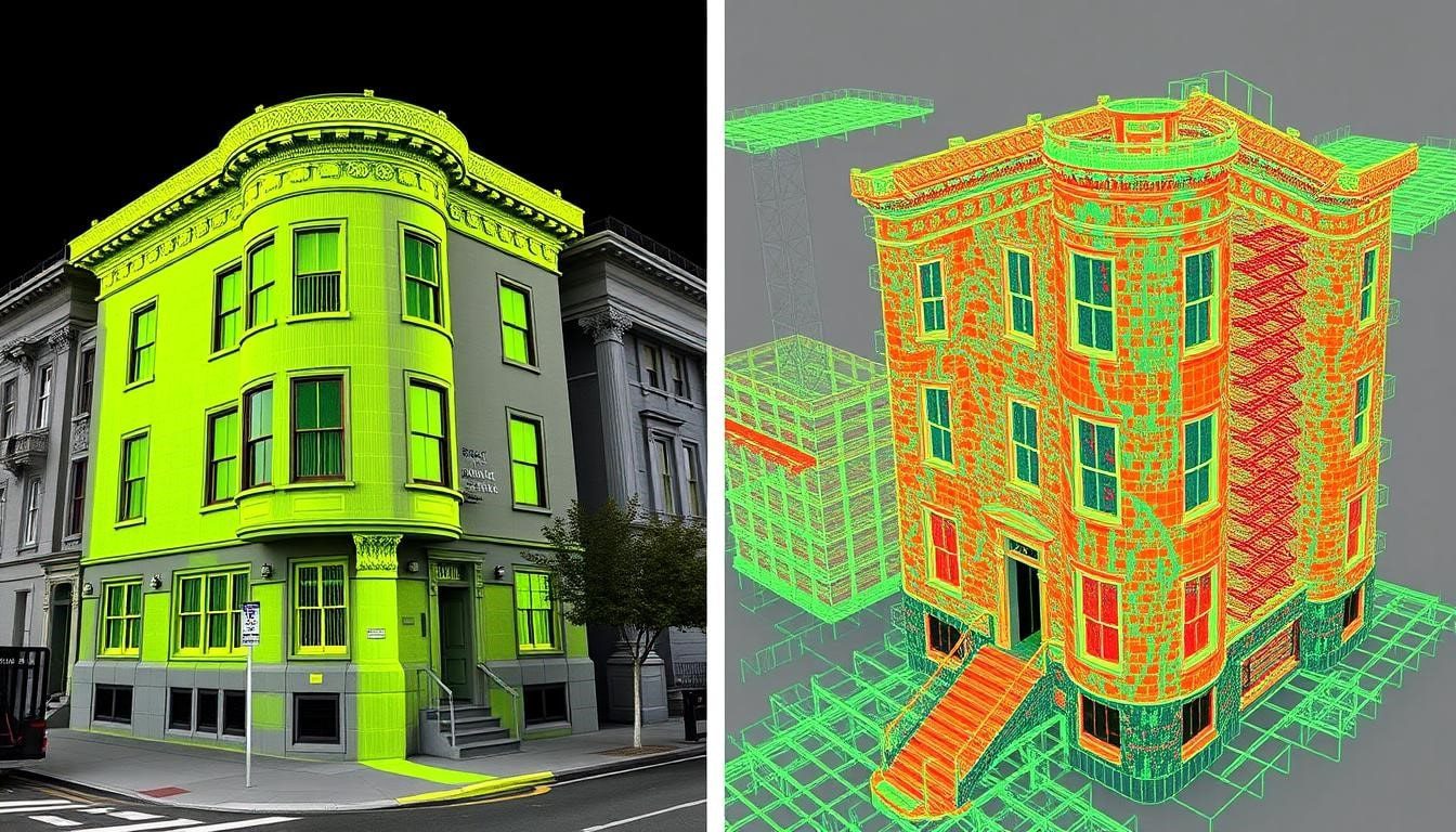
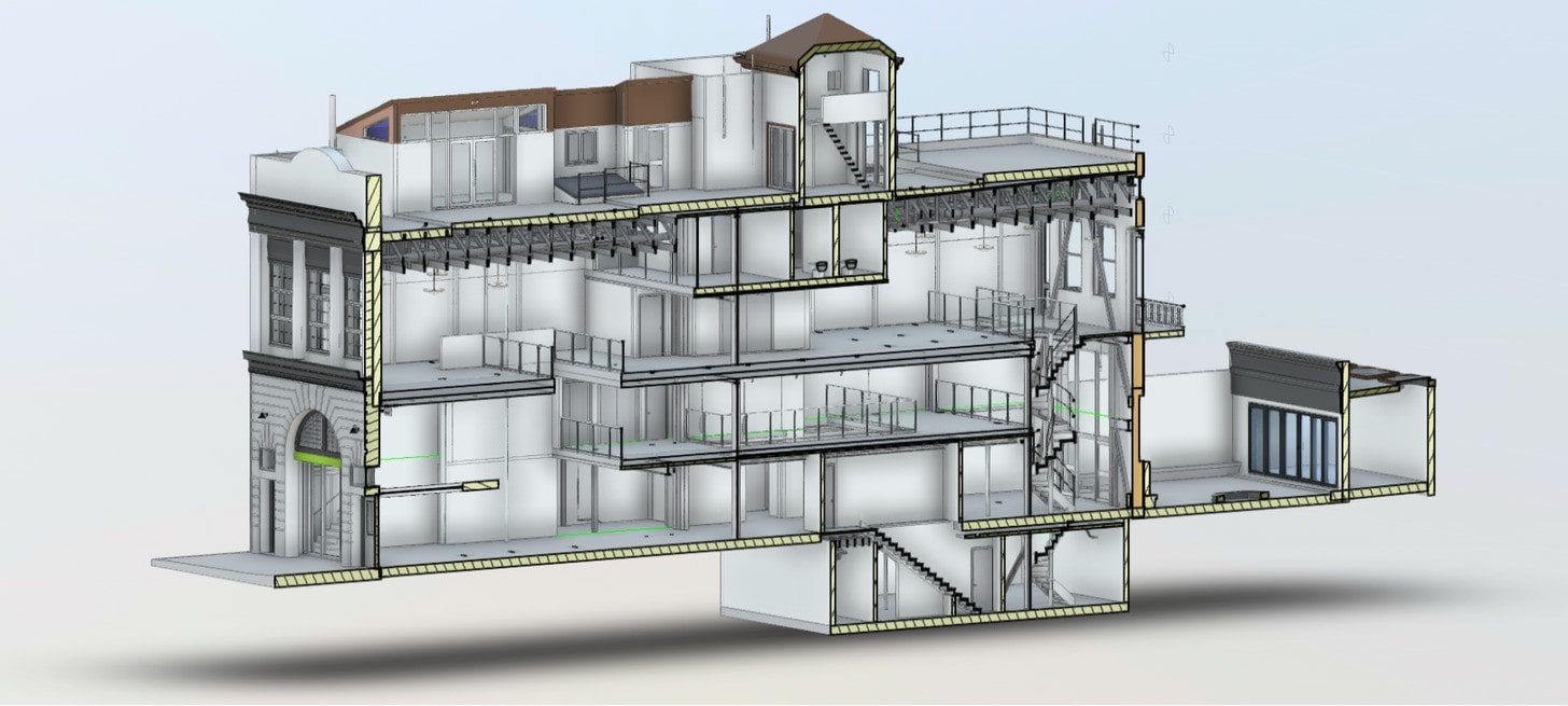
LiDAR Scanning & As-Built Drawings for a Historic San Francisco Building
A recent project in San Francisco’s Pacific Heights neighborhood showcases our full-service approach to LiDAR scanning and as-built drawings. Our team used 3D laser scanning to capture the intricate architectural details of a Victorian-era building slated for adaptive reuse. We produced comprehensive as-built drawings, including floor plans, exterior elevations, roof plans, and MEP documentation, all generated from high-density point cloud data.
This type of work is a core part of our San Francisco practice — documenting Victorian-era and mixed-use buildings throughout North Beach, the Mission District, and SoMa, where accurate existing-conditions data directly shapes renovation and preservation outcomes.
The scan-to-BIM deliverables enabled preservation architects to develop restoration strategies that honored the original design while meeting modern seismic and code requirements. This project exemplifies how our commercial as-built services in San Francisco combine precision, local expertise, and fast turnaround to keep complex projects moving.
Reach out for a tailored quote based on your property and project scope.
Who Uses Our As-Built Drawings & LiDAR Scanning in San Francisco
Our San Francisco as-built drawings and LiDAR scanning services support a wide range of professionals and project types. Architects use our scan-to-CAD and scan-to-BIM deliverables to jump straight into design without manual field measurements. Engineers rely on our point cloud services and MEP documentation for seismic retrofit analysis and structural evaluation.
Contractors use our commercial as-built documentation for tenant improvement coordination, construction sequencing, and clash detection. Property owners and developers leverage our 3D laser scanning to document existing conditions before renovations, ADU additions, and permit submissions across San Francisco.
Get a Quote for As-Built Drawings & LiDAR Scanning in San Francisco
Request a quick quote for professional as-built drawings and LiDAR scanning in San Francisco. Choose permit-ready scan to CAD deliverables (layered DWG files) or full scan to BIM models (Revit RVT with architectural and MEP layers) or both.
Our team also provides point cloud exports (E57/LAZ) for engineers and contractors who need raw 3D laser scanning data for their own analysis. Our six-step workflow takes you from initial consultation to final files efficiently:
- Scope call and site review
- On-site LiDAR scanning
- Point cloud processing and registration
- As-built drawing production in CAD/Revit
- MEP documentation and specialty deliverables as needed
- Quality review and secure file delivery.
Provide your San Francisco property address, approximate square footage, and preferred deliverables for a fast, tailored quote. We typically respond within 24 hours and can schedule same-week scans across San Francisco and the Bay Area. Request sample DWG/Revit files from similar commercial as-built or residential projects to verify format, layer structure, and level of detail before committing.
Get in touch, and we’ll put together a tailored quote for your project.
Frequently Asked Questions About Retail As-Built Drawings
A:As-built drawings are precise documents that record the current conditions of a San Francisco building, including all walls, openings, and structural elements. They capture changes made during previous construction and are vital for future renovations, seismic retrofits, permit submissions, and code compliance. In San Francisco, they are particularly important for historic properties, soft-story upgrades, and DBI permit applications. Our LiDAR scanning technology achieves ±2–3 mm accuracy, surpassing the accuracy of traditional measurement methods.
A:
The cost of 3D laser scanning in San Francisco varies with building size, complexity, and deliverables such as CAD drawings or point cloud exports. Residential LiDAR projects typically range from a few hundred to a few thousand dollars, while commercial projects are individually scoped based on square footage and required documentation. Contact us with your property address and delivery preferences for a free quote.
A:
Most residential and small commercial properties in San Francisco are scanned within a few hours using our LiDAR scanning equipment. Larger or more complex buildings, including multi-story commercial as-built projects requiring full MEP documentation, may require a full day on-site. After scanning, our team processes the point cloud data and produces final as-built drawings, scan-to-CAD files (DWG), or scan-to-BIM models (Revit), typically within one week.
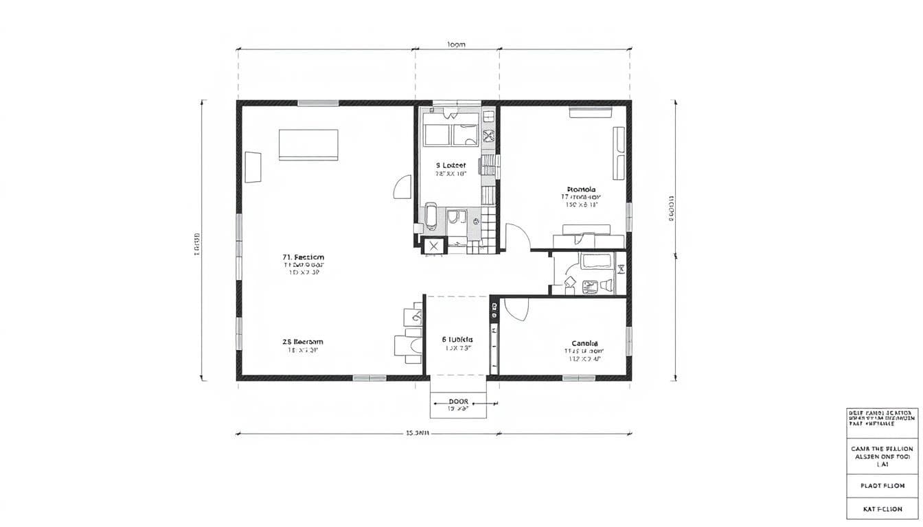
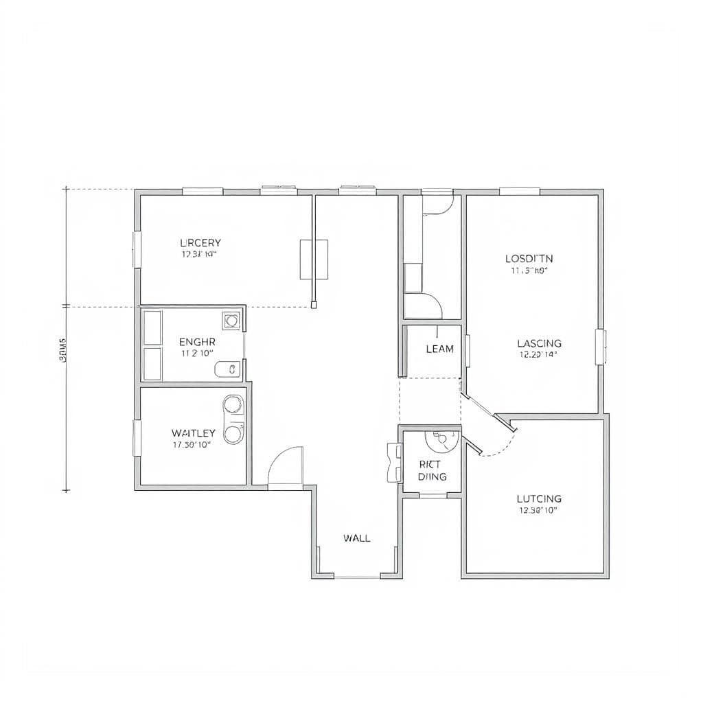
A:A standard San Francisco as-built drawing set includes floor plans, elevations, sections, and roof plans. We also offer reflected ceiling plans, MEP documentation, site plans, and 3D point cloud data exports, depending on the project scope. Deliverables can be provided as scans of CAD files (layered DWG) or as scans of BIM models (Revit with separate architectural and MEP layers). Sample files are available for you to verify the format and detail before you commit.
A:Scan-to-CAD (DWG) is the right choice for permitting, basic renovations, and projects requiring 2D documentation.
Scan-to-BIM (Revit) is better suited for complex commercial projects where architectural, structural, and MEP coordination is critical — especially when the scope involves multiple trades, clash detection, or long-term facility management.
In San Francisco, we frequently recommend BIM for adaptive reuse and seismic retrofit projects, where phased construction and code compliance demand a higher level of detail. For simpler scopes, CAD remains the faster, more cost-effective path.
A:Our LiDAR scanning provides as-built drawings in San Francisco with an accuracy of ±2–3 mm, significantly better than the ±2–3 inches typically achieved with manual measurements. This precision comes from our 3D laser scanning technology, which produces dense point cloud data for CAD drawings or BIM models. Accuracy may vary based on site conditions, surface reflectivity, and scanning range; please consult our team for specific details.
A:Accurate as-built drawings provide San Francisco architects, contractors, and property owners with a reliable record of existing conditions, minimizing surprises and costly change orders. Our LiDAR scanning captures complete building geometry as point cloud data, which we convert into CAD or BIM deliverables. These serve as a permanent digital record for future MEP documentation, permit submissions, or construction coordination.
A:Scan-to-CAD delivers 2D or simplified 3D drawings in DWG format — the standard output for permitting, drafting, and basic renovation documentation.
Scan-to-BIM delivers an intelligent 3D Revit model where architectural, structural, and MEP systems are modeled as data-rich components. This allows design teams to coordinate across trades, run clash detection, and carry the model into construction and facilities management.
Both start from the same LiDAR point cloud. The difference is how much intelligence is built into the deliverable — and how far downstream it can be used.
A:Our San Francisco point cloud services include high-density LiDAR scanning, point cloud registration and cleanup, and conversions to CAD (2D DWG) and BIM (3D Revit) models. We also offer full MEP documentation and commercial as-built services, such as BOMA calculations and reflected ceiling plans. Contact us with your project details for a tailored scope and samples.
Historic Building Documentation
Measured drawings tailored for preservation and adaptive reuse — we capture ornate facades, interior millwork, and irregular geometries to produce permit-ready plans that respect historic character while enabling code-compliant upgrades. Sample files available on request.
Learn More
Commercial LiDAR Scanning
As-built drawings for offices, retail, and multi-tenant properties — including MEP capture, reflected ceiling plans, and BOMA area calculations — to streamline tenant improvements, leasing strategy, and retrofit design. Ask for sample DWG and Revit exports.
Learn More
Residential As-Built Services
Measured floor plans, exterior elevations, roof and site plans for single-family homes, condos, and multi-family buildings — ideal for remodels, ADUs, and permit submittals. We deliver CAD/Revit files that integrate directly into your design and construction workflows.
Learn More
The LiDAR Advantage for San Francisco Projects
For architects, engineers, and contractors, LiDAR-based as-built services produce reliable measured drawings and CAD-ready files that speed design and eliminate on-site unknowns. Our 3D laser scanning captures millions of points in minutes to document existing conditions with sub-centimeter precision (typical ±2–3 mm; accuracy depends on site conditions and range).
Traditional Methods vs. LiDAR Scanning
| Comparison Point | Traditional Methods | LiDAR Scanning |
|---|---|---|
| Accuracy | ±2–3 inches | ±2–3 millimeters (typical) |
| Time on Site | Days to weeks | Hours for typical buildings |
| Data Completeness | Limited sampling | Comprehensive point cloud |
| Hard-to-Access Areas | Often estimated | Fully captured |
| Deliverable Types | 2D drawings only | 2D & 3D models, CAD, Revit |
Note: Stated precision is typical; site conditions (reflectivity, range, line-of-sight) can affect results — ask our team for site-specific specs.
Top Benefits for Your Project
- Document existing conditions precisely to reduce RFIs and change orders—saving time and money.
- Produce measured drawings, floor plans, and elevations ready for permit submittal and design coordination.
- Deliver CAD and Revit files that integrate directly into your workflow for faster design iterations.
- Minimize site disruption with quick scans—ideal for occupied buildings and tight schedules.
- Improve construction coordination with accurate files that support clash detection and sequencing.
We routinely provide sample deliverables (sample DWG and point-cloud extract) so clients can verify format and level of detail before a job starts.
Experience the LiDAR Difference
Schedule an on-site scan or demo—our team will respond quickly with a tailored quote and sample files to match your project needs.
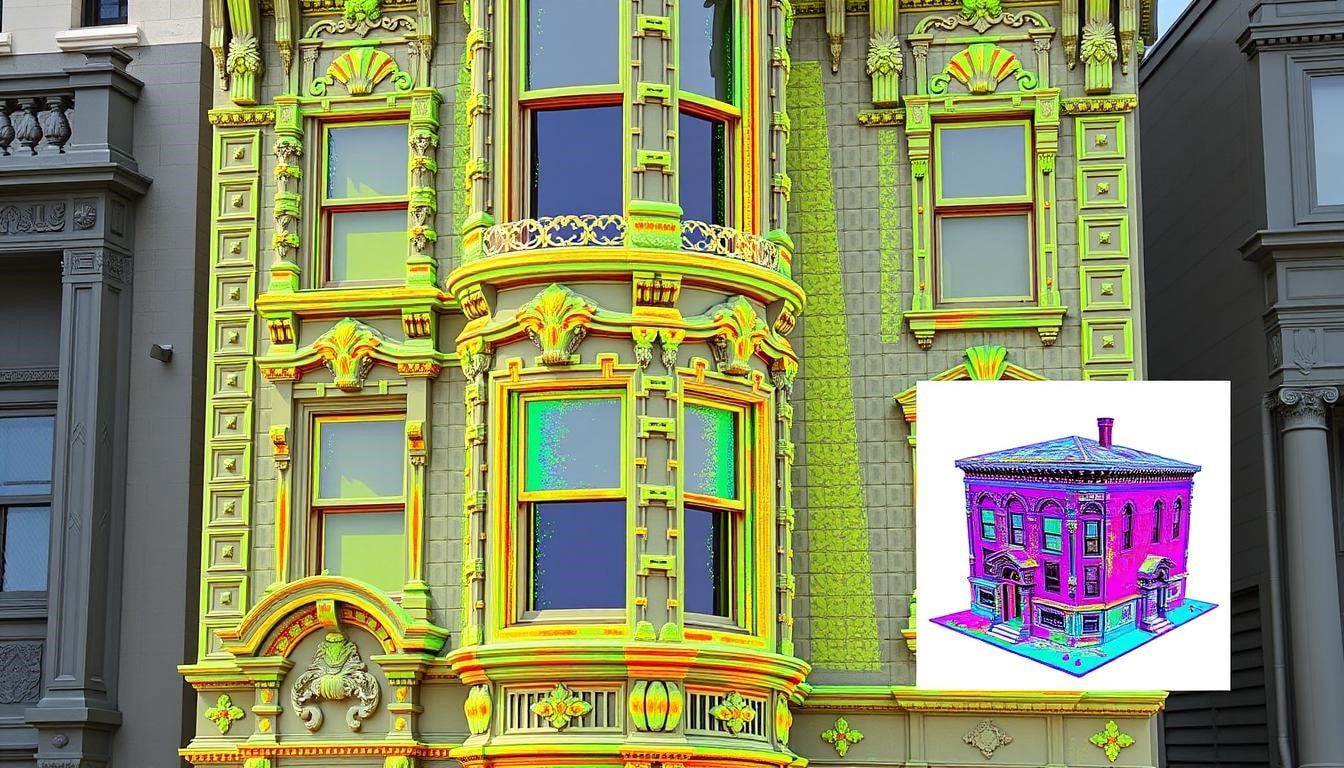
Historic Building Documentation in San Francisco
We combine LiDAR scanning with focused field verification to document existing conditions for historic projects. Our measured drawings and reports capture ornate facades, interior millwork, and irregular geometries with the attention to detail preservation architects expect—producing compliance-ready plans and files to support Historic Preservation Commission review and adaptive reuse work.
Challenges We Address
- Record intricate ornamental details and irregular geometries without disturbing historic fabric
- Document existing conditions needed for permit submittals and Preservation Commission filings
- Map prior modifications and non-standard structural elements for engineering review
- Provide non-destructive surveys and measured drawings to inform restoration strategy
Historic Deliverables
- Compliance-ready measured drawings: floor plans, elevations, sections, and annotated details
- High-resolution point clouds and CAD/Revit files delivered in your preferred format
- Existing conditions reports with annotated photos, material mapping, and condition notes
- Optional partner-delivered structural assessments when needed
“The measured drawings captured every ornamental element and structural quirk, which proved invaluable during the restoration process and for Historic Preservation Commission approval.”
— Sarah Martinez, Architect
Preserve San Francisco's Architectural Heritage
Request a historic building quote—our team will include sample DWG/Revit files, a point-cloud excerpt, and a quick checklist of required preservation deliverables.
Commercial LiDAR Scanning for SF Developers & Contractors
From downtown high-rises to neighborhood retail, our commercial as-built services give developers, property managers, and contractors the measured drawings, CAD/BIM files, and site information needed to advance construction and leasing decisions. We capture accurate floor plans, elevations, MEP information, and point clouds to support tenant improvements, seismic retrofits, and construction coordination.
Tenant Improvement Documentation
Measured floor plans, reflected ceiling plans, and MEP capture minimize site disruption and accelerate TI design. Our precise plans reduce coordination time between architects, engineers, and contractors and help keep your project on schedule.
Seismic Retrofit & Structural Support
We document existing conditions for soft-story upgrades and seismic retrofit programs, supplying structural-ready files that engineers use for effective retrofit design and permitting.
BOMA & Area Calculations
Certified BOMA area calculations and rentable-area plans support leasing strategy and ensure correct billable space. Ask for sample DWG and Revit exports to verify format and level of detail.
Commercial Deliverables
- Floor plans & elevations with full dimensions for construction and permitting
- Reflected ceiling & MEP plans for coordination among trades
- CAD (DWG) files and annotated plans ready for contractor use
- 3D BIM models (Revit) for clash detection and design coordination
- BOMA-compliant reports and ADA/egress documentation
- Point cloud and exportable files to integrate with client workflows
Streamline Your Commercial Project
Request a commercial quote or scope call — our team provides sample files, a clear scope, and can schedule an initial consultation within 24–48 hours for larger projects.
Single-Family Homes
We produce accurate floor plans and elevations for renovations and additions. Typical deliverables include 2D CAD plans and a Revit model, enabling architects and contractors to move directly into detailed design and construction documentation.
Multi-Family Housing
Our comprehensive scans capture unit layouts, common areas, and building systems for code compliance, conversions, and large remodels—helping property owners and project managers plan scopes and budgets with confidence.
ADUs & Additions
Navigate LADBS requirements with accurate as‑built data. We provide the spatial data and CAD deliverables needed for ADU permit submissions and ensure your addition aligns with local code and site constraints.
Residential As-Built Drawings in the Bay Area
We help homeowners, architects, and contractors with permit-ready measured drawings and as-built services for San Francisco homes and nearby Bay Area properties. Combining LiDAR scans with targeted field checks, we produce accurate floor plans, exterior elevations, roof and site plans, and CAD/Revit files that reduce surprises during construction and streamline remodels, ADUs, and additions.
Core Residential Services
- Complete interior and exterior measurements and site plans for homes and multi-family buildings
- Measured floor plans and exterior elevations prepared for permit submittal
- Roof plans with drainage patterns and 3D models for visualization and construction planning
- CAD, Revit, and point cloud files delivered in formats your design or contractor team prefers
Common Applications
- Kitchen and bathroom remodels, interior reconfigurations, and finish upgrades
- Home additions and ADU planning with structural-ready documentation
- Historic home restoration, seismic compliance, and retrofit support
- Real estate marketing plans and accurate as-built drawings for listings
“For our home addition in Noe Valley, the measured drawings were essential. The team captured every quirk of our 1908 house, which helped our architect design an addition that complemented the original structure and met current codes.”
— Michael Chen, Homeowner
Transform Your San Francisco Home
Request a quick quote—owners can choose permit-ready CAD or Revit deliverables and receive a fast response. Feel free to provide your property address for immediate availability and a tailored scope.
Our San Francisco As-Built Documentation Process
We combine a fast initial consultation with a clear, six-step workflow to document existing conditions and produce permit-ready site plans, measured drawings, and CAD/Revit files. Our team typically provides a quick response to scope requests and sets straightforward milestones from scan to final files.
- 1. Initial Consultation — Quick response to confirm scope, timeline, required deliverables, and any site constraints so your project stays on schedule.
- 2. Site Visit & LiDAR Scanning — Our crew conducts on-site scans and targeted field checks to thoroughly document existing conditions and capture complete measurement data.
- 3. Data Processing — We register, clean, and annotate the point cloud to produce reliable information for drafting and analysis.
- 4. CAD / BIM Development — Drafting converts point-cloud data into measured drawings, floor plans, elevations, and BIM models in your requested CAD/Revit formats.
- 5. Quality Assurance — Technical review checks accuracy and completeness so deliverables meet design and construction requirements.
- 6. Delivery & Support — Files (DWG, Revit, E57/LAZ or other formats) are delivered securely and our team remains available for follow-up questions or revisions.
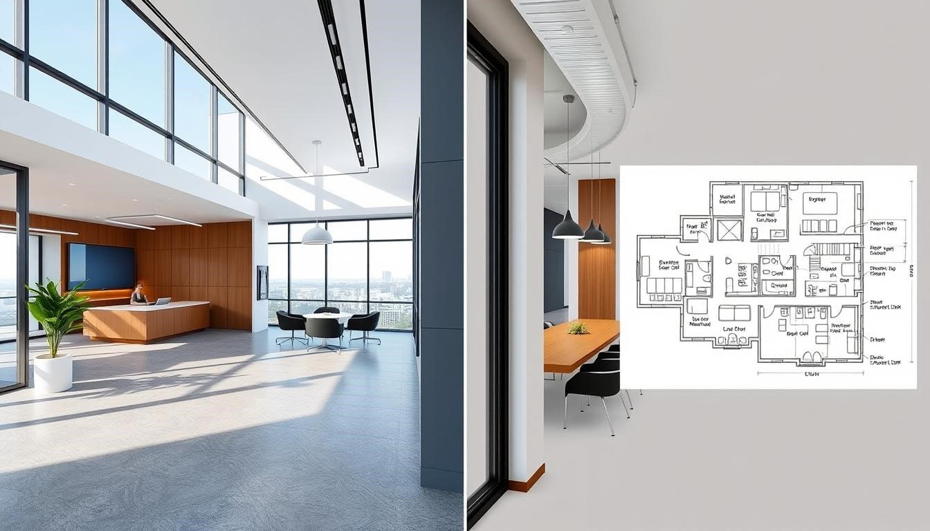
As-Built Drawing Deliverables
Choose deliverables that fit your workflow — we provide 2D and 3D documentation, CAD/BIM files, and point-cloud exports with secure delivery and optional sample files on request. Typical formats include layered DWG (AutoCAD), Revit (RVT) with architectural/MEP layers, and E57/LAZ point-cloud exports for future analysis or scan-to-BIM workflows.
2D CAD Drawings
Permit-ready measured drawings: floor plans, elevations, sections, and construction details delivered as DWG and PDF. DWGs include layers and annotations for contractor coordination, cost estimating, and permitting.
3D BIM Models
Coordinated Revit models (RVT) with architectural, structural, and MEP layers for clash detection and virtual design. Clients use BIM models for design integration, sequencing, and reduced rework during construction.
Point Cloud Data & Files
Raw or processed point-cloud exports (E57/LAZ) and annotated point sets that document existing conditions for record-keeping, verification, or later analysis. We deliver via secure download, cloud link, or FTP per client preference.
Ready to Start Your Plans?
Request sample files (DWG, Revit extract, or point-cloud excerpt) so you can inspect layer structure, level of detail, and file compatibility before the job starts. Our team will recommend the best package for your project needs and budget to save time and money.
What Our San Francisco Clients Say
Architects, contractors, developers, and property owners across San Francisco trust our measured drawings and LiDAR files for accurate existing-conditions documentation and smooth project delivery.
“The LiDAR as-built drawings captured every quirk of our 1890s Victorian in Pacific Heights. The floor plans and elevations were permit-ready and saved us time during the restoration.”
— Jennifer Wong, Homeowner (Historic renovation)
“As an architect working on complex San Francisco projects, I rely on their measured drawings. The Revit files and point cloud gave our team the confidence to proceed with sensitive historic retrofits.”
— David Chen, Principal Architect
“For our multi-floor commercial renovation in SoMa, the as-built BIM model was invaluable. It reduced coordination time between trades and kept the construction schedule on track—great quality work.”
— Maria Rodriguez, Project Manager
Feel free to request references, sample DWG/Revit excerpts, or case studies from similar projects — our team is happy to share examples and timelines to support your decision.
San Francisco Service Areas
We’re on-call across San Francisco and the surrounding Bay Area — call for same-week scans in most neighborhoods. Our crew provides LiDAR scanning and as-built services for residential and commercial properties, with clear information about site access, travel or fee estimates, and a quick response to availability requests.
San Francisco Neighborhoods
- Pacific Heights
- Noe Valley
- Mission District
- Marina
- SoMa
- Financial District
- Richmond District
- Sunset District
- North Beach
Bay Area Locations
- Oakland
- Berkeley
- Marin County
- San Mateo
- Palo Alto
- San Jose
- Walnut Creek
- Sausalito
- Alameda
- South San Francisco
Feel free to provide your property address for an immediate availability check — our team typically confirms scheduling and recommended deliverables within 24 hours and will share information about any site-specific requirements or sample files.
Request Your San Francisco As-Built Drawing Quote
Provide approximate square footage, preferred deliverables (DWG, Revit, or point-cloud), and brief site notes for a faster, more accurate quote. Our team typically replies within 24 hours — feel free to call for an immediate estimate or to request sample files.
Serving the Broader Bay Area
For projects in Oakland, San Jose, East Bay, South Bay, or Peninsula, visit our Bay Area LiDAR scanning services page.
San Francisco's Leading As-Built Documentation Specialists
Architects, contractors, engineers, developers, and property owners count on our company and team for LiDAR as-built drawings and measured drawings that reduce risk, save time and money, and keep construction projects on schedule. Request a free consultation and we’ll include sample files and a tailored quote for your next project.
Prefer to talk directly?
Call us for a quick response or to request sample DWG/Revit files for similar jobs — our team can often schedule a scope call the same day. Thanks for considering our services.
Preserving History with Precision Plans
For San Francisco’s historic properties, we offer as-built documentation for preservation projects↗ that meet local and state preservation board standards.