Start your project with reliable, scan-accurate documentation you can trust.
STATS
Years in Commercial Architecture
U.S. Markets Served
±1/2"
Verified Dimensional Accuracy
Buildings Documented
Introduction
LiDAR Precise Plans delivers specialized 3D laser scanning services for industries that demand the highest accuracy — retail, hospitality, commercial real estate, healthcare, industrial, and government facilities.
Each sector has distinct operational and technical requirements. Retail projects often require overnight scanning and 2–3 day turnaround. Hospitality properties demand flexible scheduling around 24/7 operations. Healthcare facilities require strict infection control protocols. Industrial sites require large-scale coverage with engineering-grade precision.
Our regional technicians serve the Southwest with rapid mobilization, ±2mm accuracy, and deep industry-specific experience built from hundreds of completed projects.
→ Need detailed LiDAR capture workflows? See our 3D Laser Scanning Services
→ Need construction-ready as-built drawings? See our As-Built Drawing Services
Our Core LiDAR Scanning Services
We capture exact building conditions with sub-millimeter precision to support renovation, TI work, and long-term asset management.
3D Laser Scanning for Commercial Buildings
Our state-of-the-art 3D laser scanning technology captures your building’s exact dimensions with sub-millimeter accuracy. Whether you need interior space documentation, exterior façade surveys, or comprehensive MEP system mapping, our LiDAR scanning services provide the foundation for confident decision-making in renovation projects, facility management, and construction planning.
Interior Building Scanning
High-density point cloud capture of interior spaces including office buildings, hotel lobbies, retail spaces, warehouses, and institutional facilities. Our interior scanning services are ideal for space planning, tenant improvements, renovation projects, and facility management documentation. We capture millions of data points per second, creating a complete digital record of your building's interior conditions including walls, ceilings, floors, columns, mechanical systems, and architectural details.
Exterior Façade Documentation
Detailed exterior building surveys for building envelope assessments, façade restoration projects, historic preservation, and building condition reports. Our exterior LiDAR scanning captures complete building exteriors including architectural details, window and door openings, rooflines, and site conditions. Essential for renovation planning, historic documentation, and structural analysis projects.
MEP Systems Documentation
Comprehensive mechanical, electrical, and plumbing documentation including ceiling plenum scanning, utility mapping, and infrastructure documentation. Our MEP scanning services capture complex building systems with precision accuracy, providing engineers and contractors with detailed information about HVAC ductwork, electrical conduit routing, plumbing systems, fire protection infrastructure, and telecommunications pathways.
Structural Survey & Analysis
Detailed structural element capture for structural engineering analysis, load analysis calculations, retrofit planning, and seismic assessment projects. We document structural steel, concrete frameworks, load-bearing walls, columns, beams, and foundation elements with engineering-grade accuracy suitable for structural calculations and building permit applications.
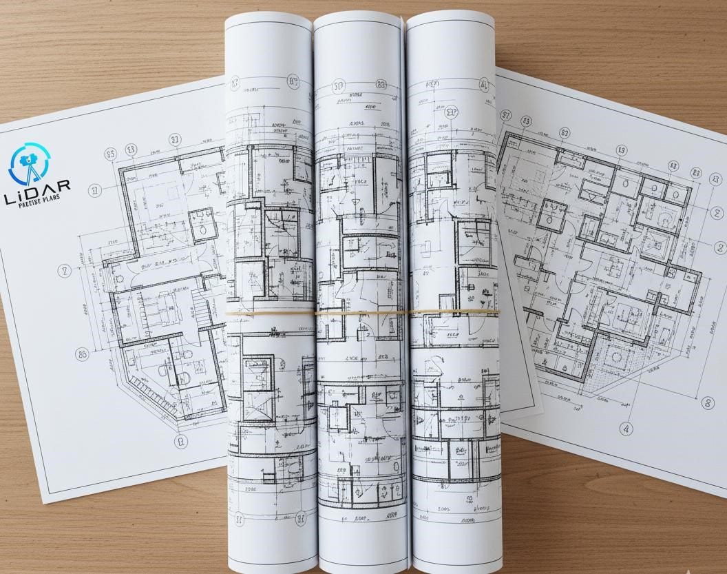
As-Built Drawing Services & CAD Deliverables
We provide comprehensive deliverables tailored to your project needs, ensuring compatibility with all major design, construction, and facility management software platforms.
2D CAD Drawing Formats
AutoCAD DWG Files
Industry-standard format compatible all major CAD platforms. Drawings delivered with proper layering, dimensioning, and annotations following CAD standards. Multiple drawing scales provided as needed.
PDF Drawings (High-Resolution)
Scalable PDF files with embedded fonts and accurate dimensions for easy sharing, printing, and markup. PDFs include clickable layer controls and bookmarks for easy navigation through large drawing sets.
Floor Plans
Detailed layouts showing walls, doors, windows, columns, stairs, elevators, and all architectural elements with dimensions. Room names, areas, and finish schedules included as required.
Elevation Drawings
Interior and exterior building elevations with height dimensions, finish indicators, and architectural details. North, South, East, and West elevations provided for complete building documentation.
Reflected Ceiling Plans
Complete ceiling documentation including lighting fixtures, HVAC diffusers, sprinkler heads, ceiling grid systems, and access panels. Height dimensions and ceiling material notes included.
MEP Drawings
Separate coordinated sheets for mechanical, electrical, and plumbing systems with detailed annotations, equipment schedules, and routing information. Includes legends, symbols, and systems.
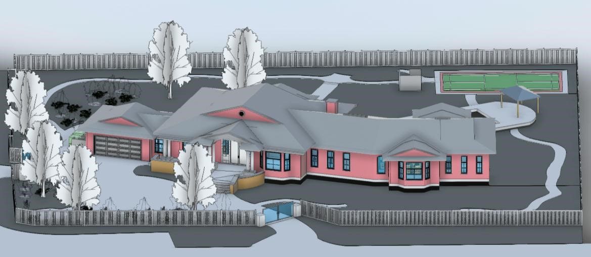
3D BIM Model Formats
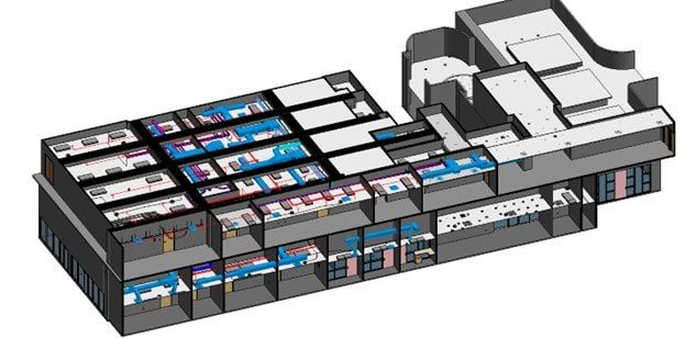
Revit Models (RVT Files)
Fully parametric Building Information Models with intelligent components. Models include architectural, structural, and MEP elements built to specified LOD standards. Compatible with Revit 2020-2025 versions.
IFC Files (Industry Foundation Classes)
Open BIM format ensuring interoperability across ArchiCAD, Tekla, Bentley MicroStation, and other BIM platforms. IFC2x3 and IFC4 formats available.
SketchUp Models (SKP Format)
3D visualization models ideal for presentations, design studies, and client communication. Models include materials, colors, and basic component information.
Navisworks Files (NWD/NWC)
Project review and coordination formats with integrated clash detection capabilities. Essential for construction coordination and model review workflows.
Point Cloud Data Formats
Registered Point Clouds
Aligned and merged scan data in RCS (Autodesk ReCap), RCP (ReCap Project), E57 (ASTM standard), LAS/LAZ (point cloud standard), or XYZ formats. Format selection based on your software requirements.
Virtual Tours (360° Panoramas)
Interactive virtual walkthroughs with hotspot navigation between scan positions. Embeddable in websites or shareable via secure links.
Orthophotos (2D Photo Elevations)
High-resolution 2D images extracted from 3D scan data showing building elevations, wall sections, or site plans with accurate scale.
Industry-Specific LiDAR Solutions
Hotels & Hospitality LiDAR Scanning
Specialized 3D laser scanning services for hotel renovations, resort documentation, and hospitality facility management. Our hotel scanning expertise minimizes guest disruption while delivering accurate documentation for lobby renovations, guest room remodels, conference center upgrades, restaurant buildouts, spa facilities, and comprehensive MEP system documentation.
We understand the unique challenges of hospitality properties including:
- 24/7 Operations: Scheduling flexibility including overnight and weekend scanning to avoid guest disruption.
- Multiple Building Types: Experience with high-rise hotels, resort complexes, convention centers, and boutique properties.
- Fast Turnaround Requirements: Rush services available for time-sensitive renovation projects.
- Accuracy for High-End Finishes: Precision documentation for luxury renovations and custom millwork.
- Historic Property Expertise: Careful documentation of historic hotels preserving architectural details.
Typical hotel scanning applications include pre-renovation documentation, space optimization studies, brand standard compliance verification, franchise conversion projects, and ongoing facilities management support.
Commercial Real Estate Documentation
Comprehensive building documentation for office buildings, retail centers, mixed-use developments, and commercial properties supporting tenant improvements, lease planning, space optimization, and property marketing.
Our commercial real estate services include:
- BOMA-Compliant Measurements: Accurate square footage calculations following BOMA standards for lease agreements.
- Tenant Improvement Planning: Detailed as-built drawings for TI design and construction.
- Base Building Documentation: Complete building systems documentation for property management.
- Marketing Materials: 3D visualizations and virtual tours for leasing and property sales.
- Portfolio Documentation: Consistent documentation standards across multiple properties.
Multifamily & Residential Real Estate
Comprehensive property documentation for apartment complexes, multifamily buildings, residential developments, and mixed-use properties. Our scanning services support property management, renovations, acquisitions, and marketing initiatives with accurate digital representations of residential assets.
Multifamily scanning applications:
- Unit Documentation: Capture of unit layouts, dimensions, and conditions for marketing materials and lease documentation.
- Common Area Mapping: Complete documentation of lobbies, amenity spaces, fitness centers, and resident gathering areas.
- Renovation & Modernization: Existing conditions surveys for building upgrades, unit renovations, and amenity improvements.
- Acquisition Due Diligence: Pre-acquisition documentation supporting property assessments and investment decisions.
- Property Portfolio Management: Standardized documentation across multiple properties for asset management and capital planning.
Healthcare Facility Scanning
Medical-grade accuracy for hospitals, clinics, surgical centers, medical office buildings, and healthcare campuses. We provide detailed MEP documentation critical for medical equipment planning, infection control compliance, healthcare facility renovations, and regulatory requirement adherence.
Healthcare-specific capabilities:
- Infection Control Protocols: Our team follows healthcare facility protocols for scanning occupied medical spaces.
- Medical Equipment Integration: Precise documentation for MRI, CT, radiation therapy, and surgical equipment placement.
- Critical System Documentation: Detailed mapping of medical gas, vacuum, electrical, and HVAC systems.
- 24/7 Availability: Emergency documentation services for immediate project needs.
Industrial & Manufacturing Facilities
Large-scale facility documentation for warehouses, manufacturing plants, distribution centers, food processing facilities, and industrial complexes. Our LiDAR technology efficiently captures expansive spaces and complex industrial environments.
Industrial scanning applications:
- Process Equipment Documentation: Capture of manufacturing lines, conveyor systems, and production equipment.
- Overhead Infrastructure: Documentation of cranes, cable trays, piping racks, and overhead systems.
- Plant Expansions: Existing conditions documentation for facility additions and modifications.
- Equipment Clearances: Verification of clearances for equipment installation and material handling.
- Safety Compliance: Documentation supporting OSHA and safety regulation compliance.
Retail & Shopping Centers
Fast-turnaround scanning for retail renovations, tenant build-outs, shopping center documentation, and store planning projects supporting rapid deployment schedules critical to retail operations.
Retail-specific services:
- After-Hours Scanning: Overnight documentation to avoid business disruption.
- Rapid Turnaround: 2-3 day deliverables for fast-track retail projects.
- Prototype Store Documentation: Capture of successful store layouts for replication.
- Mall Common Area Documentation: Complete documentation of shopping center circulation and common areas.
- Fixture Planning Support: Accurate measurements for retail fixture and display planning.
Government & Institutional Buildings
Secure, compliant documentation services for government buildings, educational facilities, libraries, courthouses, and public infrastructure. We maintain necessary clearances and follow protocols for sensitive facility documentation.
Government sector capabilities:
- Security Clearances: Team members with appropriate clearances for secure facilities.
- Compliance Documentation: Support for ADA compliance, historic preservation, and regulatory requirements.
- Large Campus Documentation: Experience with multi-building government and university campuses.
- Historic Building Expertise: Careful documentation of historic government buildings and monuments.
- Long-Term Archival: Digital preservation of historically significant structures.
Our LiDAR Scanning Process: From Site to Deliverables
Step 1: Initial Consultation & Project Planning
We begin every project with a detailed consultation to understand your specific needs, timeline constraints, and deliverable requirements. During this phase:
- Project Scope Discussion: Review building size, areas to be scanned, and level of detail required.
- Deliverable Planning: Determine which formats (CAD, BIM, point cloud) best serve your project goals.
- Timeline Development: Establish scanning schedule and delivery deadlines.
- Site Logistics: Coordinate access requirements, security procedures, and scheduling constraints.
- Free Detailed Quote: Receive comprehensive proposal within 24 hours including scope, timeline, and investment.
No project is too complex—we’ve documented single rooms to million-square-foot facilities. Our experience across diverse building types ensures we understand your unique requirements.
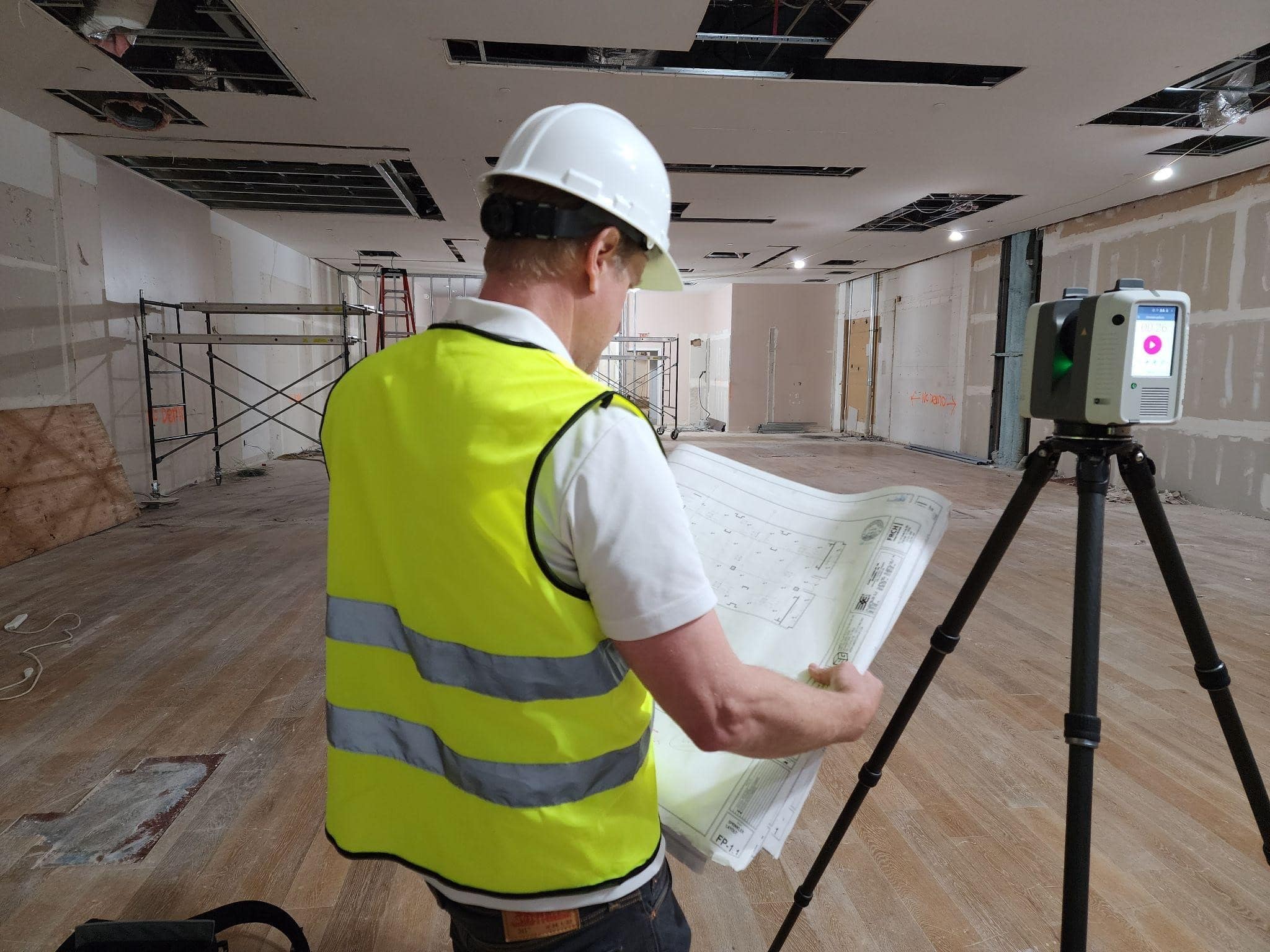
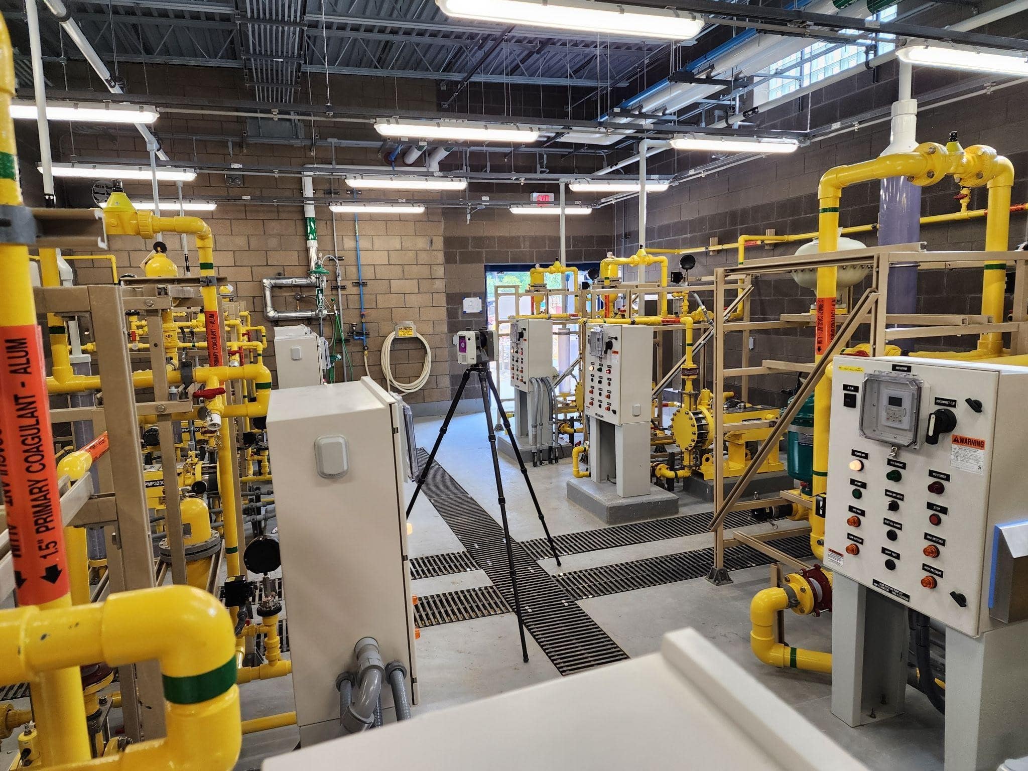
Step 2: On-Site 3D Laser Scanning
Our professional technicians arrive on-site with state-of-the-art LiDAR scanning equipment to efficiently capture your building with minimal operational disruption.
Scanning Process:
- Equipment Setup: High-precision laser scanners positioned throughout your facility.
- Systematic Coverage: Overlapping scans ensure complete building capture with no gaps.
- Quality Verification: Real-time scan review confirms data quality before leaving site.
- Safety Protocols: Our team follows all site safety requirements and facility protocols.
- Documentation: Photography and field notes supplement scan data.
Typical Scanning Duration:
- Small Buildings (under 10,000 sq ft): 1 day
- Medium Buildings (10,000-50,000 sq ft): 2-3 days
- Large Buildings (50,000-100,000 sq ft): 3-5 days
- Complex/Multi-Building: Custom timeline based on scope
Minimal Disruption Guarantee:
- Non-invasive process requires no physical contact with building surfaces
- Quiet operation suitable for occupied spaces
- Flexible scheduling including nights, weekends, and holidays
- Safe around people, electronics, and sensitive equipment (Class 1 laser)
Step 3: Data Processing & Point Cloud Registration
Raw scan data undergoes comprehensive processing to create accurate, usable 3D building models.
Processing Steps:
- Point Cloud Registration: Multiple scan positions aligned into unified 3D model.
- Data Cleaning: Removal of temporary objects, people, and extraneous elements.
- Accuracy Verification: Quality control checks ensure ±2mm dimensional accuracy.
- Colorization: Integration of high-resolution photography with scan data.
- Optimization: Point cloud data optimized for efficient viewing and modeling.
Our processing team uses industry-leading software including Autodesk ReCap, Leica Cyclone, Faro Scene, and specialized point cloud processing tools. All data undergoes multi-point quality control before advancing to the drafting phase.
Step 4: As-Built Drawing & BIM Model Creation
Experienced CAD drafters and BIM modelers transform processed point cloud data into professional construction documents and intelligent building models.
Drafting Process:
- Base Drawing Setup: CAD drawings initiated with proper layers, dimensions, and standards.
- Accurate Extraction: Building elements traced directly from point cloud ensuring dimensional accuracy.
- Annotation & Dimensioning: Complete notes, room labels, and dimensions added.
- Drawing Coordination: Multiple sheets coordinated for consistency and completeness.
- Quality Control Review: Senior drafters verify accuracy against point cloud data.
BIM Modeling Process:
- Revit Family Selection: Appropriate building components selected from standard libraries.
- Model Construction: Walls, floors, roofs, and systems built to specified LOD standard.
- Parameter Population: Component properties and metadata added to model elements.
- Clash Detection: Preliminary clash checks identify coordination issues.
- Final Model Review: BIM manager verifies model quality and standards compliance.
Our drafting team averages 10+ years of experience across commercial, industrial, and institutional projects. We follow industry standards including AIA CAD Layer Guidelines, NCS (National CAD Standard), and BIM LOD specifications.
Step 5: Client Review & Final Delivery
Your complete documentation package is delivered for review with comprehensive support ensuring you have exactly what you need for project success.
Delivery Process:
- Secure Cloud Download: All files uploaded to secure portal for immediate access.
- Review Meeting: Virtual or in-person walkthrough of deliverables.
- Revision Requests: Unlimited revisions to ensure complete satisfaction.
- Format Adjustments: File format conversions or adjustments as needed.
- Extended Support: Our team remains available for questions during your project.
What You Receive:
- All specified CAD drawings, BIM models, and point cloud data
- PDF drawing sets for easy distribution
- Organized file structure with clear naming conventions
- Brief user guide for accessing and using deliverables
Post-Delivery Support:
- Technical support for opening and using files
- Guidance on integrating deliverables into your workflow
- Assistance coordinating with architects, engineers, and contractors
- Future update services as building conditions change
Point Measurement Accuracy:
- Distance accuracy: ±1mm at 10 meters, ±2mm at 20 meters
- Angular accuracy: 19 arc seconds (0.005°)
- Overall model accuracy: ±2mm throughout entire scan dataset
- Meets or exceeds ASTM E2938 standards for 3D imaging
Registration Accuracy:
- Point cloud alignment: ±3mm between adjacent scans
- Global registration: ±5mm across entire building
- Verification through closed-loop traverse calculations
- Independent check measurements confirm stated tolerances
Deliverable Accuracy:
- CAD drawings: Dimensions accurate to ±1/4 inch (6mm) or better
- BIM models: Geometric accuracy suitable for construction coordination.
- As-built documentation: Suitable for engineering calculations and permit submissions.
- Quality guaranteed or we re-scan affected areas at no charge.
Service Areas: Southwest & Southern United States
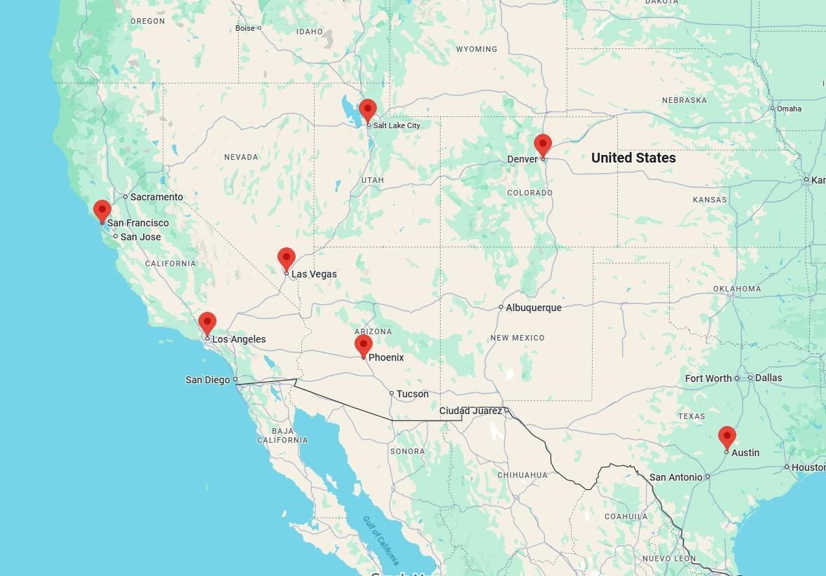
While we provide professional 3D laser scanning services nationwide, we have concentrated regional expertise and rapid-response capabilities throughout the Southwest and Southern United States. Our strategically positioned regional technicians ensure fast mobilization, local building knowledge, and cost-effective service delivery.
Why Choose Regional LiDAR Experts?
Faster Response Times
Regional technicians typically reach your site within 24-48 hours of project approval, compared to 3-5 days for providers flying in from distant locations. For time-sensitive projects, rapid mobilization prevents schedule delays.
Lower Project Costs
Reduced travel expenses translate directly to lower project costs. Our regional coverage eliminates cross-country airfare, lengthy hotel stays, and excessive travel days that add cost without adding value.
Local Building Knowledge
Understanding regional construction methods, climate considerations, building codes, and common building types enables more efficient scanning and accurate documentation. Our technicians know what to expect in construction, tilt-wall buildings, and concrete block construction.
Local Building Knowledge
Flexible Scheduling & Follow-Up Local presence makes it easy to accommodate schedule changes, perform follow-up scans for verification, and provide on-site support during your design and construction phases.
Ready to Start Your Project?
Get an accurate quote in 24 hours or less. Whether you’re planning a hotel renovation, commercial tenant improvement, or facility documentation project, we’re ready to help you move forward with confidence.
Three Easy Ways to Get Started:
📞 Call for Immediate Assistance
Speak directly with our scanning specialists: Available Monday-Friday, 8am-6pm MST
📧 Email Your Project Details
Send plans or building information to: shawn@lidarpreciseplans.com
We'll respond within 2 business hours
📋 Request a Detailed Quote
Get Free Quote - Complete our 2-minute form for a comprehensive proposal