The permit set is three weeks from submission when the GC walks the space and finds the demising wall is seven inches off the drawings. The HVAC main runs directly through where the new ceiling is supposed to land. The column on the east wall is boxed out in a way that eliminates two feet of leasable depth, depending on the layout. None of this was in the landlord’s drawings. None of it was caught until now. The schedule has just absorbed a correction cycle that costs more than the original documentation would have.
This is not an edge case on Los Angeles tenant improvement projects. It is the standard outcome when design proceeds from unverified record drawings. The building contains the truth. The drawings frequently do not.
Why Scan to BIM Matters for LA Tenant Improvements
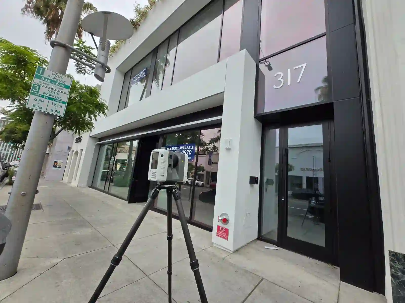
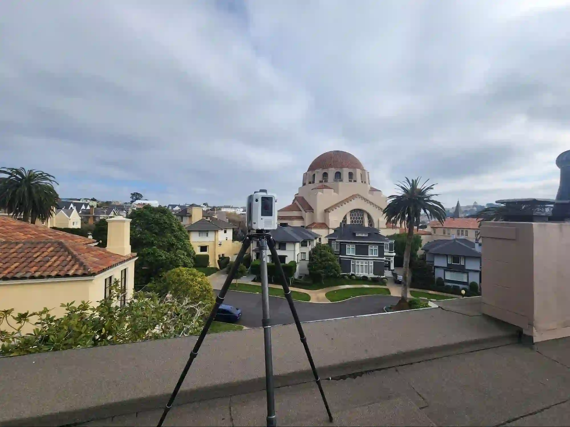
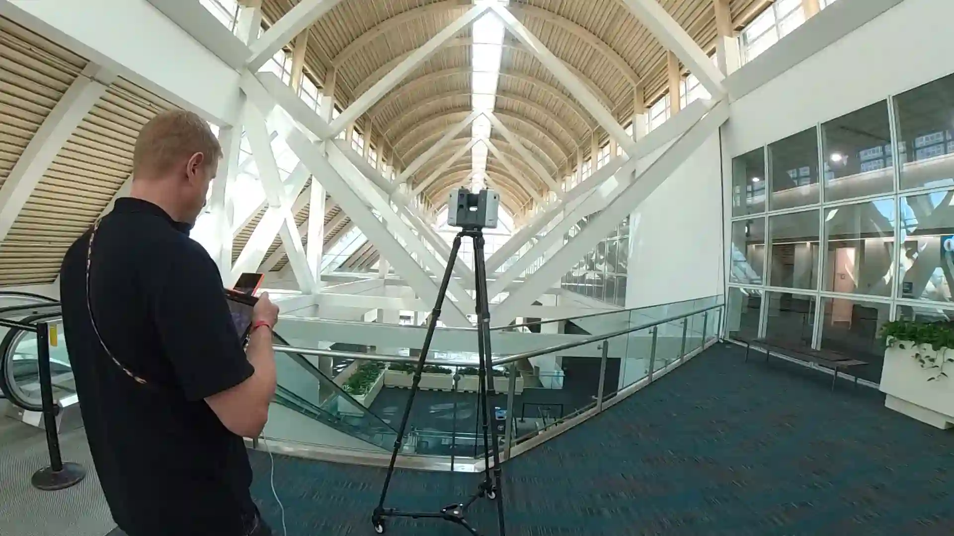
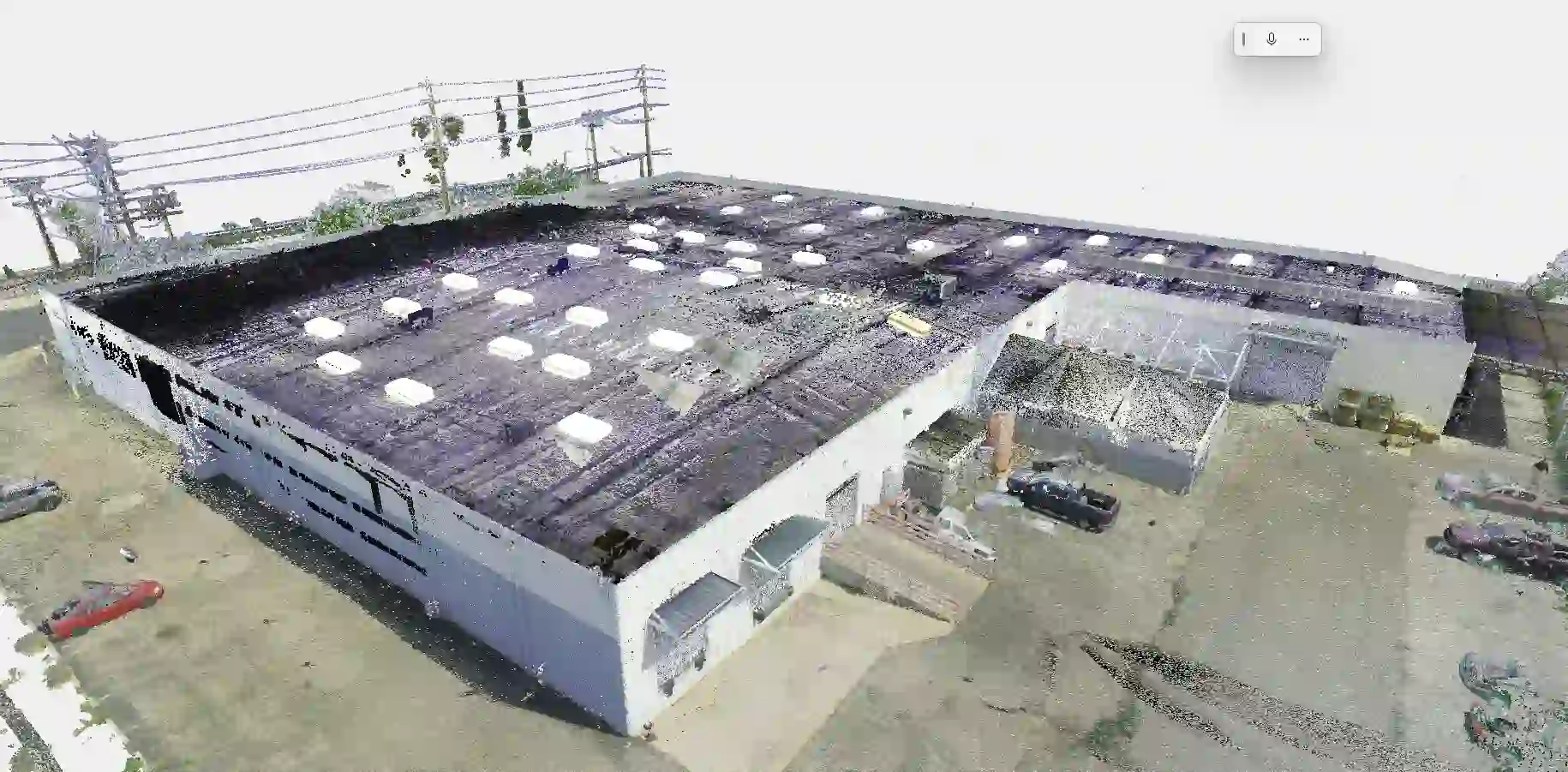
Scan to BIM for tenant improvement projects in Los Angeles uses LiDAR 3D laser scanning to capture existing field conditions at plus or minus 2mm verified accuracy and convert that data into a fully coordinated Revit model ready for design, LADBS permit submittal, and construction coordination. For architects and GCs working across LA’s commercial, retail, and mixed-use building stock, a Scan-to-BIM workflow eliminates the field conflicts, RFIs, and change orders that originate when teams design against drawings that haven’t been field-verified in years. Explore our Scan to BIM services or request a quote within 24 hours.
Why Existing Conditions Errors Derail LA Tenant Improvement Projects
Los Angeles runs one of the densest tenant improvement markets in the United States. The city’s commercial building stock spans a century: pre-war concrete loft buildings in the Arts District, 1970s office towers in Century City, 1990s retail shells throughout the San Fernando Valley, and adaptive reuse conversions across Downtown and Mid-Wilshire. Each generation of construction carried its own dimensional tolerances and documentation standards. Every subsequent tenant cycle layered undocumented modifications on top.
When an architect opens landlord-provided drawings for a 12,000-square-foot office TI in Culver City or a restaurant conversion in Los Feliz, those drawings may be the originals from 1991 with a few handwritten redlines. Previous tenants moved partitions. Electrical was rerouted to serve a different layout. HVAC zones were reconfigured. Nobody updated the base building plans. The drawings on file reflect original design intent, not current field conditions.
The consequences arrive in a predictable sequence. Design is developed against the wrong geometry. The permit set is prepared from inaccurate base plans. The GC walks the space and generates RFIs. The correction cycle begins after mobilization. According to FMI Corporation’s Construction Productivity Report, rework driven by poor project data accounts for approximately 9% of total construction costs across U.S. commercial projects. On a $900,000 LA TI buildout, that is $81,000 in potential rework exposure sitting inside a documentation gap that a LiDAR scan eliminates before design begins.
The more direct cost comes from the schedule. Tenant improvement projects in Southern California operate against lease commencement dates that carry real financial consequences. A two-week delay driven by a plan check correction or a field conflict discovered after contractor mobilization can push occupancy past the contractual date, triggering rent abatement provisions, landlord penalty clauses, and, in retail, lost opening-season revenue that compounds well beyond the direct construction cost.
What LADBS Requires and Where Unverified Drawings Create Plan Check Risk
The Los Angeles Department of Building and Safety requires accurate existing conditions documentation as part of the permit submittal for most tenant improvement projects. The specific requirements depend on occupancy classification, scope of work, and whether the project triggers mandatory accessibility upgrades under California Building Code Title 24, Chapter 11B.
What the permit set must include. For a standard commercial TI, the submission must contain accurate floor plans reflecting actual partition locations, ceiling heights, structural elements, and, where modified, MEP systems. LADBS plan checkers cross-reference submitted drawings against each other for dimensional consistency. A set produced from unverified record drawings frequently contains internal contradictions: a reflected ceiling plan that doesn’t align with the floor plan, a section that conflicts with the structural notes, and an egress path dimensioned from a wall location that no longer exists.
The scheduled consequence of a correction. Plan check corrections in LA typically add two to four weeks to the permitting timeline per correction cycle. For a fast-track TI with a firm lease commencement date, a single correction cycle can be the difference between an on-time delivery and a default. The correction itself is not the primary cost. The schedule impact is.
Title 24 adds a second documentation layer. California requires that tenant improvement projects spending above a defined threshold trigger path-of-travel upgrades to accessible routes, restrooms, and building entries. Accurate floor elevations, door clearances, and corridor widths must be documented to demonstrate compliance or calculate the 20% path-of-travel cost cap. None of those measurements can be reliably sourced from original construction documents that predate current CBC requirements.
A LiDAR-derived as-built drawing set or Scan-to-BIM Revit model provides the dimensional accuracy LADBS expects, and the floor elevation data Title 24 compliance calculations require. Our as-built drawings and Scan-to-CAD deliverables are formatted for permit submittal in AutoCAD and PDF with dimensions, annotations, and sheet organization appropriate for LADBS plan check review.
The Four Field Problems LiDAR Solves Before They Become Change Orders
Scanning to BIM for tenant improvement projects in Los Angeles is not an abstract accuracy improvement. It resolves specific, recurring field problems that generate change orders and schedule loss when discovered after design or construction has begun.
Partition and Demising Wall Discrepancies
Partition locations in record drawings are among the least reliable dimensions in any existing building. Previous tenants relocated walls. Demising boundaries shifted during lease renegotiations. Columns were enclosed, and the enclosure dimensions were never recorded.
A LiDAR scan captures every wall face in three dimensions. The Revit model shows where those walls actually are, not where a 2001 drawing assumed they would remain. Finding a seven-inch discrepancy in the model costs nothing. Finding it during framing inspection costs the full correction plus delay.
MEP System Conflicts with New Design Elements
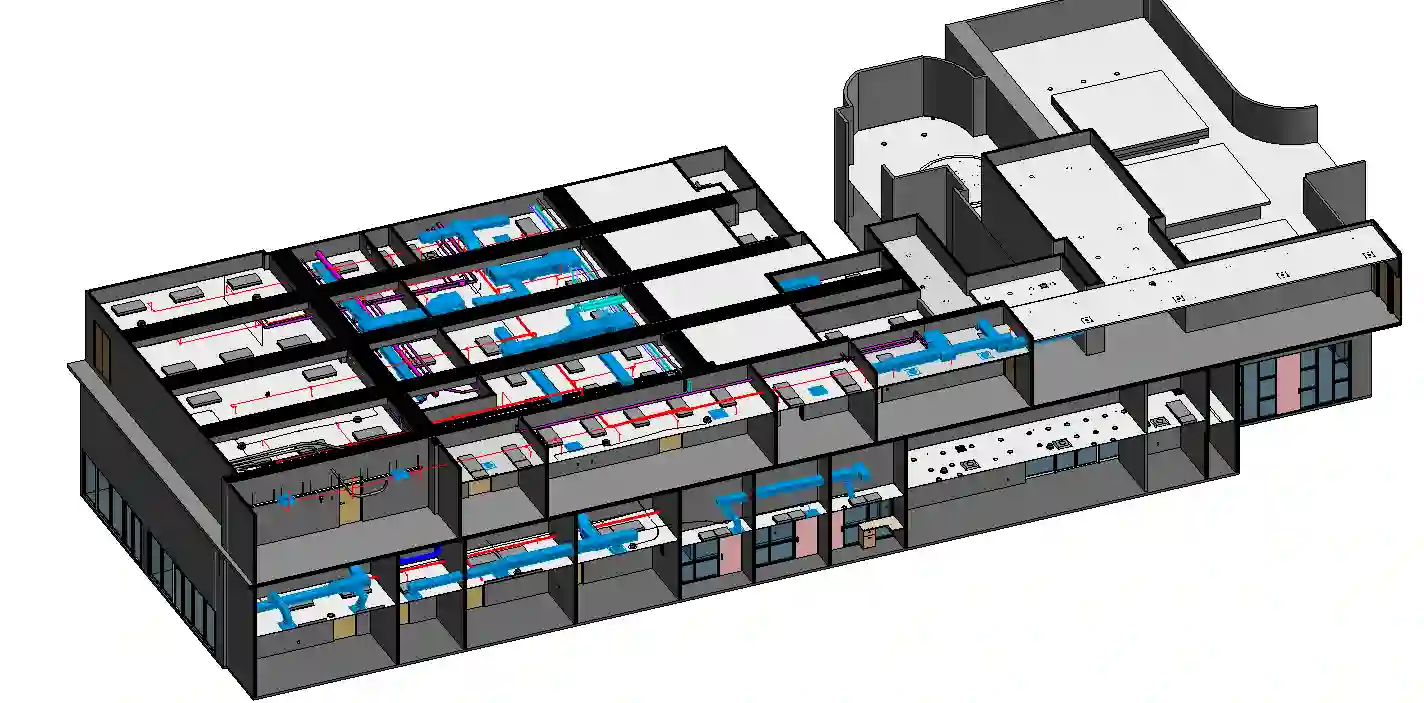
Mechanical, electrical, and plumbing conflicts are the highest-cost field discovery category in TI construction. A new ceiling grid that conflicts with an existing duct main, a lighting layout that crosses a sprinkler branch line, a server room that cannot fit the specified cooling unit because a structural beam drops four inches lower than the drawings show: each of these conflicts generates a change order averaging $18,000 to $55,000 when contractor markup, schedule impact, and design revision fees are included.
LiDAR scanning captures pipe runs, duct locations, conduit paths, and equipment footprints at field-verified accuracy. Designers coordinate against actual MEP system locations. Conflicts surface in the model during design, not on the job site during construction. Our MEP documentation services are specifically structured to support this coordination need on LA TI projects.
Floor Slope and Elevation Variation
Los Angeles commercial buildings, particularly older concrete construction, carry measurable floor slope and elevation variation across a tenant floor plate. A floor that appears level to the eye can drop two inches across 80 linear feet of open office.
That variation affects floor finish transitions, millwork base framing, accessible route compliance, and partition plumb. Traditional tape measure surveys capture elevation at discrete points. A 3D laser scan records floor elevation continuously across the entire space as part of the standard deliverable, at no additional field time.
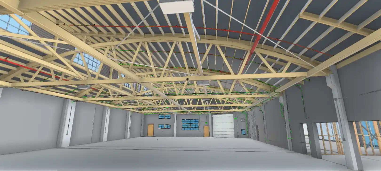
Ceiling Height Variation and Structural Clearances
Existing conditions drawings rarely document ceiling height at more than one or two reference points. Structural beams, existing mechanical equipment, and prior tenant modifications create height variation that affects reflected ceiling plans, lighting layouts, fire sprinkler coverage calculations, and HVAC diffuser placement.
The point cloud records the underside of every structural element and existing system at full three-dimensional resolution. The 3D laser scanning process captures what no tape measure can reach, and no drawing should be trusted to show.
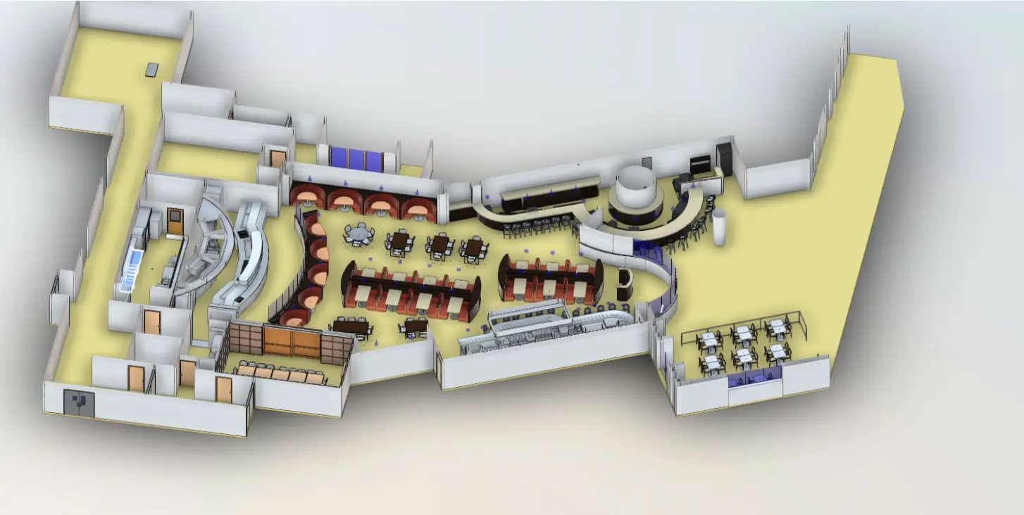
Choosing the Right LOD for Your TI Revit Model
Level of Development selection is a project decision, not a technical formality. The wrong LOD wastes budget on details the project does not need or leaves coordination gaps that create problems during construction. LOD selection should be driven by what the model will be used for, not a default assumption.
| LOD | What It Delivers | When to Use It for a TI |
| LOD 200 | Approximate geometry, basic massing | Early feasibility and space planning only |
| LOD 300 | Accurate walls, floors, ceilings, MEP, and structural | Permit submittal, design development, and trade coordination |
| LOD 400 | Fabrication-level detail on specific assemblies | Custom millwork, curtain wall, structural steel connections |
| LOD 500 | Verified as-built post-construction | Final record model after construction completion |
LOD 300 is the correct specification for most LA commercial and retail TI projects. It supports LADBS submittal, contractor pricing, and trade coordination without over-modeling elements that do not require fabrication-level detail.
LOD 400 adds fabrication-level detail to specific building elements. It is appropriate when the scope includes custom millwork requiring shop drawing coordination, curtain wall or glazing systems, or structural steel connections. Specifying LOD 400 for an entire TI model when only specific assemblies require it increases cost without adding corresponding value.
The LOD framework is a coordination tool, not a quality signal. A correctly specified LOD 300 model built from a LiDAR point cloud at plus or minus 2mm accuracy outperforms a claimed LOD 400 model built from unverified tape measure data.
How to Evaluate a Scan-to-BIM Provider for an LA TI Project
LA has no shortage of firms offering Scan-to-BIM services. The quality gap between providers is significant. Evaluating a provider on price alone is the fastest route to a deliverable that generates more problems than it solves.
Ask for the scanner make and model. Professional-grade LiDAR scanners such as the Leica RTC360 or FARO Focus produce point clouds at verified accuracy tolerances. Consumer-grade or entry-level units introduce errors that compound through the modeling process. A provider who cannot name their scanning equipment or cite its published accuracy specifications is not a provider who can commit to plus or minus 2mm deliverables.
Ask for sample Revit files from completed projects, not rendered images or screenshots. Open the file. Check that wall elements are modeled as actual Revit wall families, not extruded masses. Verify that MEP elements are modeled with correct system classifications. Confirm the model file is clean, with no orphaned elements, no duplicate geometry, and logical naming conventions. A sample file shows more about a provider’s actual capability than any project description.
Ask how they verify the model against the point cloud before delivery. A provider without a formal QA step is delivering a modeled interpretation, not a verified as-built. Dimensional checks comparing the model to source point cloud data at defined tolerance thresholds are the minimum standard for a deliverable used for permit submittal or contractor coordination.
Ask about turnaround. TI buildouts operate on compressed schedules. A provider who cannot commit to a defined delivery window is a schedule risk. Our standard turnaround runs five to 14 business days from scan completion, depending on scope and LOD.
Cost and Risk Reality: What Field Conflicts Actually Cost on a TI
A Scan-to-BIM engagement for a mid-size tenant improvement in the LA market typically ranges from $3,500 to $9,500, depending on square footage, space complexity, and LOD. That range covers site scanning, point cloud processing, and full Revit model delivery. Quotes are returned within 24 hours.
Against that investment, map the cost exposure on the other side.
A single change order driven by an MEP conflict discovered after contractor mobilization averages $18,000 to $55,000 when contractor markup, delay costs, and redesign fees are included. A plan check correction cycle that adds three weeks to the permitting timeline on a project with a $45-per-square-foot penalty clause for late delivery on a 10,000-square-foot space carries $450,000 in exposure per week of overage.
The LiDAR scanning investment for field-verified existing conditions costs less than one-tenth of a single significant field conflict. It costs a fraction of one week of lease penalty exposure. Framed as a risk transfer decision rather than a line-item expense, the math does not close.
For a deeper breakdown of what undocumented building conditions cost across a project lifecycle, see the true cost of bad building documentation.
How LiDAR Precise Plans Delivers Scan to BIM for Los Angeles Tenant Improvements
At LiDAR Precise Plans, we have documented more than 4,200 buildings across commercial, retail, hospitality, and industrial markets, including projects throughout the Los Angeles metro. Our Scan-to-BIM workflow for tenant improvement projects begins with a site scan using professional-grade LiDAR equipment, producing registered point clouds at plus or minus 2mm, or plus or minus 1/8 inch, with verified accuracy. From that data, we build Revit models to the LOD your project requires, deliver as-built drawings in AutoCAD and PDF, or provide registered point cloud files in formats your design team can use immediately.
We understand LADBS plan check requirements, Title 24 accessibility documentation, and the coordination demands of multi-disciplinary TI teams working on fast-track schedules. Our deliverables are formatted for permit submittal and contractor coordination, not a generic output standard. If your project is in pre-design, schematic design, or entering design development, field-verified existing conditions data is the highest-leverage investment you can make before the design clock starts.
LiDAR Is Where LA TI Projects Stop Assuming and Start Building
Scan to BIM for tenant improvement projects in Los Angeles replaces the most dangerous assumption in commercial construction: that the drawings on file reflect what the building actually contains. LiDAR captures what exists. The Revit model reflects it with an accuracy of plus or minus 2 mm. Design, permitting, and construction proceed from verified field data. Field conflicts surface in the model during coordination, not on the job site after mobilization.
For architects managing LADBS permit risk, GCs pricing TI scopes against compressed schedules, and tenants counting down to lease commencement, that shift from assumption to verification is where the budget and the timeline get protected.
Start your Los Angeles TI with verified field conditions before design begins. Contact us to get a Revit-ready existing conditions model within 14 business days.