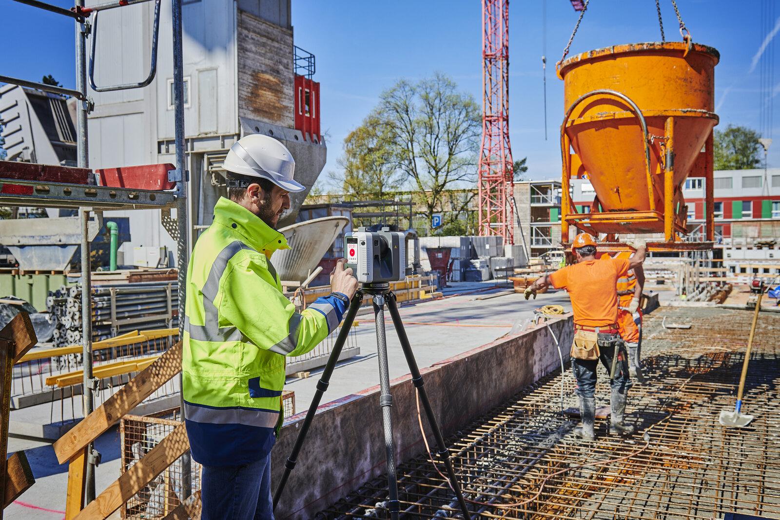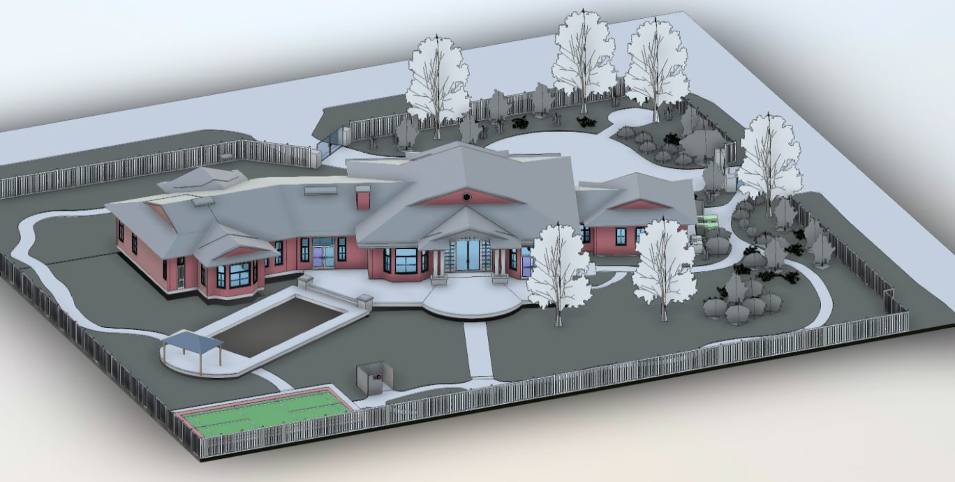
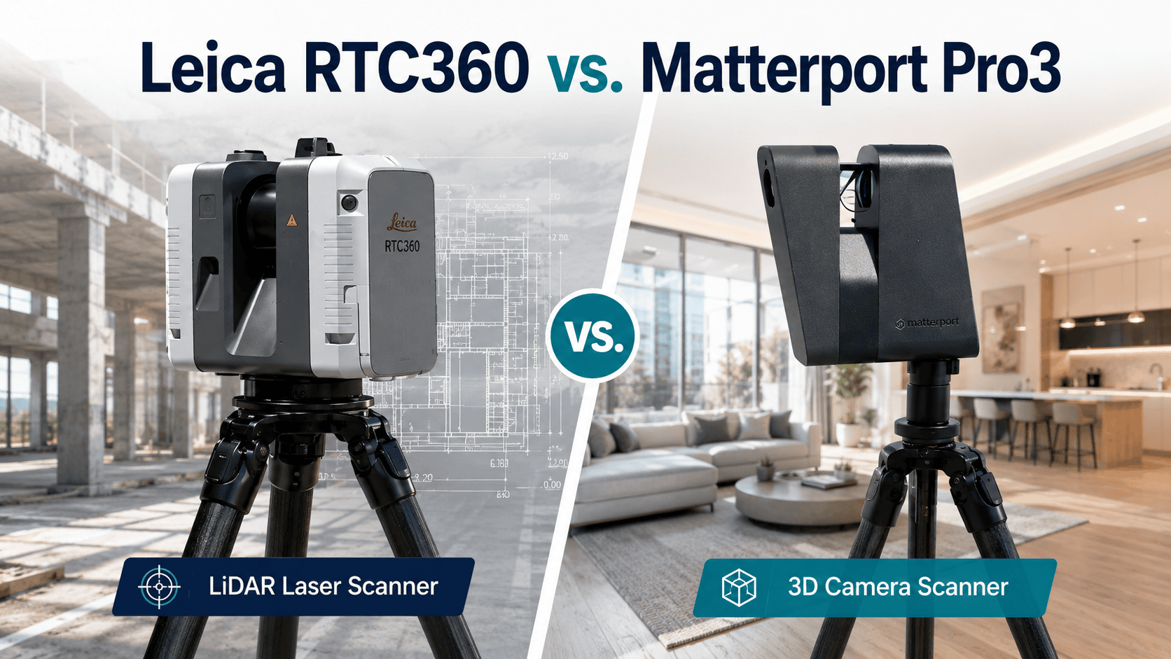

Your project manager just asked whether a Matterport 3D virtual tour would work instead of a full LiDAR scan. The budget looks tighter, and Matterport is faster and cheaper on paper. Before you say yes, understand exactly what each tool delivers and, more importantly, where each one stops being the right answer. The confusion between visual documentation and engineering-grade measurement is one of the most expensive category errors in commercial AEC.
Quick Answer:
A Matterport 3D virtual tour is an interactive digital walkthrough that captures panoramic imagery and spatial data for remote navigation of a physical space. It excels at stakeholder communication, progress documentation, leasing, and facility handover. Professional LiDAR scanning delivers engineering-grade point clouds accurate to within 2mm, the standard required for as-built drawings, Revit modeling, MEP coordination, and permit submittals. For commercial projects where someone will measure from the data, build from it, or file it for plan check, LiDAR scanning is not optional. Many commercial projects benefit from both technologies deployed for their respective strengths.
What Is a Matterport 3D Virtual Tour?
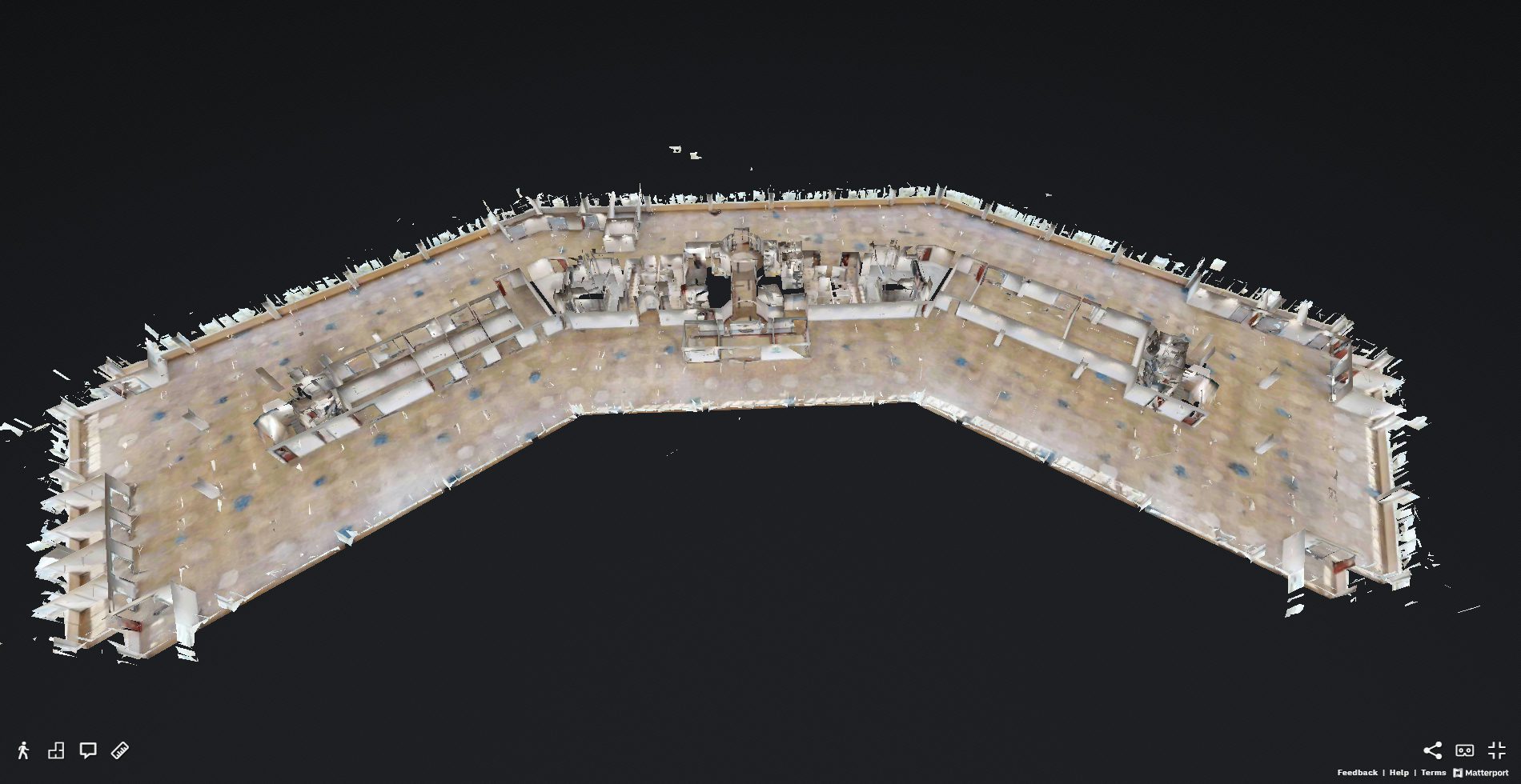
A Matterport 3D virtual tour is an interactive digital walkthrough that lets users navigate a physical space remotely using panoramic imaging and spatial mapping. The Matterport Pro3 camera captures overlapping scan positions across a building, which the platform stitches into a navigable Matterport digital twin: an immersive, cloud-hosted model that any stakeholder can explore from a browser or mobile device.
The navigation interface gives users three views: a room-level virtual walkthrough, a floor-plan overlay, and a dollhouse view that reveals the entire building’s spatial layout at once. Commercial teams adopt the platform for its low barrier to use, fast turnaround from scan to shareable link, and its ability to communicate spatial conditions to non-technical audiences without requiring construction drawings or site visits.
Common commercial applications include:
- Owner and investor progress communication during active construction
- Pre-lease Matterport commercial real estate tours for remote prospects
- Facility management handover at project closeout
- Pre-design existing conditions reference for architects
- Insurance and risk documentation for property portfolios
The Matterport Pro3 includes a built-in LiDAR depth sensor, which is the primary source of confusion with professional-grade scanning. The sensor enables spatial mapping and rough dimensioning. But the accuracy ceiling of the Pro3, approximately 20mm at 10 meters, is a fundamental constraint that determines where the platform’s utility ends for engineering workflows.
Matterport 3D Virtual Tour Accuracy vs. Professional LiDAR Scanning
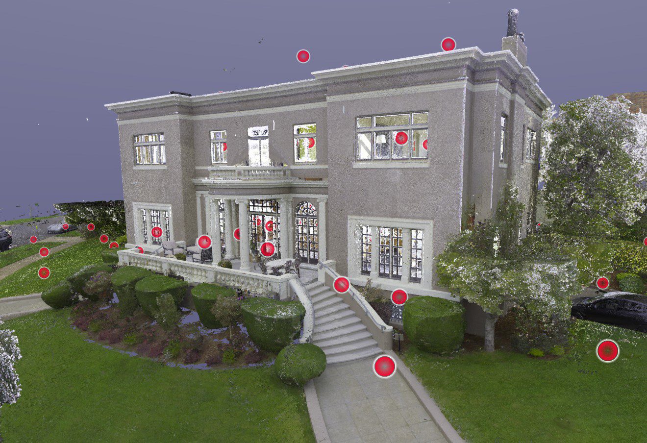
The 20mm accuracy figure is not a minor specification footnote. It is the variable that determines whether scan data belongs in a design workflow or a communication workflow.
Professional terrestrial laser scanners operate at plus or minus 2mm or better across comparable distances. That is a 10x difference in dimensional precision. For an AEC professional, that gap controls everything downstream: whether a wall modeled from scan data reflects where the wall actually stands, whether a duct run clears a structural beam, whether millwork fabricated to model dimensions fits on site.
At 20mm, a single wall location could read nearly an inch off its true position. Compound that error across 40 scan positions on a 30,000-square-foot floor plate, and the cumulative drift makes the Matterport floor plan unreliable for any dimension-dependent decision. The Matterport Pro3 also offers an E57 point cloud export as an add-on, but the data density and positional accuracy of that export fall well short of what Scan-to-BIM or Scan-to-CAD workflows require.
The distinction is not between better and worse technology. A Matterport virtual walkthrough shows what a space looks like. A professional LiDAR point cloud shows what a space measures. Conflating the two on a commercial project introduces risk at the exact point where documentation is supposed to eliminate it.
Where a Matterport 3D Virtual Tour Is Not Enough for Commercial Projects
Measurement-Critical Workflows
If anyone on your project team will measure from the data, the Matterport Pro3 is the wrong tool. This covers a wide range of commercial tasks: verifying concrete was poured to specified elevations, confirming steel placement matches structural drawings, checking MEP rough-in against the coordinated model, or producing as-built drawings for a tenant improvement permit submittal. All of these require dimensional accuracy within tolerances that Matterport cannot deliver.
BIM and Scan-to-Revit Workflows
Scan-to-BIM starts with a dense, survey-registered point cloud that serves as the geometric backbone for the Revit model. When that source data carries a 20mm positional error, the Revit model inherits that error at every modeled element. Field conflicts that BIM coordination was built to prevent appear during construction, regardless, and the documentation that was supposed to eliminate RFIs generates them instead. Professional LiDAR scanning produces the point cloud density and accuracy that Scan-to-BIM workflows require to function as intended.
Large-Scale and Industrial Facilities
For facilities above 20,000 square feet, Matterport’s position-by-position capture creates alignment drift through long corridors, open warehouse floors, and multi-story atriums. Visual registration between scan positions loses precision over distance. Professional scanners registered to survey-grade control networks eliminate drift and maintain consistent accuracy, whether the project covers 5,000 or 500,000 square feet.
Data Ownership and Security
Matterport models are cloud-hosted on Matterport’s platform. Maintaining access requires an active subscription. For secure facilities, including data centers, financial institutions, and government buildings, storing building documentation on a third-party platform raises compliance concerns. Professional LiDAR deliverables are provided as local files in standard formats: .rvt, .dwg, .e57, .rcp. The client controls the data entirely.
Where a Matterport 3D Virtual Tour Genuinely Adds Value
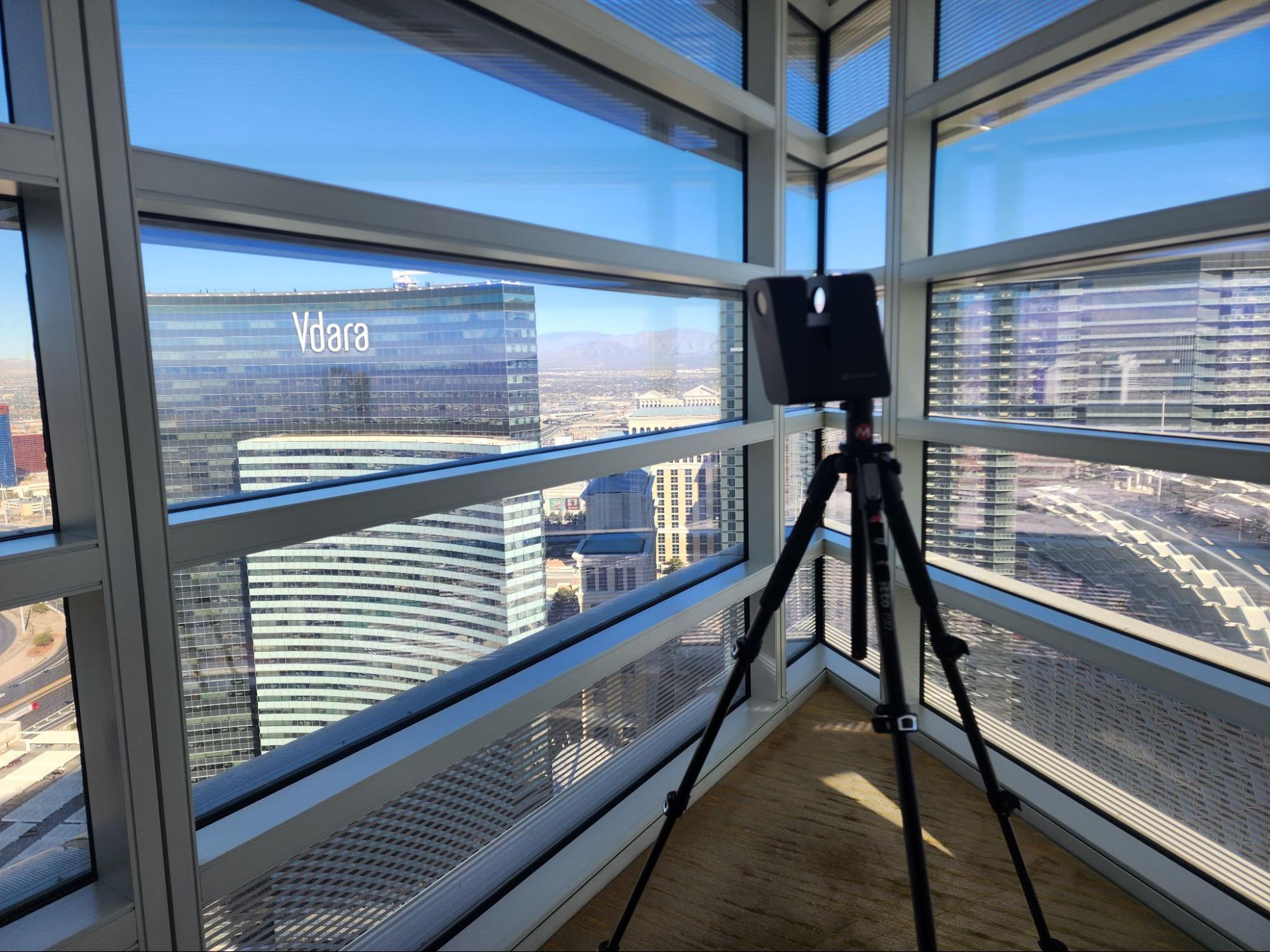
Dismissing Matterport entirely is the wrong conclusion. The platform does several things very well, and AEC firms that deploy it strategically generate real workflow value.
Progress Documentation: Weekly or bi-weekly Matterport 3D virtual tours of an active construction site produce a navigable visual record of field conditions at each stage. Owners review progress remotely. Timestamped models serve as visual evidence if disputes arise. For GCs managing owner relationships on hotel, retail, or office buildouts, that communication tool reduces friction without requiring stakeholders to read construction drawings.
Pre-Bid and Pre-Design Reference: Before a renovation begins, a Matterport walkthrough gives the design team a spatially coherent reference for understanding the building’s layout, circulation, and architectural character. Architects explore the space virtually, brief clients on existing conditions, and identify design opportunities without multiple site visits. The Matterport scan does not replace the dimensional data needed for permit-ready drawings; that requires professional LiDAR scanning. But it accelerates early-stage alignment significantly.
Leasing and Marketing: For commercial real estate professionals, a Matterport 3D virtual tour of an available property creates a leasing tool that converts remote prospects into on-site visits. The interactive dollhouse view and room-level navigation are purpose-built for non-technical audiences evaluating a space. No professional LiDAR scan competes with it for this specific purpose.
Facility Management Handover: At project closeout, a Matterport digital twin of the completed facility gives facility managers, maintenance staff, and building operators a navigable 3D reference. New team members orient to the layout, locate equipment, and access spatial context without requiring on-site walkthroughs. Portfolio managers use it across multi-location assets to standardize documentation and support remote audits.
Matterport 3D Virtual Tour Cost vs. LiDAR Scanning: What the Numbers Actually Mean
A Matterport 3D virtual tour costs less upfront and deploys faster than a professional LiDAR scan. For visual communication purposes, that cost profile is entirely appropriate. The economics shift the moment Matterport is used, where engineering documentation is required.
Consider a commercial renovation at 30,000 square feet. The GC uses a Matterport scan to capture existing conditions. The data looks complete. During design development, the architect models partition locations from the Matterport data. Millwork is specified and fabricated to those dimensions. When components arrive on site, several do not fit: walls are not where the model showed them. Cumulative positional error across multiple scan positions has drifted enough to contradict field-verified dimensions.
The RFI process begins. Millwork returns for modification. The schedule extends. The cost of professional LiDAR scanning at project outset, which would have produced verified as-built dimensions to plus or minus 1/8 inch, is a fraction of the resulting change order exposure. According to FMI research, rework accounts for approximately 5% of total construction costs on average, with inaccurate existing conditions documentation as a consistent contributing factor. On a $4 million tenant improvement, that represents $200,000 in avoidable costs. Explore how documentation errors translate directly into project cost at the resources page on the cost of bad building documentation.
Is a Matterport 3D Virtual Tour the Right Choice for Your Project?
| Project Need | Matterport 3D Virtual Tour: Suitable? |
| Leasing walkthroughs and marketing | Yes |
| Owner and investor progress updates | Yes |
| Pre-bid and pre-design reference | Yes (visual reference only) |
| Facility management handover | Yes |
| Permit-ready as-built drawings | No |
| Revit or BIM modeling | No |
| MEP coordination and clash detection | No |
| Fabrication from scan data | No |
When to Combine a Matterport 3D Virtual Tour with LiDAR Scanning
The strongest commercial documentation strategy uses each technology for what it does best. Professional LiDAR scanning captures the engineering data: the point cloud that feeds as-built drawings, Revit models, MEP documentation, and plan check submittals. A Matterport 3D virtual tour captures the visual layer: the navigable environment that communicates progress, condition, and spatial character to non-technical stakeholders.
| Project Task | Recommended Tool | Reason |
| As-built drawings for permit submittal | Professional LiDAR | Plus or minus 2mm accuracy required |
| Revit or BIM modeling | Professional LiDAR | Point cloud density and precision |
| MEP coordination and documentation | Professional LiDAR | Millimeter tolerances required |
| Weekly construction progress reporting | Matterport 3D virtual tour | Fast, intuitive, stakeholder-ready |
| Owner and investor walkthroughs | Matterport 3D virtual tour | Visual clarity for non-technical audiences |
| Pre-lease marketing of available space | Matterport 3D virtual tour | Interactive tour for remote prospects |
| Historic preservation documentation | Professional LiDAR | Dimensional precision, rich point cloud |
| Facility management handover | Matterport 3D virtual tour | Navigable reference for operations teams |
The combined approach costs more than either tool alone. On projects above 20,000 square feet with design, permitting, or construction scope, the combined investment is straightforward to justify against the change order and rework exposure that inaccurate existing conditions documentation creates. Review the scanner technology guide to understand which LiDAR systems fit different commercial project types.
How LiDAR Precise Plans Handles Both
At LiDAR Precise Plans, we deliver professional LiDAR scanning and as-built documentation across Las Vegas, Phoenix, Los Angeles, San Francisco, Denver, Salt Lake City, and Austin. We also offer Matterport 3D virtual tours as a complementary service for clients who need the visual layer alongside engineering documentation.
Every scan we produce is verified to plus or minus 2mm, plus or minus 1/8 inch dimensional accuracy. Deliverables include registered point clouds in E57, RCP, and LAS formats, as-built drawings in AutoCAD (.dwg) and PDF, Revit models at specified LOD, and MEP documentation for mechanical, electrical, and plumbing systems. Turnaround runs 5 to 14 business days, depending on scope. Quotes return within 24 hours.
Across 4,200-plus buildings documented, we have seen the downstream cost of inadequate existing conditions documentation on commercial renovations, tenant improvements, and hospitality buildouts. We do not recommend Matterport for engineering workflows. We do not recommend LiDAR scanning when a Matterport 3D virtual tour solves the actual problem. For clients who need both, we coordinate the scope so the LiDAR scan and Matterport virtual walkthrough capture happen in a single site mobilization, minimizing disruption and keeping the schedule on track.
The Difference Between Seeing a Space and Measuring It
A Matterport 3D virtual tour is highly effective when the goal is visual communication, stakeholder collaboration, and remote walkthrough access. When a project also requires engineering-grade accuracy for BIM, as-built drawings, or permit documentation, professional LiDAR scanning becomes essential. One tool shows what a space looks like. The other confirms what it measures. Knowing which question your project is asking before you spec the deliverable is the decision that protects the budget and the schedule.
Ready to confirm which approach fits your project? Call LiDAR Precise Plans at 888-543-2711 or request a scope and quote through the Get a Quote page. Pricing and turnaround details returned within 24 hours.